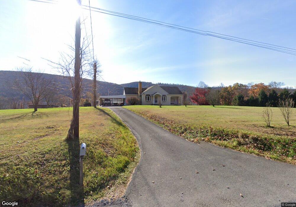
771 High Rd Ashland, PA 17921
Estimated Value: $295,000
3
Beds
2
Baths
1,554
Sq Ft
$190/Sq Ft
Est. Value
About This Home
This home is located at 771 High Rd, Ashland, PA 17921 and is currently estimated at $295,000, approximately $189 per square foot. 771 High Rd is a home located in Schuylkill County with nearby schools including North Schuylkill Elementary School and North Schuylkill Junior/Senior High School.
Create a Home Valuation Report for This Property
The Home Valuation Report is an in-depth analysis detailing your home's value as well as a comparison with similar homes in the area
Home Values in the Area
Average Home Value in this Area
Tax History Compared to Growth
Tax History
| Year | Tax Paid | Tax Assessment Tax Assessment Total Assessment is a certain percentage of the fair market value that is determined by local assessors to be the total taxable value of land and additions on the property. | Land | Improvement |
|---|---|---|---|---|
| 2025 | $3,569 | $45,950 | $11,075 | $34,875 |
| 2024 | $3,345 | $45,950 | $11,075 | $34,875 |
| 2023 | $3,345 | $45,950 | $11,075 | $34,875 |
| 2022 | $3,270 | $45,950 | $11,075 | $34,875 |
| 2021 | $3,229 | $45,950 | $11,075 | $34,875 |
| 2020 | $3,169 | $45,950 | $11,075 | $34,875 |
| 2018 | $3,060 | $45,950 | $11,075 | $34,875 |
| 2017 | $2,982 | $45,950 | $11,075 | $34,875 |
| 2015 | -- | $45,950 | $11,075 | $34,875 |
| 2011 | -- | $45,950 | $0 | $0 |
Source: Public Records
Map
Nearby Homes
- 6852 Upper Rd
- 0 W Side of Stein Rd
- 0 Airport Rd Unit PASK2024112
- 91 Chestnut St
- 238 Front St
- 334 W Butternut St
- 331 S Maple St
- 329 S Maple St
- 703 Scott St
- 626 Scott St
- 541 Chestnut St
- 549 Chestnut St
- 501 W 3rd St
- 19 S Beech St
- 141 W 5th St
- 447 W 3rd St
- 60 South St
- 125 W 5th St
- 202 W 4th St
- 721 Chestnut St