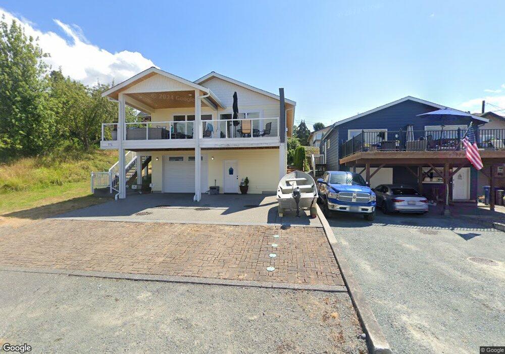
771 Maple Grove Rd Camano Island, WA 98282
Estimated Value: $850,000 - $1,020,000
3
Beds
3
Baths
1,861
Sq Ft
$492/Sq Ft
Est. Value
About This Home
This home is located at 771 Maple Grove Rd, Camano Island, WA 98282 and is currently estimated at $916,220, approximately $492 per square foot. 771 Maple Grove Rd is a home located in Island County with nearby schools including Utsalady Elementary School, Port Susan Middle School, and Stanwood High School.
Ownership History
Date
Name
Owned For
Owner Type
Purchase Details
Closed on
Mar 14, 2019
Sold by
Tollefson Marc Wallace and Tollefson Nancy Gay
Bought by
Backstrom John M
Current Estimated Value
Home Financials for this Owner
Home Financials are based on the most recent Mortgage that was taken out on this home.
Original Mortgage
$484,350
Outstanding Balance
$424,085
Interest Rate
4.3%
Mortgage Type
New Conventional
Estimated Equity
$492,135
Purchase Details
Closed on
Aug 13, 2009
Sold by
Bergstrom Danny Edor
Bought by
Tollefson Marc Wallace and Tollfeson Nancy Gay
Create a Home Valuation Report for This Property
The Home Valuation Report is an in-depth analysis detailing your home's value as well as a comparison with similar homes in the area
Home Values in the Area
Average Home Value in this Area
Purchase History
| Date | Buyer | Sale Price | Title Company |
|---|---|---|---|
| Backstrom John M | $650,000 | Wfg Natl Ttl Co Of Wa Llc | |
| Tollefson Marc Wallace | $300,000 | None Available |
Source: Public Records
Mortgage History
| Date | Status | Borrower | Loan Amount |
|---|---|---|---|
| Open | Backstrom John M | $484,350 |
Source: Public Records
Tax History Compared to Growth
Tax History
| Year | Tax Paid | Tax Assessment Tax Assessment Total Assessment is a certain percentage of the fair market value that is determined by local assessors to be the total taxable value of land and additions on the property. | Land | Improvement |
|---|---|---|---|---|
| 2025 | $5,582 | $755,894 | $370,000 | $385,894 |
| 2024 | $5,615 | $760,526 | $370,000 | $390,526 |
| 2023 | $5,615 | $735,163 | $340,000 | $395,163 |
| 2022 | $5,531 | $691,508 | $340,000 | $351,508 |
| 2021 | $5,253 | $599,273 | $290,000 | $309,273 |
| 2020 | $4,787 | $550,984 | $250,000 | $300,984 |
| 2019 | $3,829 | $495,625 | $275,000 | $220,625 |
| 2018 | $3,884 | $410,625 | $214,000 | $196,625 |
| 2017 | $2,912 | $372,762 | $175,000 | $197,762 |
| 2016 | $3,047 | $309,935 | $125,000 | $184,935 |
| 2015 | -- | $312,164 | $125,000 | $187,164 |
| 2013 | -- | $316,620 | $125,000 | $191,620 |
Source: Public Records
Map
Nearby Homes
- 1042 Shorecrest Place
- 688 Gladstone Dr
- 0 Maple Grove Rd Unit NWM2455478
- 1048 Malvern Hills Dr
- 366 Samanthia Ln
- 628 N Sunset Dr
- 1048 Cassius Ct
- 941 Cambell Dr
- 0 Cambell Dr Unit NWM2331086
- 900 N Sunset Dr
- 980 Marshall Dr
- 345 Seaview Ct
- 350 N Sunset Dr
- 25 Anadar Place
- 329 Melissa St
- 329 Burke Dr
- 325 Melissa St
- 1 S Camano Dr
- 441 Windsun Way
- 276 Melissa St
- 765 Maple Grove Rd
- 779 Maple Grove Rd
- 763 Maple Grove Rd
- 776 Maple Grove Rd
- 768 Maple Grove Rd
- 778 Maple Grove Rd
- 766 Maple Grove Rd
- 767 Brown Rd
- 782 Maple Grove Rd
- 783 Maple Grove Rd
- 762 Maple Grove Rd
- 777 Brown Rd
- 784 Maple Grove Rd
- 787 Maple Grove Rd
- 758 Maple Grove Rd
- 788 Maple Grove Rd
- 759 Brown Rd
- 1066 Scenic Ave
- 757 Maple Grove Rd
- 753 Maple Grove Rd