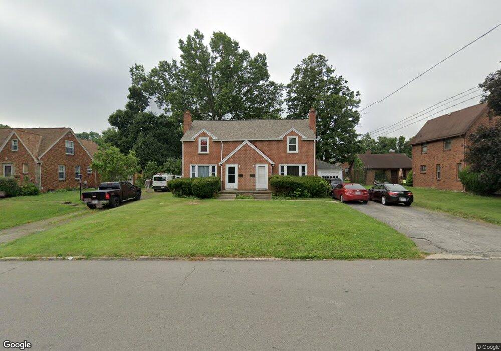
771 Maple St Unit 773 Mansfield, OH 44906
Estimated Value: $157,000 - $208,553
4
Beds
2
Baths
2,216
Sq Ft
$81/Sq Ft
Est. Value
About This Home
This home is located at 771 Maple St Unit 773, Mansfield, OH 44906 and is currently estimated at $179,888, approximately $81 per square foot. 771 Maple St Unit 773 is a home located in Richland County with nearby schools including Goal Digital Academy, Mansfield Elective Academy, and Discovery School.
Ownership History
Date
Name
Owned For
Owner Type
Purchase Details
Closed on
Aug 27, 2007
Sold by
Nemeth Frank and Nemeth Kimberley S
Bought by
Christy Thomas Keith and Christy Thomas
Current Estimated Value
Home Financials for this Owner
Home Financials are based on the most recent Mortgage that was taken out on this home.
Original Mortgage
$115,000
Outstanding Balance
$73,553
Interest Rate
6.77%
Mortgage Type
Purchase Money Mortgage
Estimated Equity
$106,335
Purchase Details
Closed on
Nov 24, 1997
Sold by
Johnson Roger W
Bought by
Nemeth Frank and Nemeth Kimberley S
Home Financials for this Owner
Home Financials are based on the most recent Mortgage that was taken out on this home.
Original Mortgage
$98,600
Interest Rate
8.5%
Mortgage Type
New Conventional
Purchase Details
Closed on
Sep 1, 1993
Sold by
Kemle Dorothy A
Bought by
Johnson Roger W
Create a Home Valuation Report for This Property
The Home Valuation Report is an in-depth analysis detailing your home's value as well as a comparison with similar homes in the area
Home Values in the Area
Average Home Value in this Area
Purchase History
| Date | Buyer | Sale Price | Title Company |
|---|---|---|---|
| Christy Thomas Keith | $115,000 | Chicago Title | |
| Nemeth Frank | $93,000 | -- | |
| Johnson Roger W | $79,500 | -- |
Source: Public Records
Mortgage History
| Date | Status | Borrower | Loan Amount |
|---|---|---|---|
| Open | Christy Thomas Keith | $115,000 | |
| Closed | Nemeth Frank | $98,600 |
Source: Public Records
Tax History
| Year | Tax Paid | Tax Assessment Tax Assessment Total Assessment is a certain percentage of the fair market value that is determined by local assessors to be the total taxable value of land and additions on the property. | Land | Improvement |
|---|---|---|---|---|
| 2024 | $2,508 | $52,370 | $4,350 | $48,020 |
| 2023 | $2,507 | $52,370 | $4,350 | $48,020 |
| 2022 | $2,095 | $36,680 | $3,730 | $32,950 |
| 2021 | $2,110 | $36,680 | $3,730 | $32,950 |
| 2020 | $2,158 | $36,680 | $3,730 | $32,950 |
| 2019 | $2,392 | $36,680 | $3,730 | $32,950 |
| 2018 | $2,360 | $36,680 | $3,730 | $32,950 |
| 2017 | $2,297 | $36,680 | $3,730 | $32,950 |
| 2016 | $2,239 | $34,670 | $4,750 | $29,920 |
| 2015 | $2,138 | $34,670 | $4,750 | $29,920 |
| 2014 | $2,110 | $34,670 | $4,750 | $29,920 |
| 2012 | $1,616 | $34,660 | $4,990 | $29,670 |
Source: Public Records
Map
Nearby Homes
- 143 Fairlawn Ave
- 135 Fairlawn Ave
- 129 Fairlawn Ave
- 679 Coleman Rd
- 686 Barnard Ave
- 189 Westwood Ave
- 116 Stewart Ave S
- 108 Stewart Ave S
- 133 Stewart Ave S
- 988 Kentland Dr
- 356 S Linden Rd
- 126 Dawson Ave
- 24 Stewart Ave S
- 232 S Trimble Rd Unit 234
- 216 S Trimble Rd Unit 218
- 244 S Trimble Rd Unit 246
- 960 W Linden Cir
- 71 Dawson Ave
- 455 Marion Ave
- 616 Cline Ave
- 779 Maple St
- 175 Fairlawn Ave
- 772 Fairlawn Ave
- 181 Fairlawn Ave
- 166 Taylor Rd Unit 168
- 766 Maple St
- 181 Fairlawn Ave(p)
- 187 Fairlawn Ave
- 180 Taylor Rd
- 778 Maple St Unit 780
- 791 Maple St
- 176 Fairlawn Ave
- 184 Taylor Rd
- 784 Maple St
- 184 Fairlawn Ave
- 790 Maple St
- 793 Maple St
- 193 Fairlawn Ave
- 186 Fairlawn Ave
- 194 Taylor Rd
Your Personal Tour Guide
Ask me questions while you tour the home.