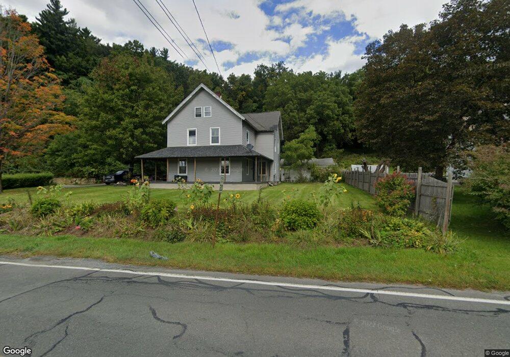
771 Massachusetts Ave Unit 773 North Adams, MA 01247
Estimated Value: $219,000 - $325,000
6
Beds
2
Baths
2,712
Sq Ft
$101/Sq Ft
Est. Value
About This Home
This home is located at 771 Massachusetts Ave Unit 773, North Adams, MA 01247 and is currently estimated at $274,413, approximately $101 per square foot. 771 Massachusetts Ave Unit 773 is a home located in Berkshire County with nearby schools including Greylock Elementary School and Drury High School.
Ownership History
Date
Name
Owned For
Owner Type
Purchase Details
Closed on
Feb 28, 2001
Sold by
Garner James A and Garner Cecelia M
Bought by
Lapier Mark A
Current Estimated Value
Home Financials for this Owner
Home Financials are based on the most recent Mortgage that was taken out on this home.
Original Mortgage
$94,254
Outstanding Balance
$34,269
Interest Rate
7%
Mortgage Type
Purchase Money Mortgage
Estimated Equity
$240,144
Purchase Details
Closed on
Jul 20, 1992
Sold by
Sanelli Bruce A
Bought by
South Adams Sb
Create a Home Valuation Report for This Property
The Home Valuation Report is an in-depth analysis detailing your home's value as well as a comparison with similar homes in the area
Home Values in the Area
Average Home Value in this Area
Purchase History
| Date | Buyer | Sale Price | Title Company |
|---|---|---|---|
| Lapier Mark A | $95,000 | -- | |
| Lapier Mark A | $95,000 | -- | |
| South Adams Sb | $55,000 | -- | |
| South Adams Sb | $55,000 | -- |
Source: Public Records
Mortgage History
| Date | Status | Borrower | Loan Amount |
|---|---|---|---|
| Open | South Adams Sb | $25,000 | |
| Open | South Adams Sb | $94,254 | |
| Closed | South Adams Sb | $94,254 |
Source: Public Records
Tax History Compared to Growth
Tax History
| Year | Tax Paid | Tax Assessment Tax Assessment Total Assessment is a certain percentage of the fair market value that is determined by local assessors to be the total taxable value of land and additions on the property. | Land | Improvement |
|---|---|---|---|---|
| 2025 | $3,337 | $199,700 | $36,000 | $163,700 |
| 2024 | $3,135 | $182,900 | $33,000 | $149,900 |
| 2023 | $2,887 | $163,400 | $33,000 | $130,400 |
| 2022 | $2,804 | $151,300 | $33,000 | $118,300 |
| 2021 | $2,605 | $140,000 | $30,500 | $109,500 |
| 2020 | $2,497 | $134,100 | $29,100 | $105,000 |
| 2019 | $2,513 | $131,500 | $29,700 | $101,800 |
| 2018 | $2,381 | $135,100 | $31,900 | $103,200 |
| 2017 | $2,362 | $133,700 | $31,600 | $102,100 |
| 2016 | $2,327 | $133,800 | $31,600 | $102,200 |
| 2015 | $2,275 | $136,300 | $32,700 | $103,600 |
Source: Public Records
Map
Nearby Homes
- 757 Massachusetts Ave Unit 761
- 781 Massachusetts Ave
- 743 Massachusetts Ave
- 799 Massachusetts Ave
- 729 Massachusetts Ave
- 823 Massachusetts Ave
- 831 Massachusetts Ave
- 41 Roberts Dr
- 707 Massachusetts Ave
- 838 Massachusetts Ave
- 50 Roberts Dr
- 60 Roberts Dr Ste 109
- 703 Massachusetts Ave
- 703 Massachusetts Ave
- 64 Demond Ave
- 213 State Rd
- 863 Massachusetts Ave
- 26 Roberts Dr
- 4 Clark St