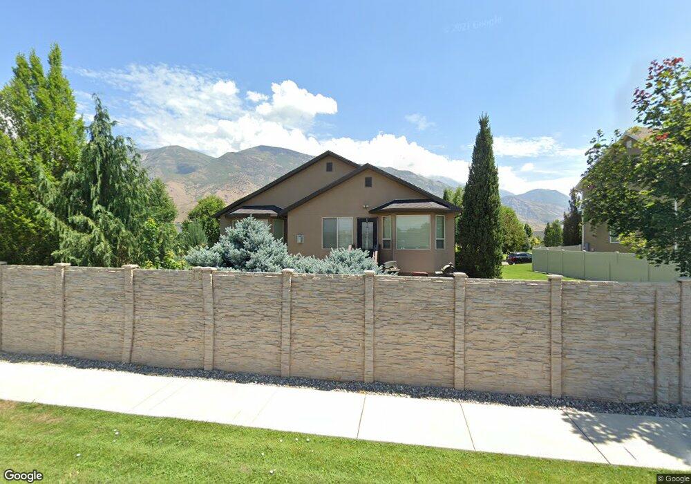
771 N 1280 E American Fork, UT 84003
Estimated Value: $792,000 - $870,000
6
Beds
4
Baths
3,346
Sq Ft
$245/Sq Ft
Est. Value
About This Home
This home is located at 771 N 1280 E, American Fork, UT 84003 and is currently estimated at $819,754, approximately $244 per square foot. 771 N 1280 E is a home located in Utah County with nearby schools including Deerfield Elementary School, Mountain Ridge Junior High School, and American Fork High School.
Ownership History
Date
Name
Owned For
Owner Type
Purchase Details
Closed on
Aug 20, 2021
Sold by
Norene Margaret C and Estate Of Jack L Norene
Bought by
Hansen Kara
Current Estimated Value
Purchase Details
Closed on
Jun 23, 2010
Sold by
Perry Homes Utah Inc
Bought by
Norene Jack and Norene Margaret
Create a Home Valuation Report for This Property
The Home Valuation Report is an in-depth analysis detailing your home's value as well as a comparison with similar homes in the area
Home Values in the Area
Average Home Value in this Area
Purchase History
| Date | Buyer | Sale Price | Title Company |
|---|---|---|---|
| Hansen Kara | -- | None Available | |
| Norene Jack | -- | Meridian Title Company | |
| Perry Homes Utah Inc | -- | Meridian Title Company |
Source: Public Records
Tax History Compared to Growth
Tax History
| Year | Tax Paid | Tax Assessment Tax Assessment Total Assessment is a certain percentage of the fair market value that is determined by local assessors to be the total taxable value of land and additions on the property. | Land | Improvement |
|---|---|---|---|---|
| 2025 | $3,429 | $401,555 | $305,200 | $424,900 |
| 2024 | $3,429 | $381,040 | $0 | $0 |
| 2023 | $3,213 | $378,455 | $0 | $0 |
| 2022 | $3,588 | $417,120 | $0 | $0 |
| 2021 | $2,905 | $527,500 | $179,300 | $348,200 |
| 2020 | $2,790 | $491,400 | $166,000 | $325,400 |
| 2019 | $2,622 | $477,500 | $154,700 | $322,800 |
| 2018 | $2,575 | $448,500 | $150,900 | $297,600 |
| 2017 | $2,410 | $226,490 | $0 | $0 |
| 2016 | $2,561 | $223,685 | $0 | $0 |
| 2015 | $2,699 | $223,685 | $0 | $0 |
| 2014 | $2,610 | $213,345 | $0 | $0 |
Source: Public Records
Map
Nearby Homes
- 649 N 1280 E
- 636 N 1280 E
- 598 N 1280 E
- 1121 E 580 N
- 1228 E 1030 N
- 2969 N 1350 W
- 2254 N 1560 W
- 1045 N 930 E Unit 58
- 1058 N 930 E Unit 64
- The McKenzie Plan at Autumn Crest
- The Christine Plan at Autumn Crest
- The Avery Plan at Autumn Crest
- The Madison Plan at Autumn Crest
- The Roosevelt Plan at Autumn Crest
- The Annie Plan at Autumn Crest
- The Michelle Plan at Autumn Crest
- 1053 N 930 E Unit 73
- 1162 E 1180 N
- 1059 N 930 E
- 1089 N 950 E
- 769 N 1280 E
- 769 N 1280 E Unit LOT 24
- 1274 E 760 N
- 795 N 1280 E
- 757 N 1300 E Unit LOT 26
- 749 N 1280 E Unit 1
- 749 N 1280 E Unit LOT 28
- 749 N 1280 E
- 827 N 1280 E
- 745 N 1300 E
- 845 N 1300 E
- 778 N 1300 E
- 782 N 1300 E
- 782 N 1300 E Unit 5
- 737 N 1280 E Unit LOT 29
- 766 N 1300 E Unit LOT 3
- 794 N 1300 E
- 754 N 1300 E Unit LOT 2
- 754 N 1300 E
- 839 N 1280 E