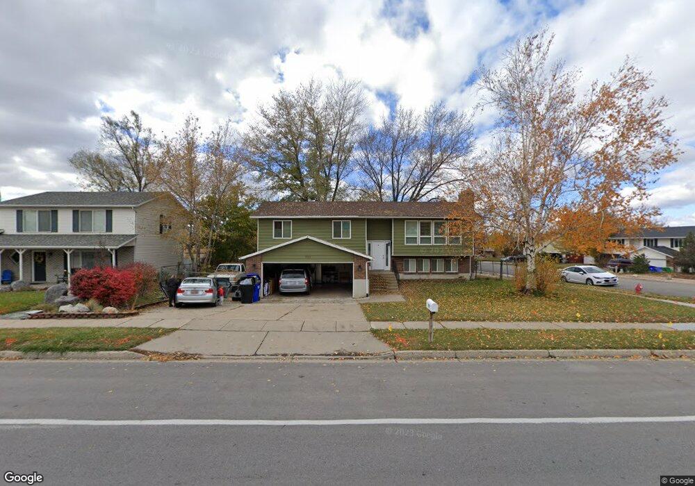
771 N 400 W Centerville, UT 84014
Estimated Value: $504,000 - $546,265
4
Beds
3
Baths
2,153
Sq Ft
$242/Sq Ft
Est. Value
About This Home
This home is located at 771 N 400 W, Centerville, UT 84014 and is currently estimated at $520,316, approximately $241 per square foot. 771 N 400 W is a home located in Davis County with nearby schools including Stewart Elementary School, Centerville Jr High, and Viewmont High School.
Ownership History
Date
Name
Owned For
Owner Type
Purchase Details
Closed on
Feb 23, 2024
Sold by
Cannon Clark L and Cannon Amanda
Bought by
771 N 400 W Llc
Current Estimated Value
Purchase Details
Closed on
Nov 8, 2016
Sold by
Edwards Brayden M and Edwards Tiffany A
Bought by
Cannon Clark L and Cannon Amanda
Purchase Details
Closed on
Jun 20, 2013
Sold by
Edwards Brayden M
Bought by
Edwards Brayden M and Edwards Tiffany A
Home Financials for this Owner
Home Financials are based on the most recent Mortgage that was taken out on this home.
Original Mortgage
$160,000
Interest Rate
3.38%
Mortgage Type
New Conventional
Purchase Details
Closed on
Jun 2, 2010
Sold by
Batin Joseph F and Batin Barbara
Bought by
Mackay Michael H and Mackay Sara T
Home Financials for this Owner
Home Financials are based on the most recent Mortgage that was taken out on this home.
Original Mortgage
$188,140
Interest Rate
5.5%
Mortgage Type
FHA
Create a Home Valuation Report for This Property
The Home Valuation Report is an in-depth analysis detailing your home's value as well as a comparison with similar homes in the area
Home Values in the Area
Average Home Value in this Area
Purchase History
| Date | Buyer | Sale Price | Title Company |
|---|---|---|---|
| 771 N 400 W Llc | -- | None Listed On Document | |
| Cannon Clark L | -- | Aspen Title | |
| Edwards Brayden M | -- | Aspen Title Insurance | |
| Edwards Brayden M | -- | Aspen Title Insurance | |
| Mackay Michael H | -- | Wasatch Title Insurance Age |
Source: Public Records
Mortgage History
| Date | Status | Borrower | Loan Amount |
|---|---|---|---|
| Previous Owner | Edwards Brayden M | $160,000 | |
| Previous Owner | Mackay Michael H | $188,140 |
Source: Public Records
Tax History Compared to Growth
Tax History
| Year | Tax Paid | Tax Assessment Tax Assessment Total Assessment is a certain percentage of the fair market value that is determined by local assessors to be the total taxable value of land and additions on the property. | Land | Improvement |
|---|---|---|---|---|
| 2025 | $2,651 | $253,550 | $152,140 | $101,410 |
| 2024 | $2,618 | $254,649 | $136,030 | $118,619 |
| 2023 | $2,503 | $242,000 | $123,240 | $118,759 |
| 2022 | $2,631 | $463,000 | $205,369 | $257,631 |
| 2021 | $2,368 | $357,000 | $171,274 | $185,726 |
| 2020 | $2,003 | $302,000 | $167,880 | $134,120 |
| 2019 | $2,024 | $298,000 | $170,307 | $127,693 |
| 2018 | $1,849 | $269,000 | $158,142 | $110,858 |
| 2016 | $1,610 | $130,130 | $50,080 | $80,050 |
| 2015 | $1,546 | $117,920 | $50,080 | $67,840 |
| 2014 | $1,423 | $111,024 | $50,080 | $60,944 |
| 2013 | -- | $104,852 | $40,206 | $64,646 |
Source: Public Records
Map
Nearby Homes
- 495 Creek View Rd
- 781 Pheasantbrook Dr
- 509 Applewood Dr
- 447 W 620 N Unit 106
- 282 W 650 N
- 281 W 650 N Unit C
- 271 Brookfield Ln
- 429 W 1050 N
- 638 N 800 W
- 171 W 650 N
- 67 W Pheasantbrook Dr
- 1154 N 700 W
- 732 W 1175 N
- 274 N 100 W
- 128 W 200 N
- 232 N 100 W
- 2 S 285 W
- 117 Cara Vella Ln
- 295 E 300 N
- 88 W 50 S Unit D-5
- 763 N 400 W
- 447 Creek View Rd
- 447 W 775 N
- 469 Creek View Rd
- 442 Creek View Rd
- 754 Mountain View Rd
- 424 Creek View Rd
- 383 W 775 N
- 759 N 400 W
- 538 W Creek View Cir
- 473 Creek View Rd
- 474 Mountain View Rd
- 374 W 775 N
- 472 Creek View Rd
- 747 N 400 W
- 746 Mountain View Rd
- 833 N 400 W
- 347 W 775 N
- 492 Mountain View Rd
- 840 Camille Cir