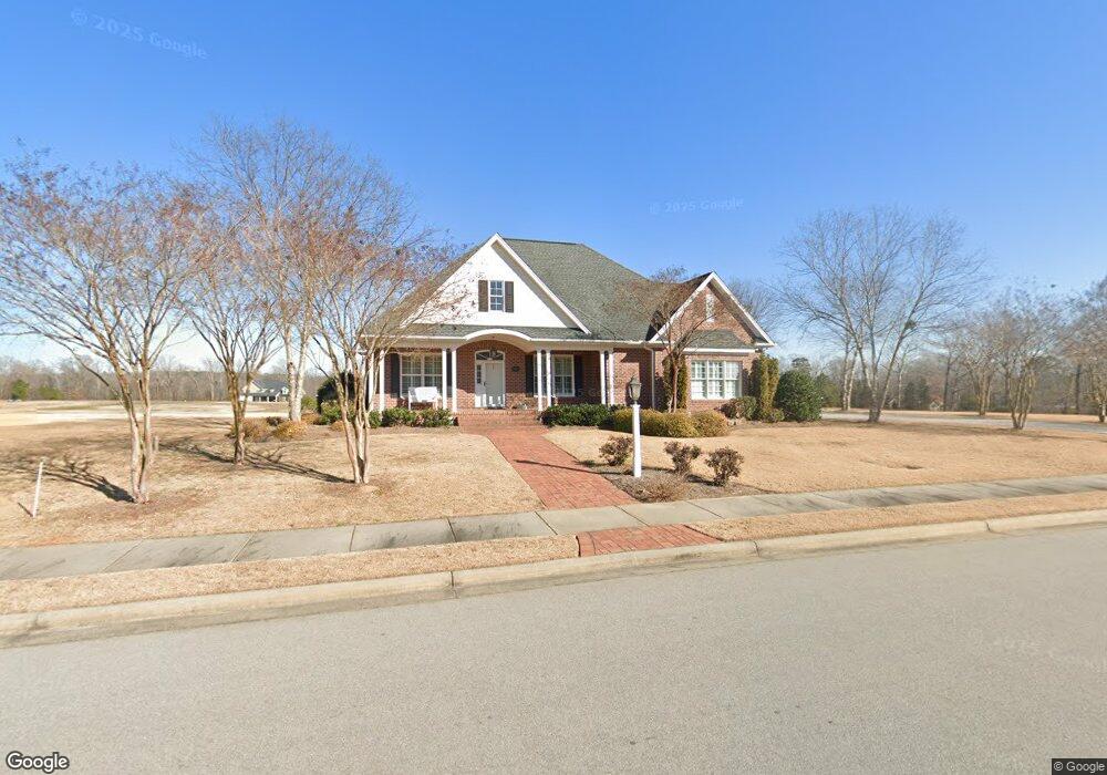
771 Rivers Edge Pkwy Roanoke Rapids, NC 27870
Estimated Value: $403,000 - $447,000
3
Beds
3
Baths
3,696
Sq Ft
$113/Sq Ft
Est. Value
About This Home
This home is located at 771 Rivers Edge Pkwy, Roanoke Rapids, NC 27870 and is currently estimated at $416,665, approximately $112 per square foot. 771 Rivers Edge Pkwy is a home located in Halifax County with nearby schools including Roanoke Rapids High School, Gingerbread House, and Miracle Tabernacle Christian School.
Ownership History
Date
Name
Owned For
Owner Type
Purchase Details
Closed on
Aug 15, 2019
Sold by
Drm Group Llc
Bought by
Tillery James J
Current Estimated Value
Purchase Details
Closed on
Nov 24, 2015
Bought by
Lee James
Home Financials for this Owner
Home Financials are based on the most recent Mortgage that was taken out on this home.
Original Mortgage
$586,500
Interest Rate
3.83%
Mortgage Type
FHA
Purchase Details
Closed on
May 26, 2010
Sold by
Bbd Development Inc
Bought by
Crocker Tillery Jr James Lee and Crocker Tillery Nancy
Home Financials for this Owner
Home Financials are based on the most recent Mortgage that was taken out on this home.
Original Mortgage
$292,500
Interest Rate
3.75%
Mortgage Type
Construction
Create a Home Valuation Report for This Property
The Home Valuation Report is an in-depth analysis detailing your home's value as well as a comparison with similar homes in the area
Home Values in the Area
Average Home Value in this Area
Purchase History
| Date | Buyer | Sale Price | Title Company |
|---|---|---|---|
| Tillery James J | $28,500 | -- | |
| Lee James | $40,000 | -- | |
| Crocker Tillery Jr James Lee | $40,000 | None Available |
Source: Public Records
Mortgage History
| Date | Status | Borrower | Loan Amount |
|---|---|---|---|
| Previous Owner | Lee James | $586,500 | |
| Previous Owner | Crocker Tillery Jr James Lee | $292,500 |
Source: Public Records
Tax History Compared to Growth
Tax History
| Year | Tax Paid | Tax Assessment Tax Assessment Total Assessment is a certain percentage of the fair market value that is determined by local assessors to be the total taxable value of land and additions on the property. | Land | Improvement |
|---|---|---|---|---|
| 2025 | $65 | $405,100 | $44,800 | $360,300 |
| 2024 | $65 | $405,100 | $44,800 | $360,300 |
| 2023 | $5,580 | $327,400 | $37,200 | $290,200 |
| 2022 | $5,669 | $327,400 | $37,200 | $290,200 |
| 2021 | $5,530 | $327,400 | $37,200 | $290,200 |
| 2020 | $5,586 | $327,400 | $37,200 | $290,200 |
| 2019 | $5,105 | $294,200 | $33,100 | $261,100 |
| 2018 | $5,101 | $294,200 | $33,100 | $261,100 |
| 2017 | $5,015 | $294,200 | $33,100 | $261,100 |
| 2016 | $5,136 | $294,200 | $33,100 | $261,100 |
| 2015 | $4,887 | $294,200 | $33,100 | $261,100 |
| 2014 | $5,213 | $328,060 | $59,470 | $268,590 |
Source: Public Records
Map
Nearby Homes
- 769 Rivers Edge Pkwy
- 782 Rivers Edge Pkwy
- 784 Rivers Edge Pkwy
- 780 Rivers Edge Pkwy
- 786 Rivers Edge Pkwy
- 778 Rivers Edge Pkwy
- 779 Rivers Edge Pkwy
- 774 Rivers Edge Pkwy
- 772 Rivers Edge Pkwy
- 770 Rivers Edge Pkwy
- 768 Rivers Edge Pkwy
- 766 Rivers Edge Pkwy
- 783 Rivers Edge Pkwy
- 792 Rivers Edge Pkwy
- 755 Rivers Edge Pkwy
- 204 Rollingwood Rd
- 764 Rivers Edge Pkwy
- 785 Rivers Edge Pkwy
- Taft Plan at Canal Walk
- Roosevelt Plan at Canal Walk
- 773 Rivers Edge Pkwy
- 773 River's Edge Pkwy
- 775 Rivers Edge Pkwy
- 775 River's Edge Pkwy
- 767 Rivers Edge Pkwy
- 786 Old Farm Rd S
- 777 Rivers Edge Pkwy
- 765 Rivers Edge Pkwy
- 788 Rivers Edge Pkwy
- 776 Rivers Edge Pkwy
- 412 Old Farm Rd
- 761 Rivers Edge Pkwy
- 414 Old Farm Rd
- 790 Rivers Edge Pkwy
- Lot 58 Rivers Edge Pkwy
- Lot 68 Rivers Edge Pkwy
- Lot 57 Rivers Edge Pkwy
- Lot 62 Rivers Edge Pkwy
- Lot 59 Rivers Edge Pkwy
- Lot 63 Rivers Edge Pkwy