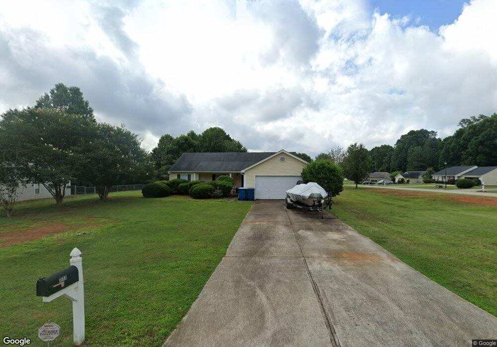
771 Samuel Ct Bethlehem, GA 30620
Estimated Value: $262,000 - $290,000
Studio
2
Baths
1,210
Sq Ft
$225/Sq Ft
Est. Value
About This Home
This home is located at 771 Samuel Ct, Bethlehem, GA 30620 and is currently estimated at $272,720, approximately $225 per square foot. 771 Samuel Ct is a home located in Barrow County with nearby schools including Bethlehem Elementary School, Haymon-Morris Middle School, and Apalachee High School.
Ownership History
Date
Name
Owned For
Owner Type
Purchase Details
Closed on
Sep 30, 2002
Sold by
Star Home Builders
Bought by
Rienecke Merrill A and Rienecke Shannon M
Current Estimated Value
Home Financials for this Owner
Home Financials are based on the most recent Mortgage that was taken out on this home.
Original Mortgage
$113,578
Outstanding Balance
$46,642
Interest Rate
6.27%
Mortgage Type
FHA
Estimated Equity
$226,078
Purchase Details
Closed on
Apr 12, 2002
Sold by
Casta Development In
Bought by
Star Home Builders I
Purchase Details
Closed on
Dec 4, 2000
Bought by
Casta Development In
Create a Home Valuation Report for This Property
The Home Valuation Report is an in-depth analysis detailing your home's value as well as a comparison with similar homes in the area
Home Values in the Area
Average Home Value in this Area
Purchase History
| Date | Buyer | Sale Price | Title Company |
|---|---|---|---|
| Rienecke Merrill A | $115,400 | -- | |
| Star Home Builders I | $27,000 | -- | |
| Casta Development In | -- | -- |
Source: Public Records
Mortgage History
| Date | Status | Borrower | Loan Amount |
|---|---|---|---|
| Open | Rienecke Merrill A | $113,578 |
Source: Public Records
Tax History
| Year | Tax Paid | Tax Assessment Tax Assessment Total Assessment is a certain percentage of the fair market value that is determined by local assessors to be the total taxable value of land and additions on the property. | Land | Improvement |
|---|---|---|---|---|
| 2025 | $2,069 | $89,524 | $21,200 | $68,324 |
| 2024 | $2,100 | $85,580 | $19,200 | $66,380 |
| 2023 | $1,693 | $85,980 | $19,200 | $66,780 |
| 2022 | $1,897 | $67,226 | $19,200 | $48,026 |
| 2021 | $1,663 | $56,088 | $16,000 | $40,088 |
| 2020 | $1,662 | $56,088 | $16,000 | $40,088 |
| 2019 | $1,690 | $56,088 | $16,000 | $40,088 |
| 2018 | $1,545 | $52,088 | $12,000 | $40,088 |
| 2017 | $1,075 | $36,934 | $12,000 | $24,934 |
| 2016 | $1,056 | $36,934 | $12,000 | $24,934 |
| 2015 | $1,071 | $37,213 | $12,000 | $25,213 |
| 2014 | $893 | $31,372 | $5,880 | $25,492 |
| 2013 | -- | $30,134 | $5,880 | $24,254 |
Source: Public Records
Map
Nearby Homes
- 916 Elijah Way
- 123 Regency Dr
- 1356 Pine View Trail
- 103 McElhannon Rd SE
- 1408 Wyndham Way
- 1224 Dale Dr
- 465 Cade Ct
- 463 Gin Mill Dr
- 812 Christmas Ave
- 784 Manger Ave
- 0 Manger Ave E Unit 20154677
- 0 Manger Ave E Unit 20127001
- 439 Vinings Ct
- 13 Rowlett Place
- 14 Rowlett Place
- 590 Manning Gin Rd
- 3207 Jack Glass Rd
- 724 Manger Ave
- 449 & 455 Carl-Bethlehem Rd
- 898 Harrison Mill Rd
- 773 Samuel Ct
- 773 Samuel Ct Unit 1
- 775 Samuel Ct Unit 35
- 775 Samuel Ct
- 1473 Elise Dr
- 890 Dustin Ct
- 1475 Elise Dr
- 1471 Elise Dr
- 892 Dustin Ct
- 892 Dustin Ct Unit 39
- 770 Samuel Ct
- 777 Samuel Ct
- 1469 Elise Dr
- 1477 Elise Dr
- 772 Samuel Ct
- 894 Dustin Ct
- 774 Samuel Ct
- 1467 Elise Dr
- 1479 Elise Dr
- 776 Samuel Ct
Your Personal Tour Guide
Ask me questions while you tour the home.