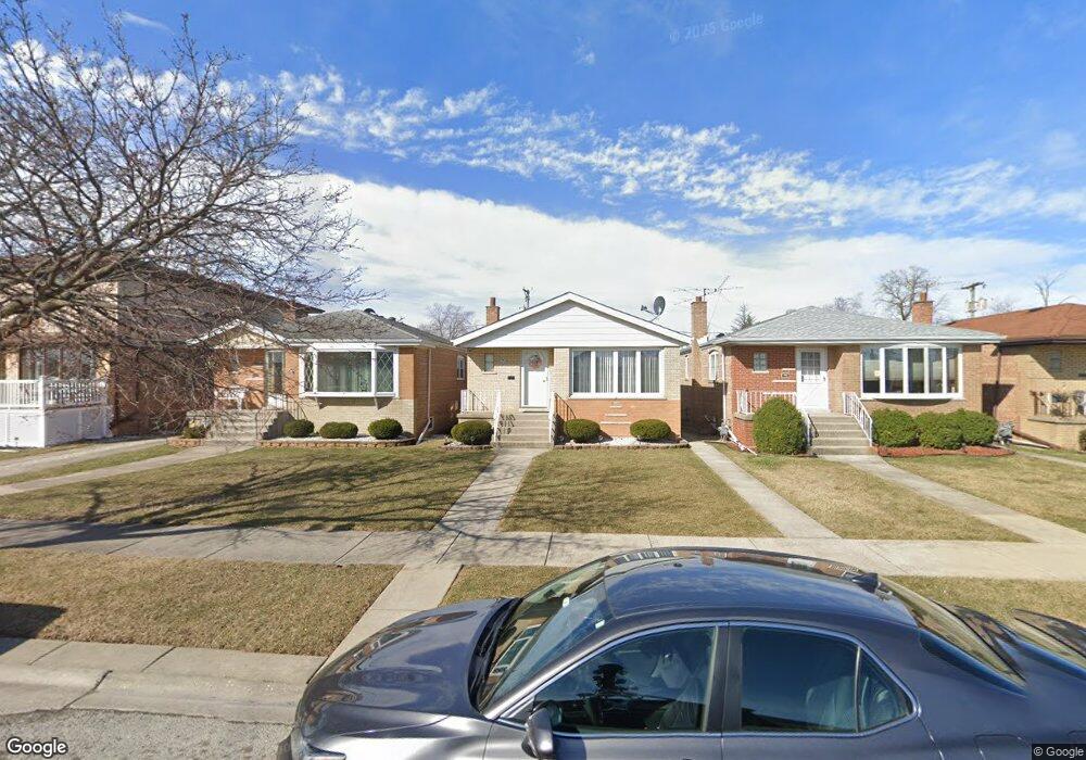
7710 Menard Ave Burbank, IL 60459
Estimated Value: $290,933 - $345,000
3
Beds
1
Bath
1,035
Sq Ft
$304/Sq Ft
Est. Value
About This Home
This home is located at 7710 Menard Ave, Burbank, IL 60459 and is currently estimated at $314,233, approximately $303 per square foot. 7710 Menard Ave is a home located in Cook County with nearby schools including Harry E. Fry School, Reavis High School, and St Albert the Great Catholic School.
Ownership History
Date
Name
Owned For
Owner Type
Purchase Details
Closed on
Nov 12, 1999
Sold by
Kajmowicz Brian
Bought by
Tumiel Krzysztof and Tumiel Beata
Current Estimated Value
Home Financials for this Owner
Home Financials are based on the most recent Mortgage that was taken out on this home.
Original Mortgage
$93,000
Interest Rate
7.97%
Purchase Details
Closed on
Feb 5, 1999
Sold by
Murphy Lawrence
Bought by
Kajmowicz Brian
Purchase Details
Closed on
Mar 30, 1997
Sold by
Murphy Eugene F
Bought by
Murphy Dorothy C
Purchase Details
Closed on
Oct 14, 1996
Sold by
Murphy Dorothy C
Bought by
Murphy Dorothy C and Murphy Eugene F
Create a Home Valuation Report for This Property
The Home Valuation Report is an in-depth analysis detailing your home's value as well as a comparison with similar homes in the area
Home Values in the Area
Average Home Value in this Area
Purchase History
| Date | Buyer | Sale Price | Title Company |
|---|---|---|---|
| Tumiel Krzysztof | $153,500 | -- | |
| Kajmowicz Brian | $113,000 | -- | |
| Murphy Dorothy C | -- | Chicago Title Insurance Co | |
| Murphy Dorothy C | -- | -- |
Source: Public Records
Mortgage History
| Date | Status | Borrower | Loan Amount |
|---|---|---|---|
| Closed | Tumiel Krzysztof | $93,000 |
Source: Public Records
Tax History
| Year | Tax Paid | Tax Assessment Tax Assessment Total Assessment is a certain percentage of the fair market value that is determined by local assessors to be the total taxable value of land and additions on the property. | Land | Improvement |
|---|---|---|---|---|
| 2025 | $6,108 | $23,001 | $3,506 | $19,495 |
| 2024 | $6,108 | $23,001 | $3,506 | $19,495 |
| 2023 | $4,958 | $23,001 | $3,506 | $19,495 |
| 2022 | $4,958 | $16,278 | $3,044 | $13,234 |
| 2021 | $4,777 | $16,277 | $3,044 | $13,233 |
| 2020 | $4,690 | $16,277 | $3,044 | $13,233 |
| 2019 | $4,807 | $16,845 | $2,767 | $14,078 |
| 2018 | $4,668 | $16,845 | $2,767 | $14,078 |
| 2017 | $4,533 | $16,845 | $2,767 | $14,078 |
| 2016 | $4,264 | $14,598 | $2,306 | $12,292 |
| 2015 | $4,062 | $14,598 | $2,306 | $12,292 |
| 2014 | $3,958 | $14,598 | $2,306 | $12,292 |
| 2013 | $4,362 | $17,141 | $2,306 | $14,835 |
Source: Public Records
Map
Nearby Homes
- 7836 Monitor Ave
- 7814 Major Ave
- 7843 Massasoit Ave
- 5822 W 79th St
- 5841 W 75th Place
- 7807 Parkside Ave
- 7544 Mason Ave
- 7808 Central Ave
- 5735 W 80th St
- 7827 Meade Ave
- 7851 Moody Ave
- 6124 W 79th St
- 7723 Melvina Ave
- 8033 Austin Ave
- 5831 W 81st Place
- 8121 Mcvicker Ave
- 7624 Lockwood Ave
- 6117 W 81st St
- 7948 Merrimac Ave
- 8215 Austin Ave
- 7708 Menard Ave
- 7712 Menard Ave
- 7706 Menard Ave
- 7714 Menard Ave
- 7704 Menard Ave
- 7716 Menard Ave
- 7702 Menard Ave
- 7720 Menard Ave
- 7711 Monitor Ave
- 7717 Monitor Ave
- 7700 Menard Ave
- 7719 Monitor Ave
- 7722 Menard Ave
- 7721 Monitor Ave
- 7707 Monitor Ave
- 7707 Monitor Ave
- 7711 Menard Ave
- 7709 Menard Ave
- 7713 Menard Ave
- 7715 Menard Ave
Your Personal Tour Guide
Ask me questions while you tour the home.