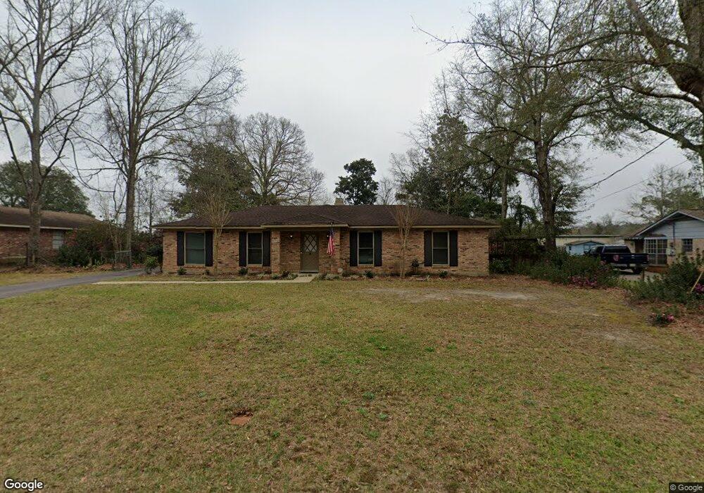
7711 Adobe Ridge Rd S Mobile, AL 36695
Second Creek NeighborhoodEstimated Value: $181,579 - $260,000
3
Beds
2
Baths
1,692
Sq Ft
$129/Sq Ft
Est. Value
About This Home
This home is located at 7711 Adobe Ridge Rd S, Mobile, AL 36695 and is currently estimated at $218,645, approximately $129 per square foot. 7711 Adobe Ridge Rd S is a home located in Mobile County with nearby schools including O'rourke Elementary School, Bernice J Causey Middle School, and Baker High School.
Ownership History
Date
Name
Owned For
Owner Type
Purchase Details
Closed on
Dec 12, 2022
Sold by
Tims Dianne
Bought by
Dianne R Tims Living Trust and Tims
Current Estimated Value
Purchase Details
Closed on
Mar 12, 1999
Sold by
Howell William L
Bought by
Tims Dianne
Home Financials for this Owner
Home Financials are based on the most recent Mortgage that was taken out on this home.
Original Mortgage
$79,755
Interest Rate
6.73%
Mortgage Type
FHA
Create a Home Valuation Report for This Property
The Home Valuation Report is an in-depth analysis detailing your home's value as well as a comparison with similar homes in the area
Home Values in the Area
Average Home Value in this Area
Purchase History
| Date | Buyer | Sale Price | Title Company |
|---|---|---|---|
| Dianne R Tims Living Trust | -- | None Listed On Document | |
| Tims Dianne | -- | -- |
Source: Public Records
Mortgage History
| Date | Status | Borrower | Loan Amount |
|---|---|---|---|
| Previous Owner | Tims Dianne | $79,755 |
Source: Public Records
Tax History Compared to Growth
Tax History
| Year | Tax Paid | Tax Assessment Tax Assessment Total Assessment is a certain percentage of the fair market value that is determined by local assessors to be the total taxable value of land and additions on the property. | Land | Improvement |
|---|---|---|---|---|
| 2024 | $519 | $13,090 | $3,000 | $10,090 |
| 2023 | $519 | $12,700 | $3,030 | $9,670 |
| 2022 | $474 | $11,150 | $2,750 | $8,400 |
| 2021 | $439 | $10,430 | $2,500 | $7,930 |
| 2020 | $439 | $10,430 | $2,500 | $7,930 |
| 2019 | $432 | $10,270 | $2,500 | $7,770 |
| 2018 | $487 | $10,240 | $0 | $0 |
| 2017 | $423 | $10,100 | $0 | $0 |
| 2016 | $516 | $12,020 | $0 | $0 |
| 2013 | -- | $11,200 | $0 | $0 |
Source: Public Records
Map
Nearby Homes
- 7671 Creekwood Dr
- 0 Creekwood Place Dr Unit 7647963
- 2039 Creekwood Place Ct
- 7912 Yorkhaven Rd
- 0 Silver Maple Dr Unit 13
- 0 Silver Maple Dr Unit 7663007
- 0 Silver Maple Dr Unit 9 & 10 363657
- 0 Silver Maple Dr Unit 7403058
- 7610 Aspen Dr
- 7971 Suzanne Way
- 8011 Suzanne Way
- 7691 Sweetgum Ct
- 8020 Suzanne Way
- 8100 Danielle Dr
- 1832 Aden Rd
- 2151 Carrington Dr
- 1542 Stone Hedge Dr W
- 8240 Taddish Dr N
- 2316 Leroy Stevens Rd
- 2040 Merrill Rd
- 7701 Adobe Ridge Rd S
- 7721 Adobe Ridge Rd S
- 7700 Adobe Ridge Rd S
- 7681 Adobe Ridge Rd S
- 7731 Adobe Ridge Rd S
- 7720 Adobe Ridge Rd S
- 7710 Adobe Ridge Rd S
- 7751 Adobe Ridge Rd S
- 7680 Adobe Ridge Rd S
- 7671 Adobe Ridge Rd S
- 7670 Adobe Ridge Rd S
- 7670 Adobe Ridge Rd S
- 7661 Adobe Ridge Rd S
- 7761 Adobe Ridge Rd S
- 7660 Adobe Ridge Rd S
- 7760 Adobe Ridge Rd S
- 7771 Adobe Ridge Rd S
- 7651 Adobe Ridge Rd S
- 2033 Adobe Ridge Rd W
- 7650 Adobe Ridge Rd S