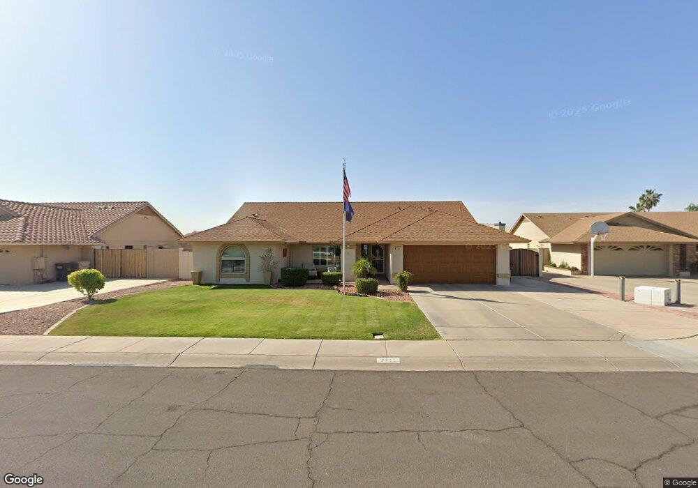
7711 W Aster Dr Peoria, AZ 85381
Estimated Value: $417,552 - $498,000
--
Bed
3
Baths
2,129
Sq Ft
$224/Sq Ft
Est. Value
About This Home
This home is located at 7711 W Aster Dr, Peoria, AZ 85381 and is currently estimated at $476,388, approximately $223 per square foot. 7711 W Aster Dr is a home located in Maricopa County with nearby schools including Oasis Elementary School, Centennial High School, and Living Word Academy.
Ownership History
Date
Name
Owned For
Owner Type
Purchase Details
Closed on
Aug 22, 1994
Sold by
Bolding Clifford and Bolding Gail P
Bought by
Roosa Gary B and Roosa Vickie L
Current Estimated Value
Home Financials for this Owner
Home Financials are based on the most recent Mortgage that was taken out on this home.
Original Mortgage
$129,465
Interest Rate
8.58%
Mortgage Type
VA
Create a Home Valuation Report for This Property
The Home Valuation Report is an in-depth analysis detailing your home's value as well as a comparison with similar homes in the area
Home Values in the Area
Average Home Value in this Area
Purchase History
| Date | Buyer | Sale Price | Title Company |
|---|---|---|---|
| Roosa Gary B | $130,000 | Old Republic Title Agency |
Source: Public Records
Mortgage History
| Date | Status | Borrower | Loan Amount |
|---|---|---|---|
| Closed | Roosa Gary B | $129,465 |
Source: Public Records
Tax History Compared to Growth
Tax History
| Year | Tax Paid | Tax Assessment Tax Assessment Total Assessment is a certain percentage of the fair market value that is determined by local assessors to be the total taxable value of land and additions on the property. | Land | Improvement |
|---|---|---|---|---|
| 2025 | $1,618 | $20,789 | -- | -- |
| 2024 | $1,594 | $19,799 | -- | -- |
| 2023 | $1,594 | $35,310 | $7,060 | $28,250 |
| 2022 | $1,561 | $27,430 | $5,480 | $21,950 |
| 2021 | $1,671 | $25,060 | $5,010 | $20,050 |
| 2020 | $1,687 | $24,770 | $4,950 | $19,820 |
| 2019 | $1,632 | $22,170 | $4,430 | $17,740 |
| 2018 | $1,578 | $20,810 | $4,160 | $16,650 |
| 2017 | $1,579 | $19,420 | $3,880 | $15,540 |
| 2016 | $1,563 | $18,360 | $3,670 | $14,690 |
| 2015 | $1,458 | $18,110 | $3,620 | $14,490 |
Source: Public Records
Map
Nearby Homes
- 12677 N 77th Dr
- 7725 W Dreyfus Dr
- 7813 W Dreyfus Dr
- 7537 W Dreyfus Dr
- 7544 W Dreyfus Dr
- 7825 W Bloomfield Rd
- 13051 N 75th Dr
- 7418 W Corrine Dr
- 7901 W Pershing Ave
- 7942 W Dreyfus Dr
- 7638 W Shaw Butte Dr
- 8007 W Corrine Dr
- 7301 W Sweetwater Ave
- 8102 W Windrose Dr Unit 1
- 8021 W Charter Oak Rd
- 7583 W Gelding Dr
- 7326 W Pershing Ave
- 13158 N 81st Ave
- 7977 W Wacker Rd Unit 249
- 7977 W Wacker Rd Unit 226
- 7703 W Aster Dr
- 7719 W Aster Dr
- 12716 N 77th Ave
- 12707 N 77th Dr
- 7727 W Aster Dr
- 7702 W Aster Dr
- 12718 N 77th Dr
- 12706 N 77th Ave
- 7718 W Aster Dr
- 7726 W Aster Dr
- 7649 W Aster Dr
- 7711 W Dahlia Dr
- 12697 N 77th Dr
- 7650 W Aster Dr
- 12696 N 77th Ave
- 12708 N 77th Dr
- 7703 W Dahlia Dr
- 7719 W Dahlia Dr
- 7641 W Aster Dr
- 7642 W Windrose Dr