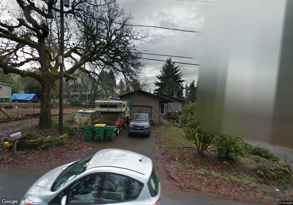
7712 SW Locust St Portland, OR 97223
Estimated Value: $445,000 - $455,685
3
Beds
1
Bath
960
Sq Ft
$469/Sq Ft
Est. Value
About This Home
This home is located at 7712 SW Locust St, Portland, OR 97223 and is currently estimated at $450,421, approximately $469 per square foot. 7712 SW Locust St is a home located in Washington County with nearby schools including Metzger Elementary School, Thomas R. Fowler Middle School, and Tigard High School.
Ownership History
Date
Name
Owned For
Owner Type
Purchase Details
Closed on
Feb 4, 2022
Sold by
Stewart Randy A
Bought by
R & L Stewart Family Trust
Current Estimated Value
Purchase Details
Closed on
May 8, 1997
Sold by
Fessler Melvin L and Fessler Margaret J
Bought by
Stewart Randy A and Stewart Lenore K
Home Financials for this Owner
Home Financials are based on the most recent Mortgage that was taken out on this home.
Original Mortgage
$112,500
Interest Rate
7.98%
Create a Home Valuation Report for This Property
The Home Valuation Report is an in-depth analysis detailing your home's value as well as a comparison with similar homes in the area
Home Values in the Area
Average Home Value in this Area
Purchase History
| Date | Buyer | Sale Price | Title Company |
|---|---|---|---|
| R & L Stewart Family Trust | $86,000 | None Listed On Document | |
| Stewart Randy A | $125,000 | First American Title Ins Co |
Source: Public Records
Mortgage History
| Date | Status | Borrower | Loan Amount |
|---|---|---|---|
| Previous Owner | Stewart Randy A | $112,500 |
Source: Public Records
Tax History Compared to Growth
Tax History
| Year | Tax Paid | Tax Assessment Tax Assessment Total Assessment is a certain percentage of the fair market value that is determined by local assessors to be the total taxable value of land and additions on the property. | Land | Improvement |
|---|---|---|---|---|
| 2026 | $3,134 | $203,030 | -- | -- |
| 2025 | $3,134 | $197,120 | -- | -- |
| 2024 | $3,028 | $191,380 | -- | -- |
| 2023 | $3,028 | $185,810 | $0 | $0 |
| 2022 | $2,915 | $185,810 | $0 | $0 |
| 2021 | $2,843 | $175,150 | $0 | $0 |
| 2020 | $2,760 | $170,050 | $0 | $0 |
| 2019 | $2,684 | $165,100 | $0 | $0 |
| 2018 | $2,562 | $160,300 | $0 | $0 |
| 2017 | $2,467 | $155,640 | $0 | $0 |
| 2016 | $2,350 | $151,110 | $0 | $0 |
| 2015 | $2,252 | $146,710 | $0 | $0 |
| 2014 | $2,186 | $142,440 | $0 | $0 |
Source: Public Records
Map
Nearby Homes
- 10534 SW 80th Ave
- 7402 SW Locust St
- 7830 SW Hemlock St
- 10125 SW 72nd Ave
- 7333 SW Pine St
- 8026 SW Pine St
- 10022 SW 72nd Ave
- 10900 SW 76th Place Unit 43
- 10900 SW 76th Place Unit 46
- 10200 SW 70th Ave
- 10910 SW 74th Ave
- 9825 SW Ventura Ct
- 11047 SW Legacy Oak Way
- 7849 SW Birch St
- 10420 SW Akilean Terrace
- 10442 SW Akilean Terrace Unit 43
- 10450 SW Akilean Terrace Unit 45
- 10470 SW 67th Ave
- 7480 SW Taylors Ferry Rd
- 8826 SW Spruce St
- 7810 SW Locust St
- 10225 SW 77th Ave
- 7706 SW Locust St
- 10255 SW 77th Ave
- 7814 SW Locust St
- 7815 SW Mapleleaf St
- 7715 SW Mapleleaf St
- 10285 SW 77th Ave
- 7707 SW Locust St
- 10210 SW 77th Ave
- 10180 SW 77th Ave
- 7811 SW Locust St
- 7910 SW Locust St
- 7905 SW Mapleleaf St
- 7627 SW Mapleleaf St
- 7619 SW Locust St
- 7618 SW Locust St
- 7909 SW Locust St
- 10057 SW 77th Ave
- 7960 SW Locust St