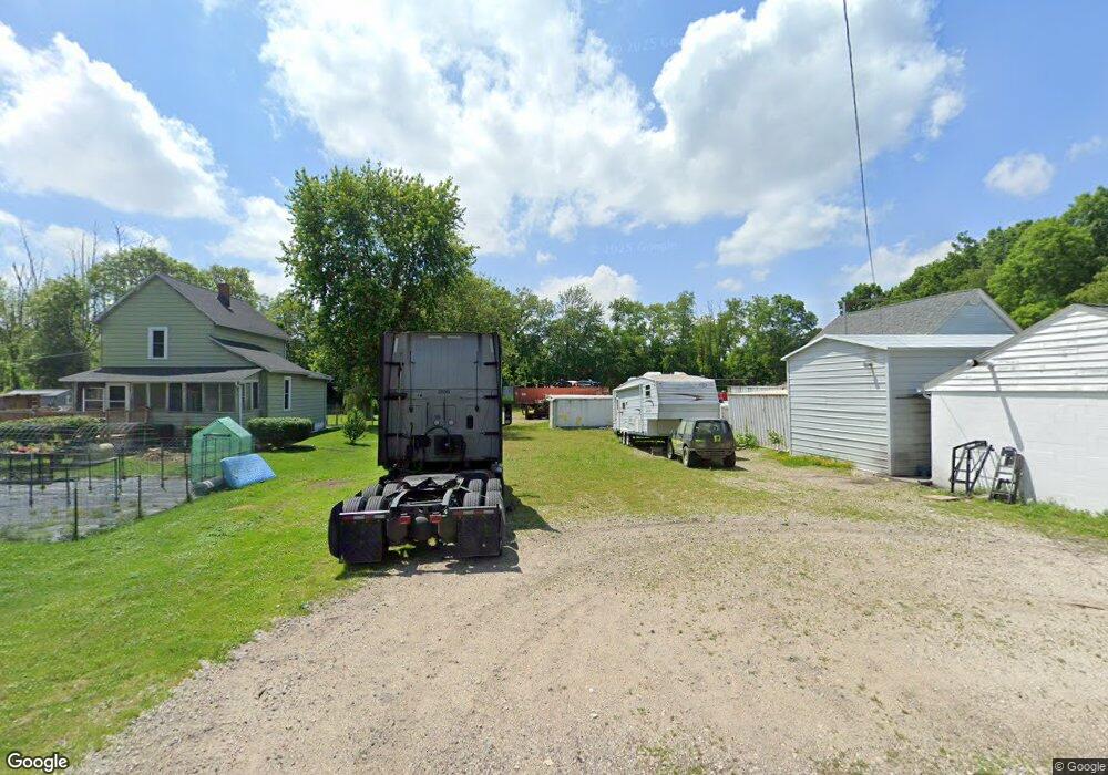
7719 S 7th Ave Clinton, OH 44216
Estimated Value: $94,000 - $203,000
2
Beds
1
Bath
1,156
Sq Ft
$122/Sq Ft
Est. Value
About This Home
This home is located at 7719 S 7th Ave, Clinton, OH 44216 and is currently estimated at $141,000, approximately $121 per square foot. 7719 S 7th Ave is a home located in Summit County with nearby schools including Northwest Primary School, W.S. Stinson Elementary School, and Northwest Middle School.
Ownership History
Date
Name
Owned For
Owner Type
Purchase Details
Closed on
May 20, 2011
Sold by
Castlerock Reo 2 Llc
Bought by
Smith Albert W
Current Estimated Value
Purchase Details
Closed on
Mar 21, 2011
Sold by
Deutsche Bank National Trust Company
Bought by
Castlerock Reo 2 Llc
Purchase Details
Closed on
Nov 12, 2010
Sold by
Trier Bruce A
Bought by
Deutsche Bank National Trust Company
Purchase Details
Closed on
Apr 2, 1998
Sold by
Hansen Dennis T
Bought by
Trier Bruce A
Home Financials for this Owner
Home Financials are based on the most recent Mortgage that was taken out on this home.
Original Mortgage
$48,800
Interest Rate
7.09%
Mortgage Type
New Conventional
Create a Home Valuation Report for This Property
The Home Valuation Report is an in-depth analysis detailing your home's value as well as a comparison with similar homes in the area
Home Values in the Area
Average Home Value in this Area
Purchase History
| Date | Buyer | Sale Price | Title Company |
|---|---|---|---|
| Smith Albert W | $6,200 | Chicago Title Insurance Co | |
| Castlerock Reo 2 Llc | $4,000 | Landcastle Title Llc | |
| Deutsche Bank National Trust Company | $26,000 | None Available | |
| Trier Bruce A | $48,900 | -- |
Source: Public Records
Mortgage History
| Date | Status | Borrower | Loan Amount |
|---|---|---|---|
| Previous Owner | Trier Bruce A | $48,800 |
Source: Public Records
Tax History Compared to Growth
Tax History
| Year | Tax Paid | Tax Assessment Tax Assessment Total Assessment is a certain percentage of the fair market value that is determined by local assessors to be the total taxable value of land and additions on the property. | Land | Improvement |
|---|---|---|---|---|
| 2025 | $304 | $6,034 | $6,034 | -- |
| 2024 | $304 | $6,034 | $6,034 | -- |
| 2023 | $222 | $6,034 | $6,034 | -- |
| 2022 | $222 | $3,819 | $3,819 | $0 |
| 2021 | $201 | $3,819 | $3,819 | $0 |
| 2020 | $174 | $3,820 | $3,820 | $0 |
| 2019 | $171 | $3,090 | $3,090 | $0 |
| 2018 | $174 | $3,090 | $3,090 | $0 |
| 2017 | $169 | $3,090 | $3,090 | $0 |
| 2016 | $169 | $2,820 | $2,820 | $0 |
| 2015 | $169 | $2,820 | $2,820 | $0 |
| 2014 | $176 | $2,820 | $2,820 | $0 |
| 2013 | $327 | $5,240 | $5,240 | $0 |
Source: Public Records
Map
Nearby Homes
- 7805 2nd St
- 18047 Racine Rd
- 11465 Clinton Rd
- 7395 S Cleveland Massillon Rd
- 0 S Cleveland Massillon Rd Unit 5126434
- 8177 S Cleveland Massillon Rd Unit 42
- 8896 Indian Hills Cir NW
- 15644 Marshallville St NW
- 16441 Bieri Rd
- 11626 Black Diamond Rd
- 8113 Erie Ave NW
- 8089 Erie Ave NW
- 8055 Erie Ave NW
- 14072 Marshallville St NW
- 18592 Edwards Rd Unit 156
- 18592 Edwards Rd Unit 126
- 13841 Hametown Rd
- 341 Alexis Ln
- 7985 Leaver Ave NW
- 360 Locust St N
- 7711 S 7th Ave
- 7718 S 6th Ave
- 7737 S 7th Ave
- 7728 S 6th Ave
- 7722 S 6th Ave
- 7728 S 6th Ave
- 7723 S 7th Ave
- 7733 S 6th Ave
- 7739 S 6th Ave
- 7754 S 5th Ave
- 7764 S 5th Ave
- 7705 S 6th Ave
- 7709 N 5th Ave
- 3000 S 1st St
- 7689 N 5th Ave
- 7684 N 5th Ave
- 18642 Warwick Rd
- 7664 N 4th Ave
- 7645 N 5th Ave
- 7614 N 6th Ave
