Estimated Value: $268,000 - $285,000
3
Beds
2
Baths
1,350
Sq Ft
$203/Sq Ft
Est. Value
About This Home
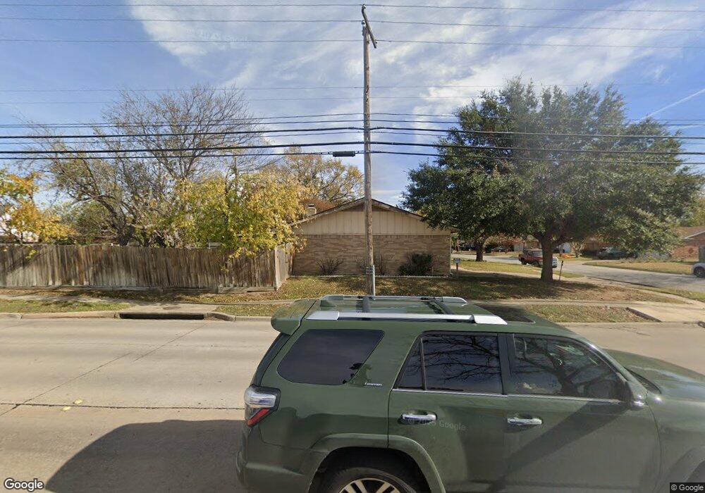
This home is located at 772 Oakwood Ave, Hurst, TX 76053 and is currently estimated at $273,740, approximately $202 per square foot. 772 Oakwood Ave is a home located in Tarrant County with nearby schools including West Hurst Elementary School, Hurst J High School, and L.D. Bell High School.
Ownership History
Date
Name
Owned For
Owner Type
Purchase Details
Closed on
Jun 21, 1996
Sold by
Hud
Bought by
Collins William Scott and Collins Melba Elaine
Current Estimated Value
Home Financials for this Owner
Home Financials are based on the most recent Mortgage that was taken out on this home.
Original Mortgage
$60,150
Outstanding Balance
$3,878
Interest Rate
8.1%
Estimated Equity
$269,862
Create a Home Valuation Report for This Property
The Home Valuation Report is an in-depth analysis detailing your home's value as well as a comparison with similar homes in the area
Home Values in the Area
Average Home Value in this Area
Purchase History
| Date | Buyer | Sale Price | Title Company |
|---|---|---|---|
| Collins William Scott | $62,024 | Safeco Land Title |
Source: Public Records
Mortgage History
| Date | Status | Borrower | Loan Amount |
|---|---|---|---|
| Open | Collins William Scott | $60,150 |
Source: Public Records
Tax History Compared to Growth
Tax History
| Year | Tax Paid | Tax Assessment Tax Assessment Total Assessment is a certain percentage of the fair market value that is determined by local assessors to be the total taxable value of land and additions on the property. | Land | Improvement |
|---|---|---|---|---|
| 2025 | $2,469 | $190,493 | $60,000 | $130,493 |
| 2024 | $2,469 | $190,493 | $60,000 | $130,493 |
| 2023 | $2,198 | $182,281 | $30,000 | $152,281 |
| 2022 | $3,591 | $155,974 | $30,000 | $125,974 |
| 2021 | $3,446 | $142,876 | $30,000 | $112,876 |
| 2020 | $3,867 | $160,721 | $30,000 | $130,721 |
| 2019 | $4,053 | $166,310 | $30,000 | $136,310 |
| 2018 | $3,128 | $150,536 | $18,000 | $132,536 |
| 2017 | $3,463 | $150,796 | $18,000 | $132,796 |
| 2016 | $3,148 | $131,654 | $18,000 | $113,654 |
| 2015 | $2,554 | $113,100 | $12,000 | $101,100 |
| 2014 | $2,554 | $113,100 | $12,000 | $101,100 |
Source: Public Records
Map
Nearby Homes
- 741 Ponderosa Dr
- 758 Briarwood Ln
- 756 Briarwood Ln
- 425 Moore Creek Rd
- 744 Briarwood Ln
- 425 Ridgecrest Dr
- 408 Simmons Dr
- 628 Elm St
- 612 Elm St
- 808 Betty Ct
- 520 W Redbud Dr
- 637 Post Oak Dr
- 708 Hurstview Dr
- 616 Timberline Dr
- 405 Billy Creek Cir
- 649 Timberline Dr
- 516 Hurstview Dr
- 829 Joanna Dr
- 632 Forest Ln
- 833 W Cheryl Ave
- 768 Oakwood Ave
- 764 Oakwood Ave
- 781 Briarwood Ln
- 779 Briarwood Ln
- 773 Oakwood Ave
- 769 Oakwood Ave
- 777 Briarwood Ln
- 760 Oakwood Ave
- 765 Oakwood Ave
- 775 Briarwood Ln
- 756 Oakwood Ave
- 761 Oakwood Ave
- 501 Precinct Line Rd
- 773 Briarwood Ln
- 772 Ponderosa Dr
- 757 Oakwood Ave
- 782 Briarwood Ln
- 780 Briarwood Ln
- 752 Oakwood Ave
- 768 Ponderosa Dr