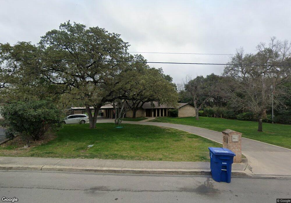
7722 Woodridge Dr San Antonio, TX 78209
Oak Park-Northwood NeighborhoodEstimated Value: $998,000 - $1,403,000
5
Beds
4
Baths
4,383
Sq Ft
$284/Sq Ft
Est. Value
About This Home
This home is located at 7722 Woodridge Dr, San Antonio, TX 78209 and is currently estimated at $1,244,407, approximately $283 per square foot. 7722 Woodridge Dr is a home located in Bexar County with nearby schools including Woodridge Elementary School, Alamo Heights Junior School, and Alamo Heights High School.
Ownership History
Date
Name
Owned For
Owner Type
Purchase Details
Closed on
Jul 22, 2022
Sold by
Mitchell Melvin M
Bought by
Clementson Brandon and Clementson Erin
Current Estimated Value
Purchase Details
Closed on
Jul 13, 2021
Sold by
Mitchell Yeola S Estate and Mitchell Melvin M
Bought by
Mitchell Melvin M
Create a Home Valuation Report for This Property
The Home Valuation Report is an in-depth analysis detailing your home's value as well as a comparison with similar homes in the area
Home Values in the Area
Average Home Value in this Area
Purchase History
| Date | Buyer | Sale Price | Title Company |
|---|---|---|---|
| Clementson Brandon | -- | Presidio Title | |
| Mitchell Melvin M | -- | None Available |
Source: Public Records
Mortgage History
| Date | Status | Borrower | Loan Amount |
|---|---|---|---|
| Closed | Clementson Brandon | $0 |
Source: Public Records
Tax History Compared to Growth
Tax History
| Year | Tax Paid | Tax Assessment Tax Assessment Total Assessment is a certain percentage of the fair market value that is determined by local assessors to be the total taxable value of land and additions on the property. | Land | Improvement |
|---|---|---|---|---|
| 2025 | $25,119 | $1,255,000 | $645,690 | $609,310 |
| 2024 | $25,119 | $1,288,000 | $645,690 | $642,310 |
| 2023 | $25,119 | $900,000 | $645,690 | $254,310 |
| 2022 | $19,367 | $800,000 | $446,120 | $353,880 |
| 2021 | $18,601 | $745,360 | $387,850 | $397,300 |
| 2020 | $16,929 | $677,600 | $387,850 | $349,250 |
| 2019 | $15,759 | $616,000 | $356,170 | $322,380 |
| 2018 | $14,028 | $560,000 | $309,550 | $337,310 |
| 2017 | $12,752 | $509,091 | $259,300 | $334,740 |
| 2016 | $11,592 | $462,810 | $133,220 | $329,590 |
| 2015 | $5,667 | $480,830 | $133,220 | $347,610 |
| 2014 | $5,667 | $451,420 | $0 | $0 |
Source: Public Records
Map
Nearby Homes
- 134 Rockhill Dr
- 215 Oakleaf Dr
- 2603 Brookhurst Dr
- 419 Woodcrest Dr
- 2434 Toftrees Dr
- 205 Larkwood Dr
- 127 Larkwood Dr
- 510 Burnside Dr
- 351 Northridge Dr
- 318 Northridge Dr
- 315 Tophill Rd
- 215 Tophill Rd
- 8033 N New Braunfels Ave Unit 400D
- 8033 N New Braunfels Ave Unit 500C
- 8033 N New Braunfels Ave Unit 300E
- 530 Burnside Dr
- 623 E Nottingham Dr
- 2119 Flamingo St
- 631 Robinhood Place
- 8218 Country Lane Ct
- 206 Rockhill Dr
- 7702 Woodridge Dr
- 212 Rockhill Dr
- 166 Rockhill Dr
- 7727 Woodridge Dr
- 319 Burnside Dr
- 315 Burnside Dr
- 203 Rockhill Dr
- 323 Burnside Dr
- 150 Rockhill Dr
- 2343 Blanton Dr
- 311 Burnside Dr
- 207 Rockhill Dr
- 218 Rockhill Dr
- 327 Burnside Dr
- 307 Burnside Dr
- 331 Burnside Dr
- 167 Rockhill Dr
- 303 Burnside Dr
- 2339 Blanton Dr