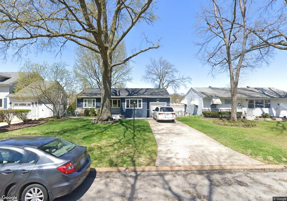
7727 General Sheridan Ln Saint Louis, MO 63123
Estimated Value: $233,000 - $256,000
2
Beds
1
Bath
1,028
Sq Ft
$236/Sq Ft
Est. Value
About This Home
This home is located at 7727 General Sheridan Ln, Saint Louis, MO 63123 and is currently estimated at $242,848, approximately $236 per square foot. 7727 General Sheridan Ln is a home located in St. Louis County with nearby schools including Mesnier Primary School, Gotsch Intermediate School, and Rogers Middle School.
Ownership History
Date
Name
Owned For
Owner Type
Purchase Details
Closed on
Jul 29, 2016
Sold by
Salt Christopher and Salt Jessica
Bought by
Salt Christopher S and Salt Jessica Marie Conrad
Current Estimated Value
Home Financials for this Owner
Home Financials are based on the most recent Mortgage that was taken out on this home.
Original Mortgage
$129,731
Outstanding Balance
$103,498
Interest Rate
3.56%
Mortgage Type
FHA
Estimated Equity
$139,350
Purchase Details
Closed on
Mar 19, 2009
Sold by
Conrad Richard L and Conrad Diana
Bought by
Salt Christopher and Salt Jessica
Home Financials for this Owner
Home Financials are based on the most recent Mortgage that was taken out on this home.
Original Mortgage
$125,681
Interest Rate
5.36%
Mortgage Type
FHA
Purchase Details
Closed on
May 8, 2000
Sold by
Conrad Helen L
Bought by
Conrad Richard L
Create a Home Valuation Report for This Property
The Home Valuation Report is an in-depth analysis detailing your home's value as well as a comparison with similar homes in the area
Home Values in the Area
Average Home Value in this Area
Purchase History
| Date | Buyer | Sale Price | Title Company |
|---|---|---|---|
| Salt Christopher S | -- | Copper Title Llc | |
| Salt Christopher | $128,000 | Title Partners Agency Llc | |
| Conrad Richard L | -- | -- |
Source: Public Records
Mortgage History
| Date | Status | Borrower | Loan Amount |
|---|---|---|---|
| Open | Salt Christopher S | $129,731 | |
| Closed | Salt Christopher | $125,681 |
Source: Public Records
Tax History Compared to Growth
Tax History
| Year | Tax Paid | Tax Assessment Tax Assessment Total Assessment is a certain percentage of the fair market value that is determined by local assessors to be the total taxable value of land and additions on the property. | Land | Improvement |
|---|---|---|---|---|
| 2025 | $2,824 | $39,940 | $15,280 | $24,660 |
| 2024 | $2,824 | $34,770 | $10,180 | $24,590 |
| 2023 | $2,730 | $34,770 | $10,180 | $24,590 |
| 2022 | $2,579 | $29,910 | $11,190 | $18,720 |
| 2021 | $2,520 | $29,910 | $11,190 | $18,720 |
| 2020 | $2,443 | $27,050 | $9,840 | $17,210 |
| 2019 | $2,422 | $27,050 | $9,840 | $17,210 |
| 2018 | $2,191 | $21,600 | $6,860 | $14,740 |
| 2017 | $2,177 | $21,600 | $6,860 | $14,740 |
| 2016 | $2,015 | $21,240 | $5,910 | $15,330 |
| 2015 | $2,021 | $21,240 | $5,910 | $15,330 |
| 2014 | $2,061 | $21,570 | $6,500 | $15,070 |
Source: Public Records
Map
Nearby Homes
- 8261 Watson Rd
- 7625 General Meade Ln
- 8215 General Sheridan Ln
- 8509 Grantshire Ln
- 430 Cannonbury Dr
- 7452 Rockwood Dr
- 1405 Culverhill Dr
- 1330 Drayton Ave
- 7243 General Sherman Ln
- 8875 Rock Forest Dr
- 8853 Raleigh Dr
- 312 Oak Tree Dr
- 308 Oak Tree Dr
- 8914 Chasebury Terrace
- 7904 Camelot Ln Unit 4
- 907 Edgar Rd
- 7101 Fernbrook Dr
- 7636 Fort Henry Dr
- 1509 Holly Dr
- 7424 Granbury Cir
- 7731 General Sheridan Ln
- 7723 General Sheridan Ln
- 7719 General Sheridan Ln
- 7735 General Sheridan Ln
- 7736 General Sherman Ln
- 7732 General Sherman Ln
- 7740 General Sherman Ln
- 7715 General Sheridan Ln
- 7728 General Sheridan Ln
- 7728 General Sherman Ln
- 7722 General Sheridan Ln
- 7724 General Sherman Ln
- 7734 General Sheridan Ln
- 7709 General Sheridan Ln
- 7712 General Sheridan Ln
- 7716 General Sherman Ln
- 7673 General Meade Ln
- 7669 General Meade Ln
- 7708 General Sherman Ln
- 7729 Cheshire Ln