Estimated Value: $186,000 - $198,000
3
Beds
2
Baths
999
Sq Ft
$192/Sq Ft
Est. Value
About This Home
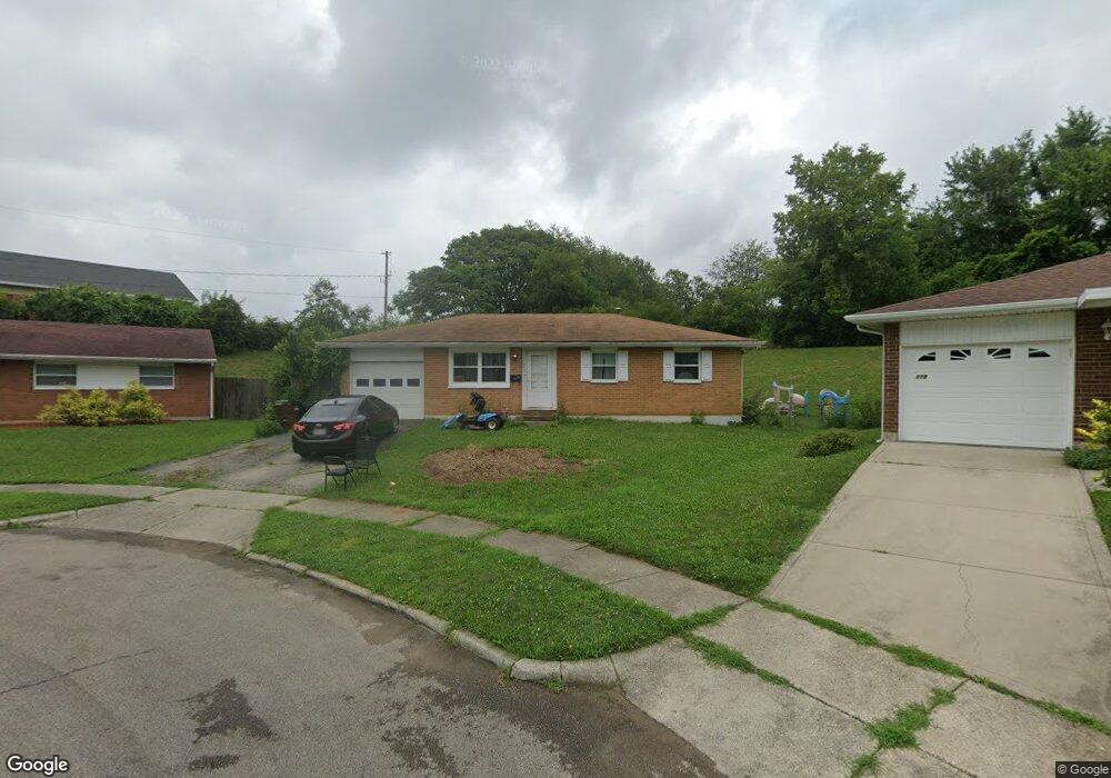
This home is located at 773 Buckskin Trail, Xenia, OH 45385 and is currently estimated at $192,005, approximately $192 per square foot. 773 Buckskin Trail is a home located in Greene County with nearby schools including Xenia High School, Summit Academy Community School for Alternative Learners - Xenia, and Legacy Christian Academy.
Ownership History
Date
Name
Owned For
Owner Type
Purchase Details
Closed on
Apr 30, 2024
Sold by
Baird Vincent D
Bought by
Thompson Jessica K
Current Estimated Value
Home Financials for this Owner
Home Financials are based on the most recent Mortgage that was taken out on this home.
Original Mortgage
$90,500
Outstanding Balance
$89,216
Interest Rate
6.82%
Mortgage Type
New Conventional
Estimated Equity
$102,789
Purchase Details
Closed on
Nov 30, 2020
Sold by
Thompson Albert J and Thompson Linda S
Bought by
Baird Vincent D and Thompson Jessica K
Home Financials for this Owner
Home Financials are based on the most recent Mortgage that was taken out on this home.
Original Mortgage
$57,000
Interest Rate
2.8%
Mortgage Type
New Conventional
Purchase Details
Closed on
Dec 4, 1990
Bought by
Thompson Albert J and Thompson Thompson
Create a Home Valuation Report for This Property
The Home Valuation Report is an in-depth analysis detailing your home's value as well as a comparison with similar homes in the area
Home Values in the Area
Average Home Value in this Area
Purchase History
| Date | Buyer | Sale Price | Title Company |
|---|---|---|---|
| Thompson Jessica K | $90,500 | None Listed On Document | |
| Baird Vincent D | $60,000 | None Available | |
| Thompson Albert J | $59,900 | -- |
Source: Public Records
Mortgage History
| Date | Status | Borrower | Loan Amount |
|---|---|---|---|
| Open | Thompson Jessica K | $90,500 | |
| Previous Owner | Baird Vincent D | $57,000 |
Source: Public Records
Tax History Compared to Growth
Tax History
| Year | Tax Paid | Tax Assessment Tax Assessment Total Assessment is a certain percentage of the fair market value that is determined by local assessors to be the total taxable value of land and additions on the property. | Land | Improvement |
|---|---|---|---|---|
| 2024 | $2,168 | $50,670 | $13,400 | $37,270 |
| 2023 | $2,168 | $50,670 | $13,400 | $37,270 |
| 2022 | $1,791 | $35,700 | $7,890 | $27,810 |
| 2021 | $1,815 | $34,680 | $6,870 | $27,810 |
| 2020 | $1,689 | $34,680 | $6,870 | $27,810 |
| 2019 | $1,574 | $30,410 | $6,650 | $23,760 |
| 2018 | $1,580 | $30,410 | $6,650 | $23,760 |
| 2017 | $1,530 | $30,410 | $6,650 | $23,760 |
| 2016 | $1,457 | $27,530 | $6,650 | $20,880 |
| 2015 | $731 | $27,530 | $6,650 | $20,880 |
| 2014 | $700 | $27,530 | $6,650 | $20,880 |
Source: Public Records
Map
Nearby Homes
- 1144 Rockwell Dr
- 1208 Bellbrook Ave
- 1272 Bellbrook Ave
- 1342 Kylemore Dr
- 1223 June Dr
- 1233 June Dr
- 1618 Navajo Dr
- 1283 June Dr
- 1391 June Dr
- 1778 Arapaho Dr
- 1568 Cheyenne Dr
- 1653 Seneca Dr
- 305-325 Bellbrook Ave
- 1403 Texas Dr
- 453 Walnut St
- 121 S Progress Dr
- 1769 Gayhart Dr
- 523 Newport Rd
- 1866 Roxbury Dr
- 343 Sheelin Rd
- 767 Buckskin Trail
- 779 Buckskin Trail
- 785 Buckskin Trail
- 761 Buckskin Trail
- 753 Buckskin Trail
- 766 Buckskin Trail
- 807 Buckskin Trail
- 745 Buckskin Trail
- 796 Buckskin Trail
- 738 Buckskin Trail
- 819 Buckskin Trail
- 733 Buckskin Trail
- 808 Buckskin Trail
- 726 Buckskin Trail
- 833 Buckskin Trail
- 801 Moccasin Trail
- 820 Buckskin Trail
- 717 Buckskin Trail
- 813 Moccasin Trail
- 834 Buckskin Trail