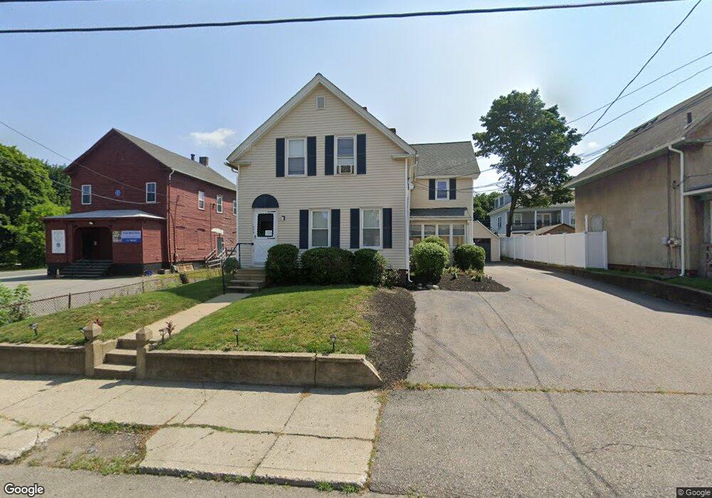
773 Main St Clinton, MA 01510
Estimated Value: $463,442 - $614,000
4
Beds
2
Baths
2,221
Sq Ft
$251/Sq Ft
Est. Value
About This Home
This home is located at 773 Main St, Clinton, MA 01510 and is currently estimated at $558,111, approximately $251 per square foot. 773 Main St is a home located in Worcester County with nearby schools including Clinton Elementary School, Clinton Senior High School, and Clinton Middle School.
Ownership History
Date
Name
Owned For
Owner Type
Purchase Details
Closed on
Jul 21, 2005
Sold by
Mcgrail Judith F and Mcgrail William T
Bought by
Mcgrail Jennifer L and Mcgrail Patrick A
Current Estimated Value
Home Financials for this Owner
Home Financials are based on the most recent Mortgage that was taken out on this home.
Original Mortgage
$260,000
Outstanding Balance
$135,109
Interest Rate
5.59%
Mortgage Type
Purchase Money Mortgage
Estimated Equity
$423,002
Purchase Details
Closed on
Apr 16, 2002
Sold by
Tierney Thomas M and Tierney Peter J
Bought by
Mcgrail William T and Mcgrail Judith F
Create a Home Valuation Report for This Property
The Home Valuation Report is an in-depth analysis detailing your home's value as well as a comparison with similar homes in the area
Home Values in the Area
Average Home Value in this Area
Purchase History
| Date | Buyer | Sale Price | Title Company |
|---|---|---|---|
| Mcgrail Jennifer L | $325,000 | -- | |
| Mcgrail William T | $130,000 | -- |
Source: Public Records
Mortgage History
| Date | Status | Borrower | Loan Amount |
|---|---|---|---|
| Open | Mcgrail Jennifer L | $260,000 | |
| Previous Owner | Mcgrail William T | $200,000 |
Source: Public Records
Tax History
| Year | Tax Paid | Tax Assessment Tax Assessment Total Assessment is a certain percentage of the fair market value that is determined by local assessors to be the total taxable value of land and additions on the property. | Land | Improvement |
|---|---|---|---|---|
| 2025 | $5,762 | $433,200 | $80,300 | $352,900 |
| 2024 | $5,197 | $395,500 | $80,300 | $315,200 |
| 2023 | $4,904 | $366,800 | $73,000 | $293,800 |
| 2022 | $4,892 | $328,100 | $66,400 | $261,700 |
| 2021 | $4,430 | $277,900 | $63,200 | $214,700 |
| 2020 | $3,811 | $246,000 | $63,200 | $182,800 |
| 2019 | $3,578 | $224,600 | $61,400 | $163,200 |
| 2018 | $3,491 | $205,600 | $69,000 | $136,600 |
| 2017 | $3,121 | $176,600 | $57,500 | $119,100 |
| 2016 | $3,050 | $176,600 | $57,500 | $119,100 |
| 2015 | $3,109 | $186,600 | $55,900 | $130,700 |
| 2014 | $3,014 | $186,600 | $55,900 | $130,700 |
Source: Public Records
Map
Nearby Homes
- 719 Main St
- 57 Clark St
- 861 Main St
- 55 Sterling St Unit 306
- 55 Sterling St Unit 312
- 55 Sterling St Unit 314
- 55 Sterling St Unit 212
- 459 High St
- 508 High St
- 25 Pearl St
- 93 Forest St
- 23 Ash St
- 229 Sterling St
- 30 Henry St Unit 30B
- 5 Catherine St
- 51 Rigby St
- 155 Cedar St
- 0 Parker Rd
- 115117 Mechanic St Unit 4
- 115117 Mechanic St Unit 3
- 773 Main St Unit 2
- 773 Main St Unit 1
- 767 Main St
- 737 Main St Unit 1
- 737 Main St
- 104 Clark St Unit 106
- 761 Main St
- 118 Clark St
- 787 Main St
- 98 Clark St Unit 100
- 753 Main St
- 137 Clark St
- 789 Main St
- 96 Clark St
- 135 Clark St
- 135 Clark St Unit 2
- 747 Main St Unit 749
- 113 Clark St
- 113 Clark St Unit 1
- 109 Clark St
Your Personal Tour Guide
Ask me questions while you tour the home.