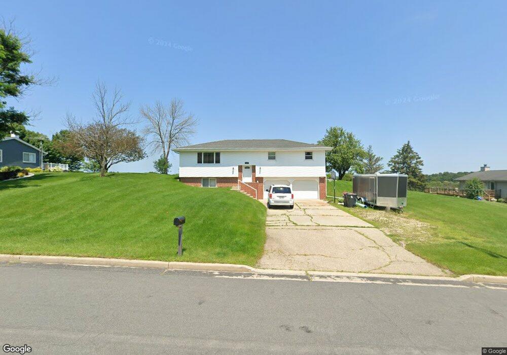
773 Spruce St Hustisford, WI 53034
Estimated Value: $332,000 - $524,000
--
Bed
--
Bath
--
Sq Ft
0.47
Acres
About This Home
This home is located at 773 Spruce St, Hustisford, WI 53034 and is currently estimated at $411,518. 773 Spruce St is a home located in Dodge County with nearby schools including John Hustis Elementary School, Hustisford High School, and Bethany Lutheran School.
Ownership History
Date
Name
Owned For
Owner Type
Purchase Details
Closed on
Nov 29, 2016
Sold by
Nass Tracy J and Nass Richard
Bought by
Wondra Christoher S
Current Estimated Value
Home Financials for this Owner
Home Financials are based on the most recent Mortgage that was taken out on this home.
Original Mortgage
$3,900
Outstanding Balance
$566
Interest Rate
3.54%
Mortgage Type
New Conventional
Estimated Equity
$410,952
Purchase Details
Closed on
Oct 17, 2013
Sold by
Long Patricia A and Long Tori E
Bought by
Nass Tracy J
Create a Home Valuation Report for This Property
The Home Valuation Report is an in-depth analysis detailing your home's value as well as a comparison with similar homes in the area
Home Values in the Area
Average Home Value in this Area
Purchase History
| Date | Buyer | Sale Price | Title Company |
|---|---|---|---|
| Wondra Christoher S | $130,000 | None Available | |
| Nass Tracy J | -- | None Available |
Source: Public Records
Mortgage History
| Date | Status | Borrower | Loan Amount |
|---|---|---|---|
| Open | Wondra Christoher S | $3,900 |
Source: Public Records
Tax History Compared to Growth
Tax History
| Year | Tax Paid | Tax Assessment Tax Assessment Total Assessment is a certain percentage of the fair market value that is determined by local assessors to be the total taxable value of land and additions on the property. | Land | Improvement |
|---|---|---|---|---|
| 2024 | $3,821 | $295,900 | $40,700 | $255,200 |
| 2023 | $3,681 | $156,200 | $30,100 | $126,100 |
| 2022 | $4,460 | $156,200 | $30,100 | $126,100 |
| 2021 | $4,093 | $156,200 | $30,100 | $126,100 |
| 2020 | $4,172 | $156,200 | $30,100 | $126,100 |
| 2019 | $3,996 | $156,200 | $30,100 | $126,100 |
| 2018 | $3,726 | $156,200 | $30,100 | $126,100 |
| 2017 | $3,766 | $156,200 | $30,100 | $126,100 |
| 2016 | $3,937 | $156,200 | $30,100 | $126,100 |
| 2015 | $3,911 | $156,200 | $30,100 | $126,100 |
| 2014 | $3,892 | $156,200 | $30,100 | $126,100 |
Source: Public Records
Map
Nearby Homes
- 727 E Lakeview Rd Unit 8
- W4436 E Lakeview Rd
- 827 E Lakeview Rd
- N4557 Lakeview Rd
- 252 S Hustis St
- 441 Sandy Ln
- 244 S Ridge St
- .68 Acre Parcel Anthony Island
- N4554 Lakeview Rd
- N4510 Anthony Island -
- N4510 & N4504 Anthony Island
- N4569 Hazelwood Rd
- N4973 Lake Dr
- Lt38 Sinissippi Point Rd
- N5025 Arrowhead Ct
- N4550 County Road Dj
- W4747 County Road Me
- N3220 Hale Rd
- Lt1 W Horseshoe Rd
- N5413 County Rd S