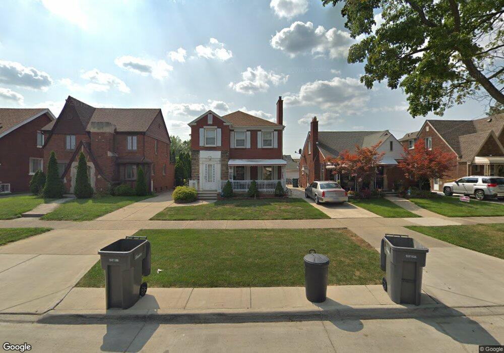
7731 E Morrow Cir Dearborn, MI 48126
Aviation NeighborhoodEstimated Value: $288,194 - $357,000
4
Beds
6
Baths
2,099
Sq Ft
$153/Sq Ft
Est. Value
About This Home
This home is located at 7731 E Morrow Cir, Dearborn, MI 48126 and is currently estimated at $321,799, approximately $153 per square foot. 7731 E Morrow Cir is a home located in Wayne County with nearby schools including McDonald Elementary School, McCollough-Unis School, and Fordson High School.
Ownership History
Date
Name
Owned For
Owner Type
Purchase Details
Closed on
Sep 12, 2007
Sold by
Srour Ali
Bought by
Wells Fargo Bank Na
Current Estimated Value
Purchase Details
Closed on
Jan 13, 2004
Sold by
Srour Imad
Bought by
Srour Ali
Home Financials for this Owner
Home Financials are based on the most recent Mortgage that was taken out on this home.
Original Mortgage
$173,250
Interest Rate
7.75%
Mortgage Type
New Conventional
Purchase Details
Closed on
Apr 30, 2002
Sold by
Srour Fay and Barade Fay Mohamed
Bought by
Srour Ali
Purchase Details
Closed on
Oct 6, 1998
Sold by
Srour Fay
Bought by
Srour Imad
Purchase Details
Closed on
Dec 2, 1997
Sold by
Srour Faten and Srour Reda
Bought by
Srour Fay M Barade Fay
Purchase Details
Closed on
Apr 12, 1995
Sold by
Sharif Makki
Bought by
Reda Srour
Create a Home Valuation Report for This Property
The Home Valuation Report is an in-depth analysis detailing your home's value as well as a comparison with similar homes in the area
Home Values in the Area
Average Home Value in this Area
Purchase History
| Date | Buyer | Sale Price | Title Company |
|---|---|---|---|
| Wells Fargo Bank Na | $178,512 | None Available | |
| Srour Ali | -- | -- | |
| Srour Ali | $187,000 | Multiple | |
| Srour Imad | -- | -- | |
| Srour Fay M Barade Fay | $120,000 | -- | |
| Reda Srour | $97,000 | -- |
Source: Public Records
Mortgage History
| Date | Status | Borrower | Loan Amount |
|---|---|---|---|
| Previous Owner | Srour Ali | $173,250 |
Source: Public Records
Tax History
| Year | Tax Paid | Tax Assessment Tax Assessment Total Assessment is a certain percentage of the fair market value that is determined by local assessors to be the total taxable value of land and additions on the property. | Land | Improvement |
|---|---|---|---|---|
| 2025 | $3,437 | $137,900 | $0 | $0 |
| 2024 | $3,460 | $123,400 | $0 | $0 |
| 2023 | $3,077 | $118,800 | $0 | $0 |
| 2022 | $3,542 | $98,300 | $0 | $0 |
| 2021 | $3,630 | $92,300 | $0 | $0 |
| 2019 | $3,580 | $75,600 | $0 | $0 |
| 2018 | $3,106 | $69,300 | $0 | $0 |
| 2017 | $731 | $60,900 | $0 | $0 |
| 2011 | -- | $50,550 | $0 | $0 |
Source: Public Records
Map
Nearby Homes
- 7900 Middlepointe St
- 7815 Normile St
- 7634 Pinehurst St
- 10339 Tireman Ave
- 7929 Normile St
- 8100 Middlepoint St
- 7830 Miller Rd
- 7658 Appoline St
- 8116 Wyoming Ave
- 8511 Lonyo St
- 8315 Freda St
- 30 Morross Cir Unit 44
- 8088 Wisconsin St
- 7524 Hartwell St
- 8265 Kentucky St
- 7857 Esper Blvd
- 8258 Meyers Rd
- 7758 Reuter St
- 8805 Whitlock Ave
- 8130 Ward St
- 7741 E Morrow Cir
- 7723 E Morrow Cir
- 7747 E Morrow Cir
- 7715 E Morrow Cir
- 7757 E Morrow Cir
- 7709 E Morrow Cir
- 7730 Middlepointe St
- 7722 Middlepointe St
- 7738 Middlepointe St
- 7748 Middlepointe St
- 7716 Middlepointe St
- 7659 E Morrow Cir
- 7754 Middlepointe St
- 7706 Middlepointe St
- 7732 E Morrow Cir
- 7738 E Morrow Cir Unit Bldg-Unit
- 7738 E Morrow Cir
- 7722 E Morrow Cir
- 7653 E Morrow Cir
- 7700 Middlepointe St
Your Personal Tour Guide
Ask me questions while you tour the home.