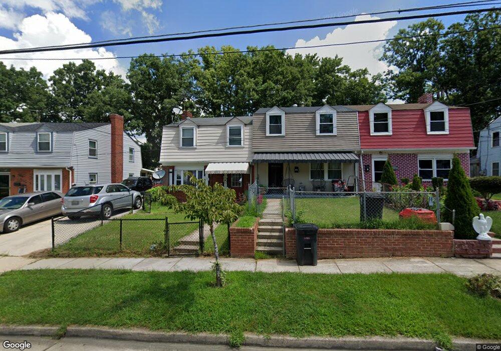
7732 Burnside Rd Hyattsville, MD 20785
Greater Landover NeighborhoodEstimated Value: $265,593 - $357,000
--
Bed
2
Baths
1,320
Sq Ft
$241/Sq Ft
Est. Value
About This Home
This home is located at 7732 Burnside Rd, Hyattsville, MD 20785 and is currently estimated at $318,148, approximately $241 per square foot. 7732 Burnside Rd is a home located in Prince George's County with nearby schools including William Paca Elementary School, Kenmoor Middle School, and Charles Herbert Flowers High School.
Ownership History
Date
Name
Owned For
Owner Type
Purchase Details
Closed on
Jun 16, 2006
Sold by
Richardson Carl
Bought by
Richardson Carl
Current Estimated Value
Home Financials for this Owner
Home Financials are based on the most recent Mortgage that was taken out on this home.
Original Mortgage
$119,000
Outstanding Balance
$70,158
Interest Rate
6.62%
Mortgage Type
Stand Alone Refi Refinance Of Original Loan
Estimated Equity
$247,990
Purchase Details
Closed on
May 23, 2006
Sold by
Richardson Carl
Bought by
Richardson Carl
Home Financials for this Owner
Home Financials are based on the most recent Mortgage that was taken out on this home.
Original Mortgage
$119,000
Outstanding Balance
$70,158
Interest Rate
6.62%
Mortgage Type
Stand Alone Refi Refinance Of Original Loan
Estimated Equity
$247,990
Purchase Details
Closed on
Oct 28, 1986
Sold by
Scott James W
Bought by
Richardson Carl
Create a Home Valuation Report for This Property
The Home Valuation Report is an in-depth analysis detailing your home's value as well as a comparison with similar homes in the area
Home Values in the Area
Average Home Value in this Area
Purchase History
| Date | Buyer | Sale Price | Title Company |
|---|---|---|---|
| Richardson Carl | -- | -- | |
| Richardson Carl | -- | -- | |
| Richardson Carl | $61,000 | -- |
Source: Public Records
Mortgage History
| Date | Status | Borrower | Loan Amount |
|---|---|---|---|
| Open | Richardson Carl | $119,000 | |
| Closed | Richardson Carl | $119,000 |
Source: Public Records
Tax History Compared to Growth
Tax History
| Year | Tax Paid | Tax Assessment Tax Assessment Total Assessment is a certain percentage of the fair market value that is determined by local assessors to be the total taxable value of land and additions on the property. | Land | Improvement |
|---|---|---|---|---|
| 2025 | $2,798 | $245,833 | -- | -- |
| 2024 | $2,798 | $232,967 | $0 | $0 |
| 2023 | $2,448 | $220,100 | $45,000 | $175,100 |
| 2022 | $2,541 | $208,667 | $0 | $0 |
| 2021 | $2,401 | $197,233 | $0 | $0 |
| 2020 | $2,312 | $185,800 | $45,000 | $140,800 |
| 2019 | $2,215 | $165,067 | $0 | $0 |
| 2018 | $2,113 | $144,333 | $0 | $0 |
| 2017 | $2,028 | $123,600 | $0 | $0 |
| 2016 | -- | $119,700 | $0 | $0 |
| 2015 | $2,028 | $115,800 | $0 | $0 |
| 2014 | $2,028 | $111,900 | $0 | $0 |
Source: Public Records
Map
Nearby Homes
- 7708 Bender Rd
- 1909 Palmer Park Rd
- 7850 Burnside Rd
- 2010 Ray Leonard Rd
- 1710 Allendale Place
- 8001 Barlowe Rd
- 7905 Greenleaf Rd
- 1859 Dutch Village Dr Unit J-287
- 1842 Dutch Village Dr Unit R-264
- 7722 Penbrook Place
- 1748 Dutch Village Dr Unit O-377
- 1911 Ray Leonard Rd
- 7600 Normandy Rd
- 1925 Dutch Village Dr Unit I-242
- 1909 Dutch Village Dr Unit I-234
- 1926 Dutch Village Dr Unit T-229
- 1760 Dutch Village Dr
- 1852 Village Green Dr Unit E-122
- 1780 Village Green Dr Unit C-68
- 1827 Village Green Dr Unit X-139
- 7734 Burnside Rd
- 7730 Burnside Rd
- 7736 Burnside Rd
- 7728 Burnside Rd
- 7726 Burnside Rd
- 7738 Burnside Rd
- 7719 Bender Rd
- 7740 Burnside Rd
- 7724 Burnside Rd
- 7725 Bender Rd
- 7723 Bender Rd
- 7727 Bender Rd
- 7742 Burnside Rd
- 7721 Bender Rd
- 7722 Burnside Rd
- 7729 Bender Rd
- 7744 Burnside Rd
- 7733 Burnside Rd
- 7717 Bender Rd
- 7731 Burnside Rd