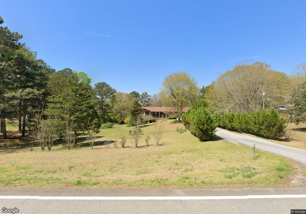
7737 Ga Highway 34 Franklin, GA 30217
Estimated Value: $202,000 - $272,439
4
Beds
3
Baths
1,624
Sq Ft
$146/Sq Ft
Est. Value
About This Home
This home is located at 7737 Ga Highway 34, Franklin, GA 30217 and is currently estimated at $237,610, approximately $146 per square foot. 7737 Ga Highway 34 is a home located in Heard County with nearby schools including Heard County High School.
Ownership History
Date
Name
Owned For
Owner Type
Purchase Details
Closed on
Jan 9, 2025
Sold by
Miller B Thomas
Bought by
J Hiram Franklin Llc
Current Estimated Value
Purchase Details
Closed on
Oct 14, 2019
Sold by
Rowe Leroy M
Bought by
Miller B Thomas
Purchase Details
Closed on
Aug 30, 1988
Sold by
Rowe Leroy M
Bought by
Rowe Leroy M
Purchase Details
Closed on
Jul 31, 1980
Sold by
Hamil James W
Bought by
Rowe Leroy M
Purchase Details
Closed on
Sep 1, 1977
Bought by
Hamil James W
Create a Home Valuation Report for This Property
The Home Valuation Report is an in-depth analysis detailing your home's value as well as a comparison with similar homes in the area
Home Values in the Area
Average Home Value in this Area
Purchase History
| Date | Buyer | Sale Price | Title Company |
|---|---|---|---|
| J Hiram Franklin Llc | -- | -- | |
| Miller B Thomas | $100,000 | -- | |
| Rowe Leroy M | -- | -- | |
| Rowe Leroy M | $24,700 | -- | |
| Hamil James W | $49,000 | -- |
Source: Public Records
Tax History Compared to Growth
Tax History
| Year | Tax Paid | Tax Assessment Tax Assessment Total Assessment is a certain percentage of the fair market value that is determined by local assessors to be the total taxable value of land and additions on the property. | Land | Improvement |
|---|---|---|---|---|
| 2024 | $1,426 | $70,733 | $5,640 | $65,093 |
| 2023 | $1,361 | $65,189 | $4,700 | $60,489 |
| 2022 | $1,238 | $53,774 | $2,910 | $50,864 |
| 2021 | $1,039 | $47,278 | $2,910 | $44,368 |
| 2020 | $1,006 | $45,345 | $2,910 | $42,435 |
| 2019 | $631 | $45,345 | $2,910 | $42,435 |
| 2018 | $1,026 | $45,345 | $2,910 | $42,435 |
| 2017 | $595 | $43,296 | $2,909 | $40,387 |
| 2016 | $595 | $43,296 | $2,909 | $40,387 |
| 2015 | -- | $38,617 | $5,200 | $33,418 |
| 2014 | -- | $38,644 | $5,200 | $33,444 |
| 2013 | -- | $45,068 | $5,200 | $39,868 |
Source: Public Records
Map
Nearby Homes
- 6215 Georgia 34
- 6110 Ga Highway 34
- 0 Lipham Rd Unit 10505011
- 307 Willis Dick Rd
- 1555 Straylott Rd
- 4383 Ga Highway 34
- 4383 Georgia 34
- 11 River's Edge Ln Unit LOT 17
- 17 River's Edge Ln Unit LOT 14
- 3939 Bevis Rd
- 92 Holliday Rd
- 2758 Straylott Rd
- 0 Young Rd Unit 10579299
- 2176 Franklin Pkwy
- 0 Bevis Rd Parcel 5
- 0 Bevis Rd Parcel 4
- The Lambert Plan at Patterson Park
- The Bradford Plan at Patterson Park
- The Millie Plan at Patterson Park
- The Coleman Plan at Patterson Park
- 7777 Ga Highway 34
- 7679 Ga Highway 34
- 7841 Ga Highway 34
- 7639 Ga Highway 34
- 7726 Ga Highway 34
- 7794 Ga Highway 34
- 7794 Ga Highway 34
- 7919 Ga Highway 34
- 7477 Ga Highway 34
- 7580 Ga Highway 34
- 7433 Ga Highway 34
- 35 Alford Rd
- 7960 Ga Highway 34
- 8156 Ga Highway 34
- 272 Alford Rd
- 8245 Georgia 34
- 8245 Ga Highway 34
- 178 Woodbine Cir
- 411 Alford Rd
- 7155 Ga Highway 34
