
Seller's Agent in 2025
Carol Delayo
Chaney Homes, LLC
(443) 623-1410
2 in this area
30 Total Sales
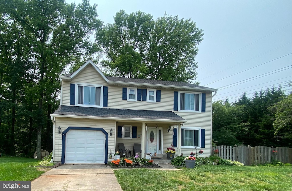
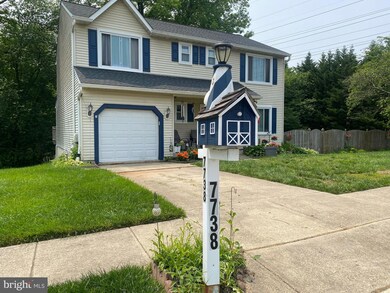
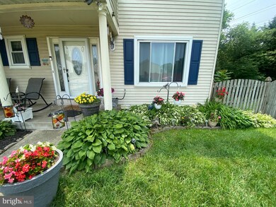
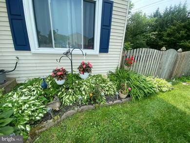


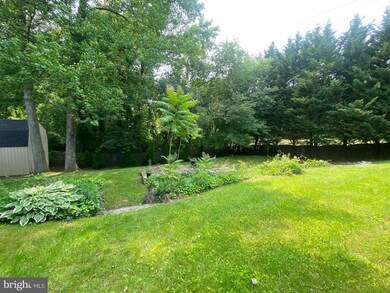
Very Special Offering at Shannon Square! This updated home sits on an oversized 1/3 acre end of a culdesac backing to trees. Recent Updates include: Beautiful New kitchen with gourmet stainless steel appliances including wall oven, cooktop, built in microwave, dishwasher and refrigerator, beautiful backsplash, soft close cabinetry and stone countertops and ceramic flooring. New Luxury Vinyl Plank flooring throughout the first floor living space. Kitchen is open to a large family room just step out to the 13 x 12 deck and Relax! The back yard is your private oasis, landscaped and backing to acres of trees!
New HVAC (2024). New Windows, Roof and Gutters (2019-2020).
2nd Floor Primary Bedroom has a huge private bath with large jacuzzi tub and separate shower. 3 more spacious bedrooms plus laundry. Finished basement offers an additional 1/2 bath, plus a large rec room with walkout to the rear yard, and 2 more rooms for workouts, office,or hobbies as well as a storage /utility room. This home offers 3 finished levels -space for everyone, all freshly painted throughout! Lovingly cared for by the original owner!
Last Agent to Sell the Property
(443) 623-1410 carol@chaneyhomes.com Chaney Homes, LLC License #628201 Listed on: 06/25/2025
| Date | Type | Sale Price | Title Company |
|---|---|---|---|
| Deed | $550,000 | Charter Title | |
| Deed | $550,000 | Charter Title | |
| Deed | $170,000 | -- |
| Date | Status | Loan Amount | Loan Type |
|---|---|---|---|
| Open | $440,000 | New Conventional | |
| Closed | $440,000 | New Conventional | |
| Previous Owner | $135,950 | No Value Available |
| Date | Event | Price | List to Sale | Price per Sq Ft |
|---|---|---|---|---|
| 07/22/2025 07/22/25 | Sold | $550,000 | 0.0% | $186 / Sq Ft |
| 06/25/2025 06/25/25 | For Sale | $549,900 | -- | $186 / Sq Ft |
| Year | Tax Paid | Tax Assessment Tax Assessment Total Assessment is a certain percentage of the fair market value that is determined by local assessors to be the total taxable value of land and additions on the property. | Land | Improvement |
|---|---|---|---|---|
| 2025 | $3,263 | $387,300 | $155,800 | $231,500 |
| 2024 | $3,263 | $369,100 | $0 | $0 |
| 2023 | $3,161 | $350,900 | $0 | $0 |
| 2022 | $2,944 | $332,700 | $140,800 | $191,900 |
| 2021 | $5,788 | $325,133 | $0 | $0 |
| 2020 | $2,803 | $317,567 | $0 | $0 |
| 2019 | $642 | $310,000 | $115,800 | $194,200 |
| 2018 | $3,019 | $297,733 | $0 | $0 |
| 2017 | $2,588 | $285,467 | $0 | $0 |
| 2016 | -- | $273,200 | $0 | $0 |
| 2015 | -- | $269,733 | $0 | $0 |
| 2014 | -- | $266,267 | $0 | $0 |
Seller's Agent in 2025
Carol Delayo
Chaney Homes, LLC
(443) 623-1410
2 in this area
30 Total Sales
Buyer's Agent in 2025
Michele & Stuart Schmidt
Keller Williams Flagship
(443) 618-5418
42 in this area
201 Total Sales
Source: Bright MLS
MLS Number: MDAA2117380
APN: 03-744-90068374
Disclaimer: Certain information contained herein is derived from information provided by parties other than Homes.com. All information provided is deemed reliable, but is not guaranteed to be accurate and should be independently verified.
![]() The data relating to real estate for sale on this website appears in part through the BRIGHT Internet Data Exchange program, a voluntary cooperative exchange of property listing data between licensed real estate brokerage firms, and is provided by BRIGHT through a licensing agreement.
The data relating to real estate for sale on this website appears in part through the BRIGHT Internet Data Exchange program, a voluntary cooperative exchange of property listing data between licensed real estate brokerage firms, and is provided by BRIGHT through a licensing agreement.
Listing information is from various brokers who participate in the Bright MLS IDX program and not all listings may be visible on the site.
The property information being provided on or through the website is for the personal, non-commercial use of consumers and such information may not be used for any purpose other than to identify prospective properties consumers may be interested in purchasing.
Some properties which appear for sale on the website may no longer be available because they are for instance, under contract, sold or are no longer being offered for sale.
Property information displayed is deemed reliable but is not guaranteed.
Copyright 2025 Bright MLS, Inc.