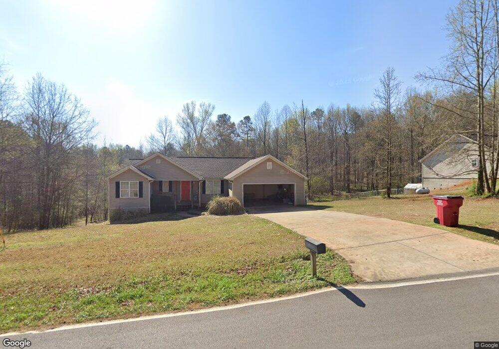
774 Borders Rd Commerce, GA 30530
Estimated Value: $295,384 - $368,000
3
Beds
2
Baths
1,439
Sq Ft
$224/Sq Ft
Est. Value
About This Home
This home is located at 774 Borders Rd, Commerce, GA 30530 and is currently estimated at $322,596, approximately $224 per square foot. 774 Borders Rd is a home located in Banks County with nearby schools including Banks County Primary School, Banks County Elementary School, and Banks County Middle School.
Ownership History
Date
Name
Owned For
Owner Type
Purchase Details
Closed on
Aug 31, 2012
Sold by
Scbt
Bought by
Frady Lisa
Current Estimated Value
Home Financials for this Owner
Home Financials are based on the most recent Mortgage that was taken out on this home.
Original Mortgage
$86,734
Outstanding Balance
$59,616
Interest Rate
3.58%
Mortgage Type
New Conventional
Estimated Equity
$262,980
Purchase Details
Closed on
Aug 30, 2007
Sold by
Dowdy Gary
Bought by
Knight Ronny L and Knight Teresa D
Create a Home Valuation Report for This Property
The Home Valuation Report is an in-depth analysis detailing your home's value as well as a comparison with similar homes in the area
Home Values in the Area
Average Home Value in this Area
Purchase History
| Date | Buyer | Sale Price | Title Company |
|---|---|---|---|
| Frady Lisa | $85,000 | -- | |
| Knight Ronny L | $153,000 | -- |
Source: Public Records
Mortgage History
| Date | Status | Borrower | Loan Amount |
|---|---|---|---|
| Open | Frady Lisa | $86,734 |
Source: Public Records
Tax History
| Year | Tax Paid | Tax Assessment Tax Assessment Total Assessment is a certain percentage of the fair market value that is determined by local assessors to be the total taxable value of land and additions on the property. | Land | Improvement |
|---|---|---|---|---|
| 2025 | $1,926 | $108,625 | $17,501 | $91,124 |
| 2024 | $1,926 | $102,895 | $15,910 | $86,985 |
| 2023 | $1,435 | $90,512 | $13,200 | $77,312 |
| 2022 | $1,627 | $79,410 | $12,234 | $67,176 |
| 2021 | $1,537 | $70,804 | $8,739 | $62,065 |
| 2020 | $1,397 | $62,925 | $7,344 | $55,581 |
| 2019 | $1,404 | $62,925 | $7,344 | $55,581 |
| 2018 | $1,291 | $57,104 | $5,649 | $51,455 |
| 2017 | $1,360 | $57,647 | $9,239 | $48,408 |
| 2016 | $1,399 | $57,647 | $9,239 | $48,408 |
| 2015 | -- | $57,647 | $9,239 | $48,408 |
| 2014 | -- | $57,496 | $9,088 | $48,408 |
| 2013 | -- | $57,496 | $9,088 | $48,408 |
Source: Public Records
Map
Nearby Homes
- 731 Borders Rd
- 161 Meadow Lake Dr
- 193 Wrights Mill Ln
- 224 Hebron Rd
- 0 Freedom Ln Unit 9B
- 0 Freedom Ln Unit 18C 10380663
- 0 Freedom Ln Unit 9D
- 0 Freedom Ln Unit 9C
- 0 Freedom Ln Unit 18B 10379747
- 0 Freedom Ln Unit 9E
- 166 Freedom Ln
- 163 M t Trail
- 333 Sims Bridge Rd
- 0 Varner Rd
- 1020 Riverbend Rd
- 775 Riverbend Rd
- 7527 Highway 326
- 2100 Westbrook Rd
- 3381 Georgia 326
- 2015 Highway 59
- 774 Borders Rd
- 770 Borders Rd
- 770 Borders Rd Unit 11C
- 721 Borders Rd
- 784 Borders Rd
- 672 Borders Rd
- 731 Hebron Rd
- Lot 1B Hebron Rd
- 663 Borders Rd
- 785 Borders Rd
- 633 Borders Rd
- 636 Borders Rd
- 576 Borders Rd
- 571 Borders Rd
- 549 Borders Rd
- 829 Hebron Rd
- 595 Hebron Rd
- 521 Borders Rd
- 469 Hebron Rd
- 499 Hebron Rd
Your Personal Tour Guide
Ask me questions while you tour the home.