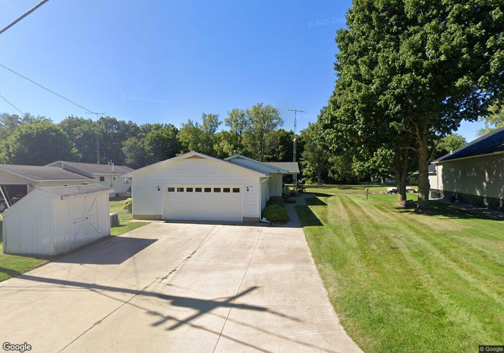
774 E Channel Dr Coldwater, MI 49036
Estimated Value: $327,000 - $386,847
3
Beds
2
Baths
1,428
Sq Ft
$251/Sq Ft
Est. Value
About This Home
This home is located at 774 E Channel Dr, Coldwater, MI 49036 and is currently estimated at $358,962, approximately $251 per square foot. 774 E Channel Dr is a home located in Branch County with nearby schools including Coldwater High School.
Ownership History
Date
Name
Owned For
Owner Type
Purchase Details
Closed on
Feb 25, 2022
Sold by
Myers Revocable Living Trust
Bought by
Ingersoll Todd M and Ingersoll Mindy B
Current Estimated Value
Home Financials for this Owner
Home Financials are based on the most recent Mortgage that was taken out on this home.
Original Mortgage
$127,000
Outstanding Balance
$118,153
Interest Rate
3.55%
Mortgage Type
New Conventional
Estimated Equity
$240,809
Purchase Details
Closed on
Nov 7, 2000
Sold by
Myers Norman D and Myers Betty M
Bought by
Myers, Norman D & Betty M Trust
Create a Home Valuation Report for This Property
The Home Valuation Report is an in-depth analysis detailing your home's value as well as a comparison with similar homes in the area
Purchase History
| Date | Buyer | Sale Price | Title Company |
|---|---|---|---|
| Ingersoll Todd M | $292,000 | Branch County Abstract & Title | |
| Myers, Norman D & Betty M Trust | -- | -- |
Source: Public Records
Mortgage History
| Date | Status | Borrower | Loan Amount |
|---|---|---|---|
| Open | Ingersoll Todd M | $127,000 |
Source: Public Records
Tax History
| Year | Tax Paid | Tax Assessment Tax Assessment Total Assessment is a certain percentage of the fair market value that is determined by local assessors to be the total taxable value of land and additions on the property. | Land | Improvement |
|---|---|---|---|---|
| 2025 | $5,011 | $142,576 | $0 | $0 |
| 2024 | $20 | $123,669 | $0 | $0 |
| 2023 | $770 | $104,729 | $0 | $0 |
| 2022 | $2,002 | $99,988 | $0 | $0 |
| 2020 | -- | $94,094 | $0 | $0 |
| 2019 | -- | $90,097 | $0 | $0 |
| 2018 | -- | $85,107 | $0 | $0 |
| 2017 | -- | $83,190 | $0 | $0 |
| 2016 | -- | $78,192 | $0 | $0 |
| 2015 | -- | $72,477 | $0 | $0 |
| 2014 | -- | $78,336 | $0 | $0 |
| 2013 | -- | $68,655 | $0 | $0 |
Source: Public Records
Map
Nearby Homes
- 727 Skipper Ln
- 242 Bickford Dr
- 797 Middle Lake Dr
- 204 Crockett Dr
- 204 Dons Dr
- 202 Dons Dr
- 181 Dons Dr
- 0 Brocklebank Rd
- 382 W Russell Dr
- 250 S Centennial Rd
- 481 Quimby Rd
- 808 Rolling Meadows Dr
- 486 Maple Ln
- 0 Warren Rd
- 944 Lukesport Rd
- 211 S Ray Quincy Rd
- 536 Hickory Ln
- 564 Lake Dr
- 566 Lake Dr Unit A
- 201 Wildwood Beach Rd
- 772 E Channel Dr
- 770 E Channel Dr
- 766 E Channel Dr
- 268 S Fremont Rd
- 264 S Fremont Rd
- 764 E Channel Dr
- 721 Skipper Ln
- 273 S Fremont Rd
- 725 Skipper Ln
- 267 S Fremont Rd
- 263 S Fremont Rd
- 275 S Fremont Rd
- 269 S Fremont Rd
- 271 S Fremont Rd
- 760 E Channel Dr
- 277 S Fremont Rd
- 727 Fizz Ln
- 758 E Channel Dr
- 279 S Fremont Rd
- 279 S Fremont Rd
Your Personal Tour Guide
Ask me questions while you tour the home.