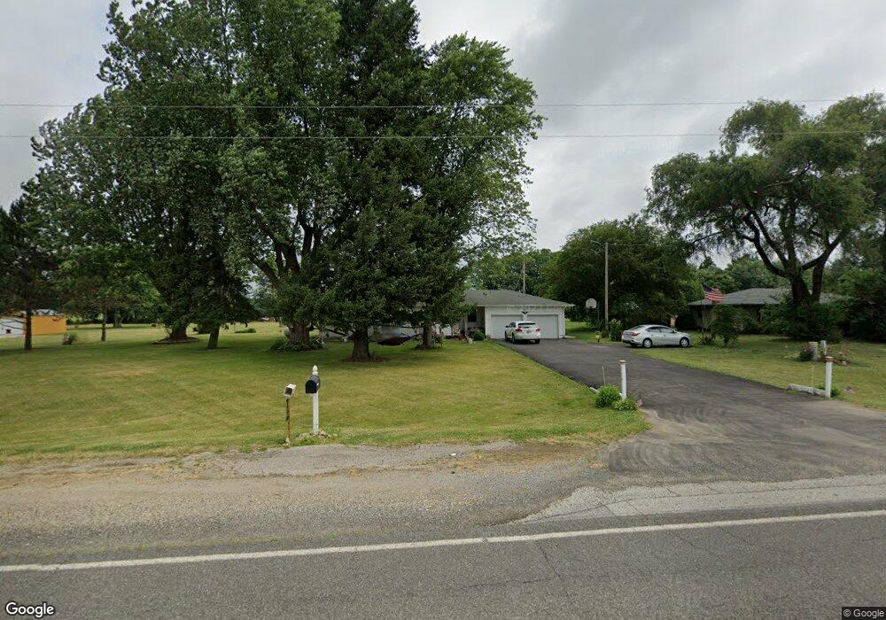
774 Lincoln Hwy Bourbon, IN 46504
Estimated Value: $184,000 - $302,000
2
Beds
1
Bath
1,280
Sq Ft
$179/Sq Ft
Est. Value
About This Home
This home is located at 774 Lincoln Hwy, Bourbon, IN 46504 and is currently estimated at $229,156, approximately $179 per square foot. 774 Lincoln Hwy is a home located in Marshall County with nearby schools including Triton Elementary School, Triton Junior-Senior High School, and Bourbon Christian School.
Ownership History
Date
Name
Owned For
Owner Type
Purchase Details
Closed on
Jun 11, 2015
Sold by
Carpenter Lake D and Carpenter Elizabeth F
Bought by
Davenport Dixie I
Current Estimated Value
Home Financials for this Owner
Home Financials are based on the most recent Mortgage that was taken out on this home.
Original Mortgage
$114,000
Outstanding Balance
$88,516
Interest Rate
3.82%
Mortgage Type
New Conventional
Estimated Equity
$140,640
Create a Home Valuation Report for This Property
The Home Valuation Report is an in-depth analysis detailing your home's value as well as a comparison with similar homes in the area
Home Values in the Area
Average Home Value in this Area
Purchase History
| Date | Buyer | Sale Price | Title Company |
|---|---|---|---|
| Davenport Dixie I | -- | Metropolitan Title In Llc |
Source: Public Records
Mortgage History
| Date | Status | Borrower | Loan Amount |
|---|---|---|---|
| Open | Davenport Dixie I | $114,000 |
Source: Public Records
Tax History Compared to Growth
Tax History
| Year | Tax Paid | Tax Assessment Tax Assessment Total Assessment is a certain percentage of the fair market value that is determined by local assessors to be the total taxable value of land and additions on the property. | Land | Improvement |
|---|---|---|---|---|
| 2024 | $289 | $164,400 | $45,000 | $119,400 |
| 2022 | $283 | $157,500 | $42,400 | $115,100 |
| 2021 | $278 | $121,800 | $32,600 | $89,200 |
| 2020 | $273 | $116,800 | $30,500 | $86,300 |
| 2019 | $267 | $110,700 | $22,100 | $88,600 |
| 2018 | $379 | $106,400 | $21,300 | $85,100 |
| 2017 | $372 | $105,500 | $21,300 | $84,200 |
| 2016 | $371 | $107,800 | $21,800 | $86,000 |
| 2014 | $557 | $104,200 | $20,100 | $84,100 |
| 2013 | $462 | $100,100 | $19,500 | $80,600 |
Source: Public Records
Map
Nearby Homes
- 121 S Pearl St
- 968 Route 19
- 505 Lincoln St
- 301 E North St
- 606 N Thayer St
- 407 N Harris St
- 202 W Center St
- 203 N Thompson St
- 106 W Liberty Ave
- 605 N Main St
- 415 N 950 W
- 838 17th Rd
- 2983 N Murphy Ln
- 1350 Route 19
- 9135 W 750 N
- 10396 W 100 S
- V/L N 650 W
- 18448 State Road 331
- 16855 Hickory Rd
- 10682 Hawthorn Rd Unit 8
- 748 Lincoln Hwy
- 726 Lincoln Hwy
- 786 Lincoln Hwy
- 814 Lincoln Hwy
- 712 Lincoln Hwy
- 646 Lincoln Hwy
- 836 Lincoln Hwy
- 874 Lincoln Hwy
- 620 Lincoln Hwy
- 542 Lincoln Hwy
- 13176 Beech Rd
- 516 Lincoln Hwy
- 440 Lincoln Hwy
- 13099 Apple Rd
- 13083 Apple Rd
- 13079 Apple Rd
- 12967 Apple Rd
- 13381 Apple Rd
- 13141 Apple Rd
- 13826 Beech Rd