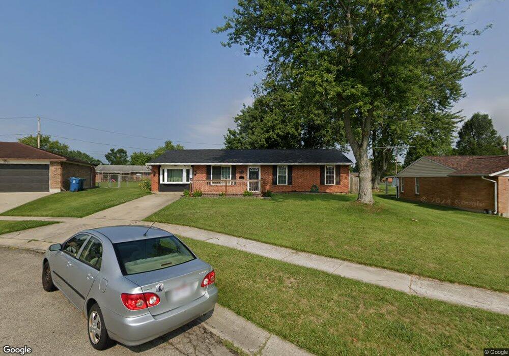
7741 Sharsted Cir Dayton, OH 45424
Estimated Value: $173,000 - $181,000
3
Beds
1
Bath
988
Sq Ft
$179/Sq Ft
Est. Value
About This Home
This home is located at 7741 Sharsted Cir, Dayton, OH 45424 and is currently estimated at $176,686, approximately $178 per square foot. 7741 Sharsted Cir is a home located in Montgomery County with nearby schools including Wayne High School and Huber Heights Christian Academy.
Ownership History
Date
Name
Owned For
Owner Type
Purchase Details
Closed on
Apr 12, 2019
Sold by
Mach Kervyn D and Mach Janice E
Bought by
Lanning Nathan M
Current Estimated Value
Home Financials for this Owner
Home Financials are based on the most recent Mortgage that was taken out on this home.
Original Mortgage
$97,280
Outstanding Balance
$85,526
Interest Rate
4.3%
Mortgage Type
VA
Estimated Equity
$91,160
Purchase Details
Closed on
Apr 20, 2009
Sold by
Mach Gregory J and Mach Kristina K
Bought by
Mach Kervyn D and Mach Janice E
Purchase Details
Closed on
Nov 23, 1999
Sold by
Thomas Kenneth G and Thomas Cheryl A
Bought by
Mach Gregory J and Mach Kristina K
Home Financials for this Owner
Home Financials are based on the most recent Mortgage that was taken out on this home.
Original Mortgage
$79,482
Interest Rate
7.97%
Create a Home Valuation Report for This Property
The Home Valuation Report is an in-depth analysis detailing your home's value as well as a comparison with similar homes in the area
Home Values in the Area
Average Home Value in this Area
Purchase History
| Date | Buyer | Sale Price | Title Company |
|---|---|---|---|
| Lanning Nathan M | $95,000 | Home Services Title Llc | |
| Mach Kervyn D | $87,200 | Attorney | |
| Mach Gregory J | $81,800 | -- |
Source: Public Records
Mortgage History
| Date | Status | Borrower | Loan Amount |
|---|---|---|---|
| Open | Lanning Nathan M | $97,280 | |
| Previous Owner | Mach Gregory J | $79,482 |
Source: Public Records
Tax History Compared to Growth
Tax History
| Year | Tax Paid | Tax Assessment Tax Assessment Total Assessment is a certain percentage of the fair market value that is determined by local assessors to be the total taxable value of land and additions on the property. | Land | Improvement |
|---|---|---|---|---|
| 2024 | $2,324 | $43,650 | $10,150 | $33,500 |
| 2023 | $2,324 | $43,650 | $10,150 | $33,500 |
| 2022 | $2,023 | $30,080 | $7,000 | $23,080 |
| 2021 | $2,063 | $30,080 | $7,000 | $23,080 |
| 2020 | $2,065 | $30,080 | $7,000 | $23,080 |
| 2019 | $1,975 | $25,420 | $7,000 | $18,420 |
| 2018 | $1,982 | $25,420 | $7,000 | $18,420 |
| 2017 | $1,970 | $25,420 | $7,000 | $18,420 |
| 2016 | $1,871 | $23,500 | $7,000 | $16,500 |
| 2015 | $1,848 | $23,500 | $7,000 | $16,500 |
| 2014 | $1,848 | $23,500 | $7,000 | $16,500 |
| 2012 | -- | $28,050 | $9,630 | $18,420 |
Source: Public Records
Map
Nearby Homes
- 7660 Stonecrest Dr
- 7211 Stonehurst Dr
- 7221 Serpentine Dr
- 7611 Shepherdess Dr
- 7011 Safari Dr
- 7741 Shalamar Dr
- 6960 Serene Place
- 6701 Springport Way
- 6681 Spokane Dr
- 7061 Rio Vista Ct
- 6652 Loblolly Dr
- 7424 Chatlake Dr
- 2020 Cedar Lake Dr
- 6811 Highbury Rd
- 6605 Highbury Rd
- 8282 Briar Ridge Ct
- 6809 Casa Grande Ct
- 7515 Beldale Ave
- 7866 Harshmanville Rd
- 6601 Grovehill Dr
- 7761 Sharsted Cir
- 7762 Shepherdess Dr
- 7752 Shepherdess Dr
- 7190 Stonehurst Dr
- 7772 Shepherdess Dr
- 7781 Sharsted Cir
- 7742 Shepherdess Dr
- 7700 Sharsted Cir
- 7788 Shepherdess Dr
- 7720 Sharsted Cir
- 7740 Sharsted Cir
- 7732 Shepherdess Dr
- 7780 Sharsted Cir
- 7761 Shepherdess Dr
- 7751 Shepherdess Dr
- 7771 Shepherdess Dr
- 7230 Stonehurst Dr
- 7741 Shepherdess Dr
- 7200 Serpentine Dr
- 7722 Shepherdess Dr