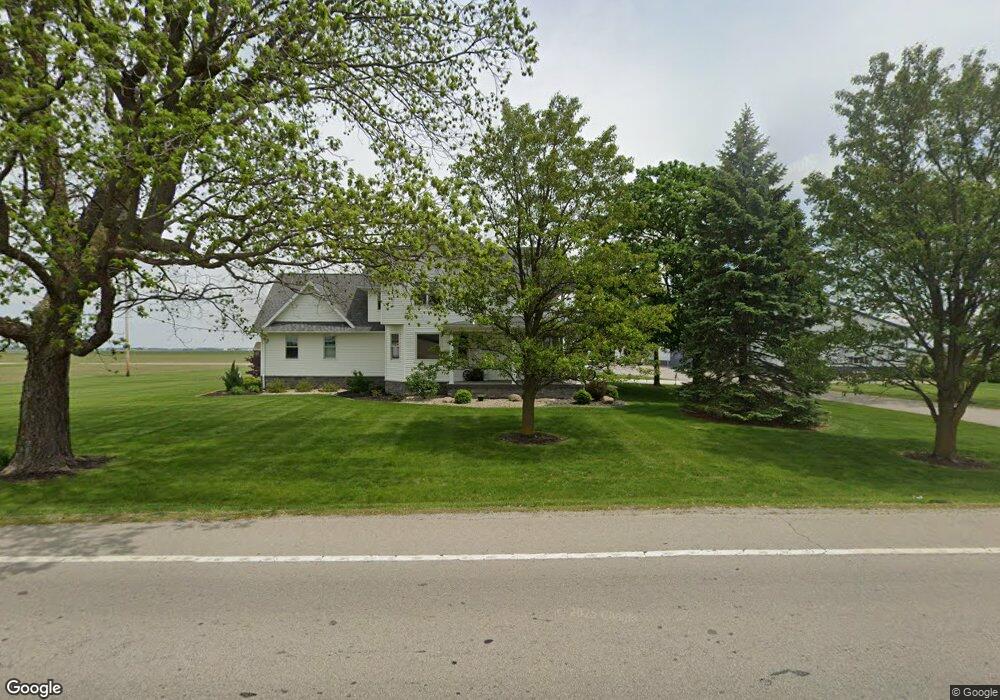
7742 Us Route 127 Paulding, OH 45879
Estimated Value: $174,000 - $384,000
4
Beds
3
Baths
3,366
Sq Ft
$90/Sq Ft
Est. Value
About This Home
This home is located at 7742 Us Route 127, Paulding, OH 45879 and is currently estimated at $302,645, approximately $89 per square foot. 7742 Us Route 127 is a home located in Paulding County with nearby schools including Wayne Trace High School.
Ownership History
Date
Name
Owned For
Owner Type
Purchase Details
Closed on
Oct 30, 2020
Sold by
Stoller Josiah D
Bought by
Josiah D Stoller and Alison K Stoller
Current Estimated Value
Purchase Details
Closed on
Jan 19, 2018
Sold by
Stoller Dale Allen and Stoller Jodi R
Bought by
Stoller Josiah and Stoller Alison K
Purchase Details
Closed on
Mar 29, 2017
Sold by
Metzger Shirley Ann and Metzger Harlan
Bought by
Stoller Dale Allen
Create a Home Valuation Report for This Property
The Home Valuation Report is an in-depth analysis detailing your home's value as well as a comparison with similar homes in the area
Home Values in the Area
Average Home Value in this Area
Purchase History
| Date | Buyer | Sale Price | Title Company |
|---|---|---|---|
| Josiah D Stoller | -- | -- | |
| Stoller Josiah | -- | None Available | |
| Stoller Dale Allen | -- | None Available | |
| Metzger Shirley Ann | -- | None Available |
Source: Public Records
Tax History Compared to Growth
Tax History
| Year | Tax Paid | Tax Assessment Tax Assessment Total Assessment is a certain percentage of the fair market value that is determined by local assessors to be the total taxable value of land and additions on the property. | Land | Improvement |
|---|---|---|---|---|
| 2024 | $2,750 | $80,050 | $7,770 | $72,280 |
| 2023 | $2,750 | $80,050 | $7,770 | $72,280 |
| 2022 | $2,584 | $80,050 | $7,770 | $72,280 |
| 2021 | $2,403 | $64,610 | $7,770 | $56,840 |
| 2020 | $2,482 | $16,700 | $7,770 | $8,930 |
| 2019 | $653 | $42,530 | $7,770 | $34,760 |
| 2018 | $1,548 | $42,530 | $7,770 | $34,760 |
| 2017 | $1,550 | $41,760 | $7,000 | $34,760 |
| 2016 | $1,143 | $41,760 | $7,000 | $34,760 |
| 2015 | $1,062 | $40,010 | $7,000 | $33,010 |
| 2014 | $1,075 | $40,010 | $7,000 | $33,010 |
| 2013 | $1,168 | $40,010 | $7,000 | $33,010 |
Source: Public Records
Map
Nearby Homes
- 225 2nd St
- 0 Road 72
- 14255 Road 126
- 300 S Williams St
- 714 W Wayne St
- 720 W Wayne St
- 717 W Harrison St
- 120 S Grant St
- 720 W Perry St
- 301 N Main St
- 215 N Dewitt St
- 516 N Williams St
- 726 N Main St
- 741 Tom Tim Dr
- 829 Greenbriar Ave
- Tract 2 - 0000 Ohio 111
- 0000 Ohio 111
- 775 N Walnut St
- 11051 Road 93
- 907 Country View Dr
- 7776 Us Route 127
- 0 St Rt 127 Unit 5031441
- 0 St Rt 127 Unit 5086649
- 0 St Rt 127 Unit 4585168
- 0 St Rt 127 Unit 4624710
- 0 St Rt 127 Unit 4597796
- 0 St Rt 127 Unit 4557085
- 0 St Rt 127 Unit 4610838
- 7477 Us Route 127
- 13150 State Route 613
- 12800 State Route 613
- 285 2nd St
- 325 2nd St
- 12710 State Route 613
- 300 3rd St
- 12815 Tr 92
- 355 2nd St
- 7334 Us Route 127
- 340 3rd St
- 340 Second St