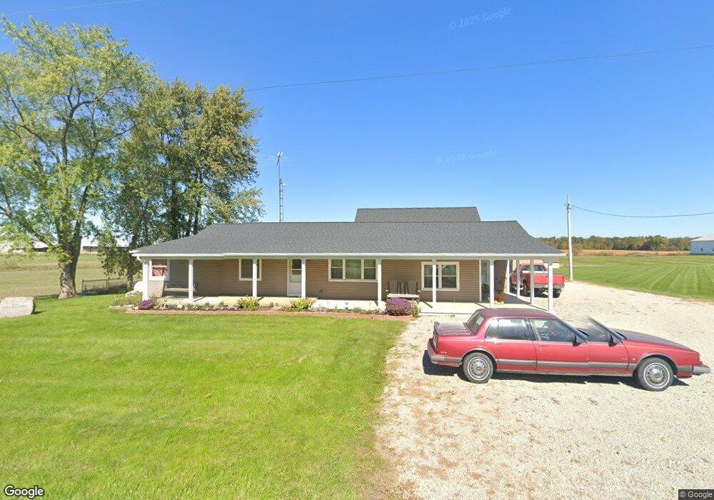
7748 State Route 242 Versailles, OH 45380
Estimated Value: $339,000 - $516,000
4
Beds
3
Baths
2,604
Sq Ft
$155/Sq Ft
Est. Value
About This Home
This home is located at 7748 State Route 242, Versailles, OH 45380 and is currently estimated at $402,867, approximately $154 per square foot. 7748 State Route 242 is a home with nearby schools including Versailles Elementary School, Versailles Middle School, and Versailles High School.
Ownership History
Date
Name
Owned For
Owner Type
Purchase Details
Closed on
Oct 28, 2005
Sold by
Smith Gary F and Smith Jane M
Bought by
Delzeith Randal John and Delzeith Jennifer
Current Estimated Value
Home Financials for this Owner
Home Financials are based on the most recent Mortgage that was taken out on this home.
Original Mortgage
$145,000
Interest Rate
5.89%
Mortgage Type
Fannie Mae Freddie Mac
Create a Home Valuation Report for This Property
The Home Valuation Report is an in-depth analysis detailing your home's value as well as a comparison with similar homes in the area
Home Values in the Area
Average Home Value in this Area
Purchase History
| Date | Buyer | Sale Price | Title Company |
|---|---|---|---|
| Delzeith Randal John | $145,000 | -- |
Source: Public Records
Mortgage History
| Date | Status | Borrower | Loan Amount |
|---|---|---|---|
| Closed | Delzeith Randal John | $145,000 |
Source: Public Records
Tax History Compared to Growth
Tax History
| Year | Tax Paid | Tax Assessment Tax Assessment Total Assessment is a certain percentage of the fair market value that is determined by local assessors to be the total taxable value of land and additions on the property. | Land | Improvement |
|---|---|---|---|---|
| 2024 | $3,198 | $96,770 | $5,990 | $90,780 |
| 2023 | $3,202 | $96,770 | $5,990 | $90,780 |
| 2022 | $2,533 | $78,960 | $4,990 | $73,970 |
| 2021 | $2,023 | $60,310 | $4,990 | $55,320 |
| 2020 | $2,033 | $60,310 | $4,990 | $55,320 |
| 2019 | $1,655 | $49,240 | $4,990 | $44,250 |
| 2018 | $1,662 | $49,240 | $4,990 | $44,250 |
| 2017 | $1,454 | $49,240 | $4,990 | $44,250 |
| 2016 | $1,456 | $45,850 | $4,990 | $40,860 |
| 2015 | $1,456 | $45,850 | $4,990 | $40,860 |
| 2014 | $1,532 | $45,850 | $4,990 | $40,860 |
| 2013 | $1,569 | $43,660 | $4,740 | $38,920 |
Source: Public Records
Map
Nearby Homes
- 552 Reed Ave
- 546 Reed Ave
- 547 Reed Ave
- 435 Reed Ave
- 447 Reed Ave
- 1031 Baker Rd
- 1025 Baker Rd
- 0 St Rt 121 Unit 10041143
- 0000 Marker Rd
- 59 W Ward St
- 0 Ohio 121
- 129 E Wood St
- 304 E Wood St
- 632 N Center St
- 631 N Center St
- 00 State Route 121
- 8363 Horatio-New Harrison Rd
- 6109 Beamsville Union City Rd
- 6099 Beamsville Union City Rd
- 6315 Oliver Rd
- 9818 State Route 121
- 9832 State Route 121
- 9846 State Route 121
- 9784 State Route 121
- 10034 Wolf Rd
- 7623 State Route 242
- 9920 State Route 121
- 9947 State Route 121
- 10010 Conover Rd
- 10026 Conover Rd
- 10032 Conover Rd
- 10042 Conover Rd
- 9948 Conover Rd
- 10052 Conover Rd
- 10062 Conover Rd
- 10072 Conover Rd
- 7666 Chase Rd
- 10265 Wolf Rd
- 7572 State Route 242
- 10090 Conover Rd