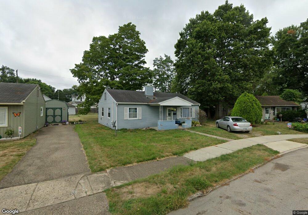
775 Cherokee Dr Lancaster, OH 43130
Estimated Value: $103,000 - $174,000
3
Beds
1
Bath
864
Sq Ft
$173/Sq Ft
Est. Value
About This Home
This home is located at 775 Cherokee Dr, Lancaster, OH 43130 and is currently estimated at $149,136, approximately $172 per square foot. 775 Cherokee Dr is a home located in Fairfield County with nearby schools including Thomas Ewing Junior High School, Lancaster High School, and St Mary Elementary School.
Ownership History
Date
Name
Owned For
Owner Type
Purchase Details
Closed on
Jul 26, 2022
Sold by
Helber Alma F
Bought by
J & Tate Enterprise Llc
Current Estimated Value
Purchase Details
Closed on
Sep 21, 2011
Sold by
Fannie Mae
Bought by
Helber Joseph and Helber Alma
Purchase Details
Closed on
Jul 5, 2011
Sold by
Azbell Nancy E
Bought by
Federal National Mortgage Association
Purchase Details
Closed on
Oct 20, 2006
Sold by
Franke Gary
Bought by
Azbell Nancy E
Home Financials for this Owner
Home Financials are based on the most recent Mortgage that was taken out on this home.
Original Mortgage
$76,000
Interest Rate
6.5%
Mortgage Type
Purchase Money Mortgage
Purchase Details
Closed on
Oct 18, 2005
Sold by
Williams George Edward and Williams George E
Bought by
Franke Gary
Create a Home Valuation Report for This Property
The Home Valuation Report is an in-depth analysis detailing your home's value as well as a comparison with similar homes in the area
Home Values in the Area
Average Home Value in this Area
Purchase History
| Date | Buyer | Sale Price | Title Company |
|---|---|---|---|
| J & Tate Enterprise Llc | -- | Carrie Lott Llc | |
| Helber Joseph | $39,000 | Amerititle Box | |
| Federal National Mortgage Association | $48,000 | None Available | |
| Azbell Nancy E | $76,000 | Title First Agency | |
| Franke Gary | $55,000 | -- |
Source: Public Records
Mortgage History
| Date | Status | Borrower | Loan Amount |
|---|---|---|---|
| Previous Owner | Azbell Nancy E | $76,000 |
Source: Public Records
Tax History Compared to Growth
Tax History
| Year | Tax Paid | Tax Assessment Tax Assessment Total Assessment is a certain percentage of the fair market value that is determined by local assessors to be the total taxable value of land and additions on the property. | Land | Improvement |
|---|---|---|---|---|
| 2024 | $3,254 | $36,190 | $6,090 | $30,100 |
| 2023 | $1,345 | $36,190 | $6,090 | $30,100 |
| 2022 | $1,353 | $36,190 | $6,090 | $30,100 |
| 2021 | $1,017 | $25,510 | $6,090 | $19,420 |
| 2020 | $976 | $25,510 | $6,090 | $19,420 |
| 2019 | $929 | $25,510 | $6,090 | $19,420 |
| 2018 | $766 | $19,980 | $6,090 | $13,890 |
| 2017 | $767 | $19,980 | $6,090 | $13,890 |
| 2016 | $747 | $19,980 | $6,090 | $13,890 |
| 2015 | $745 | $19,340 | $6,090 | $13,250 |
| 2014 | $711 | $19,340 | $6,090 | $13,250 |
| 2013 | $711 | $19,340 | $6,090 | $13,250 |
Source: Public Records
Map
Nearby Homes
- 571 E Chestnut St
- 846 E Main St
- 619 E Main St
- 844 E Wheeling St
- 629 E Wheeling St
- 545 E Main St
- 534 E Wheeling St
- 1106 E Walnut St
- 608 E Mulberry St
- 441 E Locust St
- 641 King St
- 403 S Ewing St
- 538 E 6th Ave
- 700 E Allen St
- 154 E Main St
- 632 N Eastwood Ave
- 1035 Sugar Grove Rd SE
- 1021 Sugar Grove Rd SE
- 1046 Sugar Grove Rd SE
- 627 Harding Ave
- 771 Cherokee Dr
- 779 Cherokee Dr
- 767 Cherokee Dr
- 781 Cherokee Dr
- 220 Wyandotte St
- 218 Wyandotte St
- 774 Cherokee Dr
- 224 Wyandotte St
- 216 Wyandotte St
- 226 Wyandotte St
- 783 Cherokee Dr
- 761 Cherokee Dr
- 228 Wyandotte St
- 787 Cherokee Dr
- 788 Cherokee Dr
- 766 Cherokee Dr
- 230 Wyandotte St
- 754 Cherokee Dr
- 757 Cherokee Dr
- 232 Wyandotte St