Estimated Value: $241,418 - $325,000
3
Beds
2
Baths
2,241
Sq Ft
$128/Sq Ft
Est. Value
About This Home
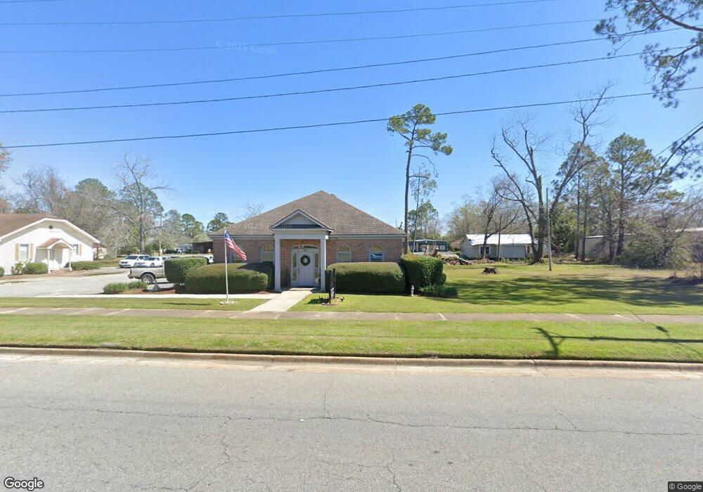
This home is located at 775 Cox Still Rd, Adel, GA 31620 and is currently estimated at $286,105, approximately $127 per square foot. 775 Cox Still Rd is a home located in Cook County with nearby schools including Cook Primary School, Cook Elementary School, and Cook County Middle School.
Ownership History
Date
Name
Owned For
Owner Type
Purchase Details
Closed on
Jun 21, 2012
Sold by
Howell Jack F
Bought by
Pounds David A
Current Estimated Value
Home Financials for this Owner
Home Financials are based on the most recent Mortgage that was taken out on this home.
Original Mortgage
$138,163
Outstanding Balance
$95,572
Interest Rate
3.79%
Mortgage Type
New Conventional
Estimated Equity
$190,533
Create a Home Valuation Report for This Property
The Home Valuation Report is an in-depth analysis detailing your home's value as well as a comparison with similar homes in the area
Home Values in the Area
Average Home Value in this Area
Purchase History
| Date | Buyer | Sale Price | Title Company |
|---|---|---|---|
| Pounds David A | $130,000 | -- |
Source: Public Records
Mortgage History
| Date | Status | Borrower | Loan Amount |
|---|---|---|---|
| Open | Pounds David A | $138,163 |
Source: Public Records
Tax History Compared to Growth
Tax History
| Year | Tax Paid | Tax Assessment Tax Assessment Total Assessment is a certain percentage of the fair market value that is determined by local assessors to be the total taxable value of land and additions on the property. | Land | Improvement |
|---|---|---|---|---|
| 2024 | $1,941 | $74,050 | $6,256 | $67,794 |
| 2023 | $1,688 | $64,658 | $6,256 | $58,402 |
| 2022 | $1,670 | $63,988 | $5,586 | $58,402 |
| 2021 | $1,487 | $53,432 | $5,586 | $47,846 |
| 2020 | $1,487 | $53,432 | $5,586 | $47,846 |
| 2019 | $1,488 | $53,432 | $5,586 | $47,846 |
| 2018 | $1,545 | $53,432 | $5,586 | $47,846 |
| 2017 | $1,489 | $53,432 | $5,586 | $47,846 |
| 2016 | $1,492 | $53,432 | $5,586 | $47,846 |
| 2015 | $1,494 | $53,432 | $5,586 | $47,846 |
| 2014 | $1,497 | $53,432 | $5,586 | $47,846 |
| 2013 | -- | $56,094 | $6,206 | $49,888 |
Source: Public Records
Map
Nearby Homes
- 625 Coxstill Rd
- 1377 Hutchinson Parrish Rd
- 701 Gloria St
- 315 Newton Dr
- 901 E 4th St
- 1306 Bear Creek Rd
- 1402 Bear Creek Rd
- 2302 Thomas St
- 2503 Dianne St
- 322 Magnolia Dr
- 2603 Dianne St
- 93 Oak Forrest Dr
- 418 E 3rd St
- 304 E 3rd St
- 211 S Gordon Ave
- 415 E 8th St
- 804 S Forrest Ave
- 105 Orchard Cir
- 137 Hood Dr
- 806 S Forrest Ave
- 827 Cox Still Rd
- 784 Coxstill Rd
- 725 Coxstill Rd
- 740 Cox Still Rd
- 784 Cox Still Rd
- 812 Cox Still Rd
- 705 Cox Still Rd
- 218 Ted St
- 690 Cox Still Rd
- 675 Cox Still Rd
- 0 Coxstill Rd
- 182 Ted St
- 625 Cox Still Rd
- 620 Cox Still Rd
- 136 Ted St
- 605 Cox Still Rd
- 932 Hutchinson Parrish Rd
- 163 Ted St
- 1014 Cox Still Rd
- 610 Cox Still Rd