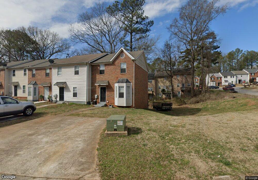
775 Crestside Ct Unit 1 Austell, GA 30168
Estimated Value: $143,000 - $159,000
About This Home
This home is located at 775 Crestside Ct Unit 1, Austell, GA 30168 and is currently estimated at $151,907, approximately $117 per square foot. 775 Crestside Ct Unit 1 is a home located in Cobb County with nearby schools including Bryant Elementary School, Lindley Middle School, and Pebblebrook High School.
Ownership History
We collect this data history from publicly available records. To have your information removed, we recommend requesting removal directly through your county’s website.
Purchase Details
Purchase Details
Home Financials for this Owner
Home Financials are based on the most recent Mortgage that was taken out on this home.Purchase Details
Home Financials for this Owner
Home Financials are based on the most recent Mortgage that was taken out on this home.Purchase Details
Home Financials for this Owner
Home Financials are based on the most recent Mortgage that was taken out on this home.Home Values in the Area
Average Home Value in this Area
Purchase History
We collect this data history from publicly available records. To have your information removed, we recommend requesting removal directly through your county’s website.
| Date | Buyer | Sale Price | Title Company |
|---|---|---|---|
| $40,000 | -- | ||
| -- | -- | ||
| $109,000 | -- | ||
| -- | -- | ||
| -- | -- |
Mortgage History
We collect this data history from publicly available records. To have your information removed, we recommend requesting removal directly through your county’s website.
| Date | Status | Borrower | Loan Amount |
|---|---|---|---|
| Previous Owner | $103,550 | ||
| Previous Owner | $81,000 |
Tax History
We collect this data history from publicly available records. To have your information removed, we recommend requesting removal directly through your county’s website.
| Year | Tax Paid | Tax Assessment Tax Assessment Total Assessment is a certain percentage of the fair market value that is determined by local assessors to be the total taxable value of land and additions on the property. | Land | Improvement |
|---|---|---|---|---|
| 2025 | $1,466 | $48,664 | $11,200 | $37,464 |
| 2024 | $1,751 | $58,076 | $11,200 | $46,876 |
| 2023 | $1,638 | $54,316 | $6,000 | $48,316 |
| 2022 | $1,648 | $54,316 | $6,000 | $48,316 |
| 2021 | $902 | $29,704 | $3,200 | $26,504 |
| 2020 | $902 | $29,704 | $3,200 | $26,504 |
| 2019 | $902 | $29,704 | $3,200 | $26,504 |
| 2018 | $847 | $27,924 | $3,200 | $24,724 |
| 2017 | $594 | $20,652 | $3,200 | $17,452 |
| 2016 | $531 | $18,472 | $3,200 | $15,272 |
| 2015 | $454 | $15,400 | $2,800 | $12,600 |
| 2014 | $458 | $15,400 | $0 | $0 |
Map
- 7237 Crestside Dr
- 750 Six Flags Dr Unit 368
- 967 Pine Hollow Rd
- 7244 Rockhouse Rd Unit 7
- 680 Knox Springs Rd
- 7406 Factory Shoals Rd SW
- 1178 Summerstone Trace
- 6971 Factory Shoals Rd
- 6834 Winding Wade Trail
- 7098 Pleasant Dr
- 1184 Flamingo Dr
- 549 Joann Ave
- 760 Wade Farm Dr
- 7254 Silverton Trail
- 1203 Blairs Pointe Dr Unit 1
- 1194 Park Center Cir
- 1190 Park Center Cir
- 1182 Laurel Log Place
- 1250 Park Center Cir
- 0 Hembree Ln Unit 10633605
- 7215 Crestside Dr
- 7215 Crestside Dr
- 7213 Crestside Dr
- 7217 Crestside Dr
- 7217 Crestside Dr Unit 7217
- 7211 Crestside Dr Unit 7211
- 7211 Crestside Dr
- 7211 Crestside Dr Unit none
- 7219 Crestside Dr
- 7219 Crestside Dr Unit 7219
- 7221 Crestside Dr Unit 7221
- 7223 Crestside Dr
- 7223 Crestside Dr Unit 7223
- 773 Crestside Ct Unit 1
- 771 Crestside Ct
- 771 Crestside Ct
- 769 Crestside Ct Unit 1
- 7225 Crestside Dr Unit 1
- 767 Crestside Ct
- 7214 Crestside Dr Unit 7214
Ask me questions while you tour the home.