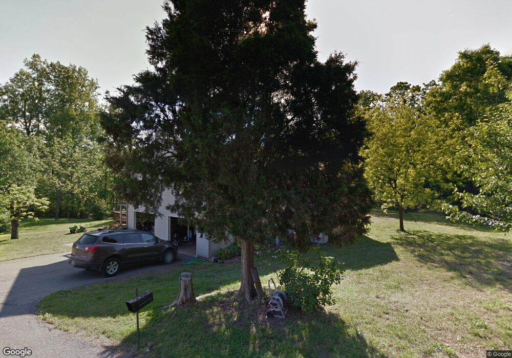
775 Furnace Rd Iron Station, NC 28080
Estimated Value: $299,000 - $552,616
3
Beds
2
Baths
1,500
Sq Ft
$301/Sq Ft
Est. Value
About This Home
This home is located at 775 Furnace Rd, Iron Station, NC 28080 and is currently estimated at $451,654, approximately $301 per square foot. 775 Furnace Rd is a home located in Lincoln County with nearby schools including Iron Station Elementary School, East Lincoln Middle School, and East Lincoln High School.
Ownership History
Date
Name
Owned For
Owner Type
Purchase Details
Closed on
Apr 29, 2021
Sold by
Mitchell Kenneth and Mitchell Donna
Bought by
Rice John E and Rice Darlene H
Current Estimated Value
Purchase Details
Closed on
May 12, 2020
Sold by
Michael Kenneth E and Michael Donna S
Bought by
Michael Kenneth E and Michael Donna S
Purchase Details
Closed on
Nov 7, 2013
Sold by
Mclain Troy and Mclain Laurel
Bought by
Michael Bryan Casey
Create a Home Valuation Report for This Property
The Home Valuation Report is an in-depth analysis detailing your home's value as well as a comparison with similar homes in the area
Home Values in the Area
Average Home Value in this Area
Purchase History
| Date | Buyer | Sale Price | Title Company |
|---|---|---|---|
| Rice John E | $47,000 | Fidelity National Title Co | |
| Michael Kenneth E | -- | None Available | |
| Michael Bryan Casey | $23,465 | None Available |
Source: Public Records
Tax History Compared to Growth
Tax History
| Year | Tax Paid | Tax Assessment Tax Assessment Total Assessment is a certain percentage of the fair market value that is determined by local assessors to be the total taxable value of land and additions on the property. | Land | Improvement |
|---|---|---|---|---|
| 2025 | $2,651 | $490,560 | $150,644 | $339,916 |
| 2024 | $2,598 | $490,560 | $150,644 | $339,916 |
| 2023 | $2,585 | $490,560 | $150,644 | $339,916 |
| 2022 | $1,919 | $299,502 | $105,764 | $193,738 |
| 2021 | $1,919 | $299,502 | $105,764 | $193,738 |
| 2020 | $1,703 | $193,738 | $0 | $193,738 |
| 2019 | $1,647 | $290,023 | $96,285 | $193,738 |
| 2018 | $1,552 | $259,380 | $95,786 | $163,594 |
| 2017 | $1,451 | $259,380 | $95,786 | $163,594 |
| 2016 | $1,451 | $259,380 | $95,786 | $163,594 |
| 2015 | $1,508 | $259,380 | $95,786 | $163,594 |
| 2014 | $1,524 | $263,188 | $97,536 | $165,652 |
Source: Public Records
Map
Nearby Homes
- 5045 Amity Ln Unit 12
- 1011 Lester Trail
- 1076 Furnace Rd
- 812 Trinity Ln
- 132 Huncoat Hollow Ln
- Lot 6 Walnut Ridge Rd Unit 6
- 341 Camp Creek Rd
- 0000 Chase Dr Unit 3
- 000 N Carolina 73
- 1711 Furnace Road Extension
- 2170 Otis Dellinger Rd
- 375 Timber Rd
- 00 Timber Rd
- 1404 Old Mill Rd
- 5345 Christopher Rd
- 5406 Christopher Rd
- 1850 Furnace Rd
- 4465 Brancer Ln
- 4161 Mineral Ln
- 25 Planters Row Rd
- 739 Furnace Rd
- 785 Furnace Rd
- 765 Furnace Rd
- 777 Furnace Rd
- 795 Furnace Rd
- 805 Furnace Rd
- 717 Furnace Rd
- 764 Furnace Rd
- 849 Furnace Rd
- 710 Furnace Rd
- 4930 Amity Ln
- 4911 Amity Ln
- 854 Furnace Rd
- 830 Furnace Rd
- 873 Furnace Rd
- 4958 Amity Ln
- 667 Furnace Rd
- Lot 11 & 12 Furnace Rd
- 4955 Amity Ln
- 4974 Amity Ln