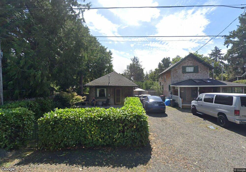
775 G St Seaside, OR 97138
Estimated Value: $290,000 - $424,650
1
Bed
1
Bath
476
Sq Ft
$782/Sq Ft
Est. Value
About This Home
This home is located at 775 G St, Seaside, OR 97138 and is currently estimated at $372,163, approximately $781 per square foot. 775 G St is a home located in Clatsop County with nearby schools including Seaside High School.
Ownership History
Date
Name
Owned For
Owner Type
Purchase Details
Closed on
Oct 6, 2021
Sold by
Shea Peter Ryan and Shea Melanie
Bought by
Jones Randolph C and Jones Karen L
Current Estimated Value
Purchase Details
Closed on
Sep 30, 2020
Sold by
Shea Peter Ryan and Shea Melanie
Bought by
Mincio Kevin and Hager Heather
Purchase Details
Closed on
Oct 26, 2015
Sold by
Novak Walter B
Bought by
Shea Peter Ryan and Shea Melanie
Home Financials for this Owner
Home Financials are based on the most recent Mortgage that was taken out on this home.
Original Mortgage
$280,000
Interest Rate
3.87%
Mortgage Type
Seller Take Back
Create a Home Valuation Report for This Property
The Home Valuation Report is an in-depth analysis detailing your home's value as well as a comparison with similar homes in the area
Purchase History
| Date | Buyer | Sale Price | Title Company |
|---|---|---|---|
| Jones Randolph C | -- | Pacific Title Company | |
| Mincio Kevin | $285,000 | Pacific Title Company | |
| Shea Peter Ryan | $300,000 | Pacific Title Company |
Source: Public Records
Mortgage History
| Date | Status | Borrower | Loan Amount |
|---|---|---|---|
| Previous Owner | Shea Peter Ryan | $280,000 |
Source: Public Records
Tax History
| Year | Tax Paid | Tax Assessment Tax Assessment Total Assessment is a certain percentage of the fair market value that is determined by local assessors to be the total taxable value of land and additions on the property. | Land | Improvement |
|---|---|---|---|---|
| 2025 | $2,108 | $193,026 | -- | -- |
| 2024 | $2,143 | $187,404 | -- | -- |
| 2023 | $2,083 | $181,947 | $0 | $0 |
| 2022 | $2,021 | $176,648 | $0 | $0 |
| 2021 | $2,063 | $171,503 | $0 | $0 |
| 2020 | $1,990 | $166,509 | $0 | $0 |
| 2019 | $1,939 | $161,660 | $0 | $0 |
Source: Public Records
Map
Nearby Homes
- 934 H St
- 782 Woodland Ct
- 1265 D St
- 1255 A St
- 3389 U S 101
- 3387-3389 U S 101
- 2674 U S 101
- 735 3rd St
- 802 25th Ave
- 2657 N Hwy 101 Unit 6
- 616 24th Ave
- 1065 Picture Place
- 1396 N Ocean Ave
- 1054 Picture Place
- 0 Cross Creek St Unit 12
- 0 Cross Creek St Unit 10
- 0 Cross Creek St Unit 11
- 0 Cross Creek St Unit 26-112
- 0 Cross Creek St Unit 13
- 0 Cross Creek St Unit 26-114
Your Personal Tour Guide
Ask me questions while you tour the home.