Estimated Value: $1,331,934 - $1,844,000
4
Beds
3
Baths
4,434
Sq Ft
$346/Sq Ft
Est. Value
About This Home
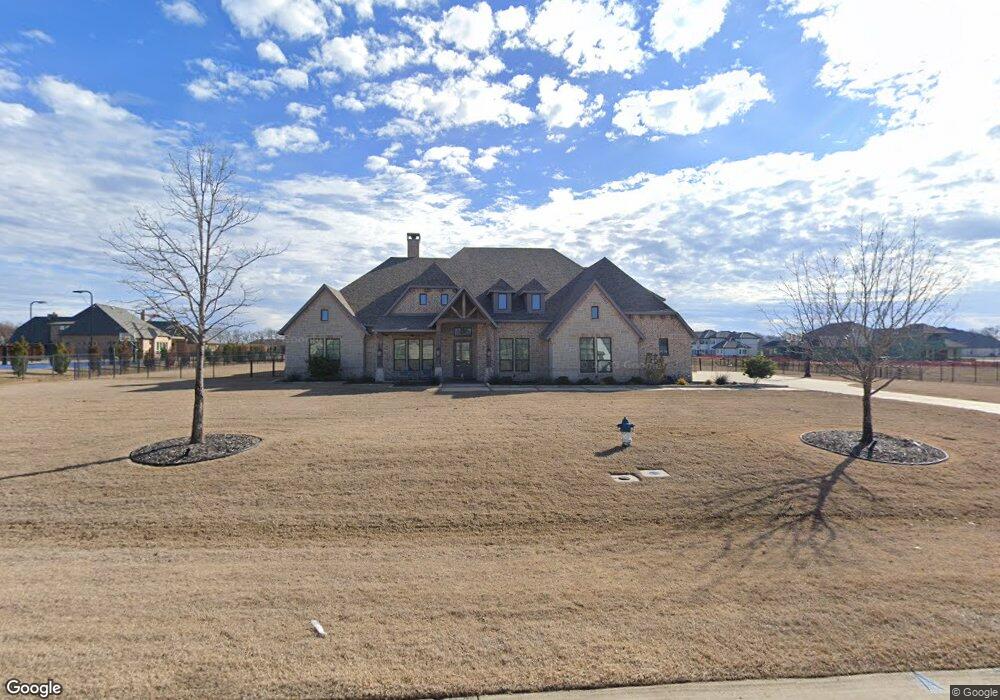
This home is located at 775 Kenwood Trail, Allen, TX 75002 and is currently estimated at $1,536,234, approximately $346 per square foot. 775 Kenwood Trail is a home located in Collin County with nearby schools including Joe V. Hart Elementary School, Willow Springs Middle School, and Sloan Creek Intermediate School.
Ownership History
Date
Name
Owned For
Owner Type
Purchase Details
Closed on
Dec 3, 2018
Sold by
Smith Kevin and Smith Mary
Bought by
Kinsella Kyle J and Kinsella Melissa L
Current Estimated Value
Home Financials for this Owner
Home Financials are based on the most recent Mortgage that was taken out on this home.
Original Mortgage
$680,000
Outstanding Balance
$603,393
Interest Rate
4.75%
Mortgage Type
Unknown
Estimated Equity
$932,841
Purchase Details
Closed on
Apr 4, 2017
Sold by
Mcch Industries Llc
Bought by
Tbf Ral Este Inc
Purchase Details
Closed on
Sep 23, 2016
Sold by
Cadg Lewis Park Llc
Bought by
Mcch Industries Llc
Home Financials for this Owner
Home Financials are based on the most recent Mortgage that was taken out on this home.
Original Mortgage
$175,000
Interest Rate
3.43%
Mortgage Type
Purchase Money Mortgage
Create a Home Valuation Report for This Property
The Home Valuation Report is an in-depth analysis detailing your home's value as well as a comparison with similar homes in the area
Home Values in the Area
Average Home Value in this Area
Purchase History
| Date | Buyer | Sale Price | Title Company |
|---|---|---|---|
| Kinsella Kyle J | -- | Chicago Title | |
| Tbf Ral Este Inc | $175,000 | None Available | |
| Mcch Industries Llc | -- | Chicago Title |
Source: Public Records
Mortgage History
| Date | Status | Borrower | Loan Amount |
|---|---|---|---|
| Open | Kinsella Kyle J | $680,000 | |
| Previous Owner | Mcch Industries Llc | $175,000 |
Source: Public Records
Tax History Compared to Growth
Tax History
| Year | Tax Paid | Tax Assessment Tax Assessment Total Assessment is a certain percentage of the fair market value that is determined by local assessors to be the total taxable value of land and additions on the property. | Land | Improvement |
|---|---|---|---|---|
| 2025 | $17,546 | $1,236,115 | $472,500 | $1,115,190 |
| 2024 | $17,546 | $1,123,741 | $420,000 | $937,373 |
| 2023 | $17,546 | $1,021,583 | $360,000 | $892,285 |
| 2022 | $18,354 | $928,712 | $270,000 | $947,224 |
| 2021 | $17,246 | $930,884 | $225,000 | $705,884 |
| 2020 | $16,331 | $767,531 | $217,500 | $550,031 |
| 2019 | $4,862 | $217,500 | $217,500 | $0 |
| 2018 | $4,882 | $216,000 | $216,000 | $0 |
| 2017 | $5,356 | $237,000 | $237,000 | $0 |
| 2016 | $4,023 | $176,640 | $176,640 | $0 |
Source: Public Records
Map
Nearby Homes
- 303 Riva Ridge
- 14 Brookhaven Dr
- 725 Chapel Ct
- 270 Cottar Dr
- 121 Cottar Dr
- 201 Cottar Dr
- 23 Santa Monica Cir
- 198 Alexander Ct
- 208 Camino Real W
- 205 Carriage Trail
- 835 Bentwater Dr
- 903 Stellar Truth Way
- 1479 Dean Meadow Ln
- 1319 Dean Meadow Ln
- 1232 Unity Village Trail
- 425 Stinson Rd
- 1545 Sara Cove
- 1212 Unity Village Trail
- Plan D00262 at Dean Farms
- Plan D00240 at Dean Farms
- 765 Kenwood Trail
- 755 Kenwood Trail
- 805 Kenwood Trail
- 790 Kenwood Trail
- 780 Kenwood Trail
- 835 Kenwood Trail
- 770 Kenwood Trail
- 770 Kenwood Trail
- 745 Kenwood Trail
- 800 Kenwood Trail
- 760 Kenwood Trail
- 750 Kenwood Trail
- 980 Hamlin Ct
- 820 Kenwood Trail
- 820 Kenwood Trail
- 740 Kenwood Trail
- 845 Kenwood Trail
- 830 Kenwood Trail
- 970 Hamlin Ct
- 810 Kenwood Trail