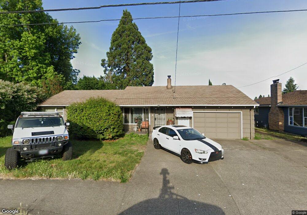
775 Lancaster Dr SE Salem, OR 97317
Meadowlawn NeighborhoodEstimated Value: $308,000 - $367,000
3
Beds
1
Bath
1,257
Sq Ft
$263/Sq Ft
Est. Value
About This Home
This home is located at 775 Lancaster Dr SE, Salem, OR 97317 and is currently estimated at $330,146, approximately $262 per square foot. 775 Lancaster Dr SE is a home located in Marion County with nearby schools including Four Corners Elementary School, Houck Middle School, and South Salem High School.
Ownership History
Date
Name
Owned For
Owner Type
Purchase Details
Closed on
Oct 4, 2010
Sold by
Elliott Gail M
Bought by
Muscat Anthony R
Current Estimated Value
Home Financials for this Owner
Home Financials are based on the most recent Mortgage that was taken out on this home.
Original Mortgage
$132,712
Outstanding Balance
$87,576
Interest Rate
4.35%
Mortgage Type
FHA
Estimated Equity
$242,570
Purchase Details
Closed on
Feb 22, 2000
Sold by
Green Barbara Lucille
Bought by
Elliott Gail M
Create a Home Valuation Report for This Property
The Home Valuation Report is an in-depth analysis detailing your home's value as well as a comparison with similar homes in the area
Home Values in the Area
Average Home Value in this Area
Purchase History
| Date | Buyer | Sale Price | Title Company |
|---|---|---|---|
| Muscat Anthony R | $134,500 | Ticor Title | |
| Elliott Gail M | -- | Ticor Title |
Source: Public Records
Mortgage History
| Date | Status | Borrower | Loan Amount |
|---|---|---|---|
| Open | Muscat Anthony R | $132,712 |
Source: Public Records
Tax History Compared to Growth
Tax History
| Year | Tax Paid | Tax Assessment Tax Assessment Total Assessment is a certain percentage of the fair market value that is determined by local assessors to be the total taxable value of land and additions on the property. | Land | Improvement |
|---|---|---|---|---|
| 2024 | $2,933 | $145,340 | -- | -- |
| 2023 | $2,718 | $141,110 | $0 | $0 |
| 2022 | $2,181 | $137,000 | $0 | $0 |
| 2021 | $2,160 | $133,010 | $0 | $0 |
| 2020 | $2,028 | $129,140 | $0 | $0 |
| 2019 | $2,044 | $125,380 | $0 | $0 |
| 2018 | $2,053 | $0 | $0 | $0 |
| 2017 | $1,728 | $0 | $0 | $0 |
| 2016 | $1,657 | $0 | $0 | $0 |
| 2015 | $1,639 | $0 | $0 | $0 |
| 2014 | $1,517 | $0 | $0 | $0 |
Source: Public Records
Map
Nearby Homes
- 728 Bonita Place SE
- 4201 Wadsworth Ln SE
- 4075 Beck Ave SE
- 0 Lancaster Dr SE
- 423 Lancaster Dr SE
- 420 Elma Ave SE
- 386 40th Place SE
- 4218 Akin Ct SE
- 446 44th Ave SE
- 4385 Mahrt Ave SE
- 1064 Connecticut Ave SE
- 4130 State St Unit 9
- 0 Lancaster (Lot Unit 82W06AB10500) Dr SE
- 270 Brink Ct SE
- 4525 Blue Sky Ct SE
- 250 Brink Ct SE
- 4591 Juliana Loop SE
- 4223 Campbell Dr SE Unit 4225
- 220 37th Ave NE
- 967 Shenandoah Dr SE
- 765 Lancaster Dr SE
- 795 Lancaster Dr SE
- 778 Meadowlawn Dr SE
- 766 Meadowlawn Dr SE
- 794 Meadowlawn Dr SE
- 755 Lancaster Dr SE
- 805 Lancaster Dr SE
- 758 Meadowlawn Dr SE
- 790 Lancaster Dr SE
- 760 Lancaster Dr SE
- 745 Lancaster Dr SE
- 800 Meadowlawn Dr SE
- 4013 MacLeay Rd SE
- 748 Meadowlawn Dr SE
- 735 Lancaster Dr SE
- 740 Lancaster Dr SE
- 773 Meadowlawn Dr SE
- 802 Meadowlawn Dr SE
- 793 Meadowlawn Dr SE
- 4055 MacLeay Rd SE