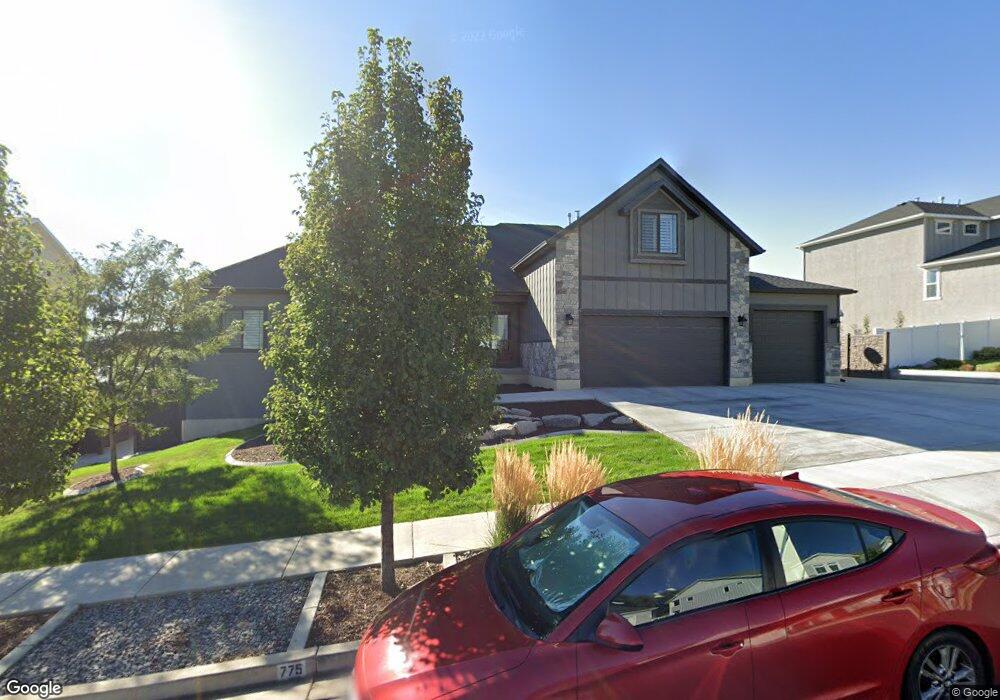
775 N 700 W American Fork, UT 84003
Estimated Value: $812,000 - $1,460,000
4
Beds
4
Baths
2,940
Sq Ft
$416/Sq Ft
Est. Value
About This Home
This home is located at 775 N 700 W, American Fork, UT 84003 and is currently estimated at $1,223,552, approximately $416 per square foot. 775 N 700 W is a home located in Utah County with nearby schools including Shelley Elementary School, American Fork Junior High School, and American Fork High School.
Ownership History
Date
Name
Owned For
Owner Type
Purchase Details
Closed on
Apr 7, 2025
Sold by
Titanium Spendthrift Trust and Zaccardi Peter J
Bought by
Titanium Spendthrift Trust and Pulver
Current Estimated Value
Purchase Details
Closed on
Jul 6, 2017
Sold by
Pulver Jeffrey L and Pulver Cynthia A
Bought by
Zaccardi Peter J and Wayne Jenson J
Home Financials for this Owner
Home Financials are based on the most recent Mortgage that was taken out on this home.
Original Mortgage
$125,000
Interest Rate
4.02%
Purchase Details
Closed on
May 22, 2017
Sold by
Pulver Cynthia Ann
Bought by
Pulver Jeffery L and Pulver Cynthia A
Home Financials for this Owner
Home Financials are based on the most recent Mortgage that was taken out on this home.
Original Mortgage
$125,000
Interest Rate
4.02%
Create a Home Valuation Report for This Property
The Home Valuation Report is an in-depth analysis detailing your home's value as well as a comparison with similar homes in the area
Home Values in the Area
Average Home Value in this Area
Purchase History
| Date | Buyer | Sale Price | Title Company |
|---|---|---|---|
| Titanium Spendthrift Trust | -- | None Listed On Document | |
| Zaccardi Peter J | -- | Accommodation | |
| Pulver Jeffery L | -- | Provo Land Title Co | |
| Pulver Cynthia Ann | -- | Provo Land Title Co |
Source: Public Records
Mortgage History
| Date | Status | Borrower | Loan Amount |
|---|---|---|---|
| Previous Owner | Pulver Cynthia A | $125,000 | |
| Previous Owner | Pulver Cynthia Ann | $424,100 | |
| Previous Owner | Camberlango Developmemt Group Llc | $377,313 |
Source: Public Records
Tax History Compared to Growth
Tax History
| Year | Tax Paid | Tax Assessment Tax Assessment Total Assessment is a certain percentage of the fair market value that is determined by local assessors to be the total taxable value of land and additions on the property. | Land | Improvement |
|---|---|---|---|---|
| 2025 | $4,577 | $593,395 | $301,800 | $777,100 |
| 2024 | $4,577 | $508,530 | $0 | $0 |
| 2023 | $4,282 | $504,460 | $0 | $0 |
| 2022 | $4,482 | $521,015 | $0 | $0 |
| 2021 | $3,928 | $713,300 | $211,400 | $501,900 |
| 2020 | $3,825 | $673,700 | $195,700 | $478,000 |
| 2019 | $3,434 | $625,500 | $195,700 | $429,800 |
| 2018 | $3,352 | $583,700 | $188,200 | $395,500 |
| 2017 | $1,970 | $185,200 | $0 | $0 |
| 2016 | $1,810 | $158,100 | $0 | $0 |
| 2015 | $1,744 | $144,500 | $0 | $0 |
| 2014 | $1,768 | $144,500 | $0 | $0 |
Source: Public Records
Map
Nearby Homes
- 822 W 800 St N Unit LOT319
- 822 N 860 W Unit 317
- 962 N 780 St W Unit 508
- 974 N 780 St W Unit 509
- 916 N 780 St W Unit 501
- 602 W 860 N
- 3935 W 1000 N Unit 438
- 3983 W 1000 N Unit 442
- 4007 W 1000 N
- 3947 W 1000 N Unit 439
- 3959 W 1000 N
- 901 N Lakota Rd
- 987 N 410 W
- 641 N 420 W
- 471 W 1040 N
- 777 W State Rd
- 914 N 400 W Unit A
- 893 N 1580 E
- 418 N 1322 E
- 3889 W 950 Cir N Unit 366
- 775 N 700 W Unit 23
- 797 W 800 N
- 787 N 700 W Unit 24
- 787 N 700 W
- 763 N 700 W Unit 22
- 763 N 700 W
- 778 N 780 St W
- 764 N 780 W Unit 107
- 776 N 700 W Unit 9
- 802 N 780 W
- 788 N 700 W Unit 8
- 754 N 700 W Unit 10
- 809 N 700 W Unit 25
- 809 N 700 W
- 751 N 700 W Unit 21
- 751 N 700 W
- 758 N 780 W Unit 106
- 812 N 780 St W
- 812 N 780 St W Unit LOT303
- 802 N 700 W