Estimated Value: $192,156 - $256,000
--
Bed
--
Bath
1,174
Sq Ft
$189/Sq Ft
Est. Value
About This Home
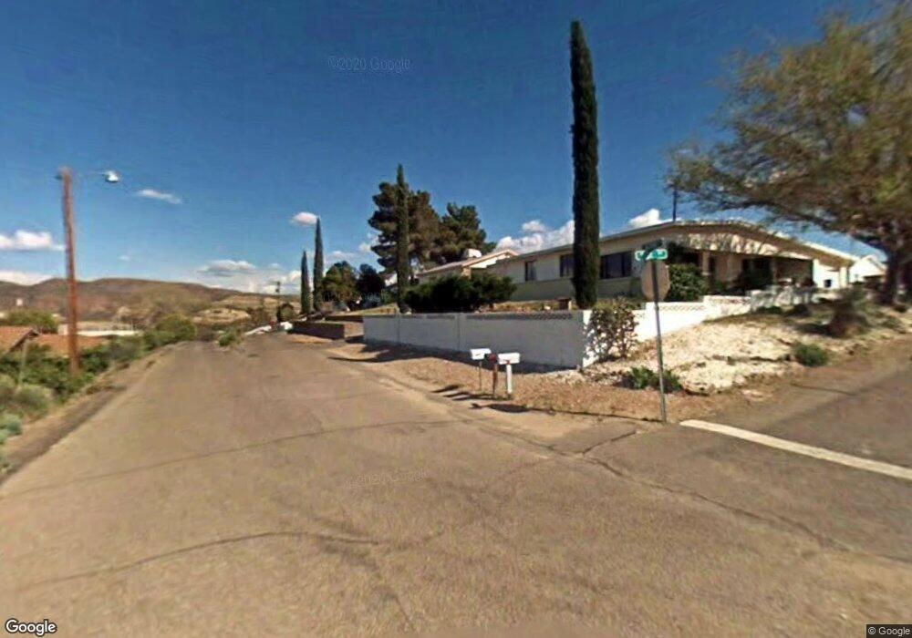
This home is located at 775 N Rose Ln, Globe, AZ 85501 and is currently estimated at $222,039, approximately $189 per square foot. 775 N Rose Ln is a home located in Gila County with nearby schools including Copper Rim Elementary School, High Desert Middle School, and Globe High School.
Ownership History
Date
Name
Owned For
Owner Type
Purchase Details
Closed on
Sep 23, 2007
Sold by
Brown John F and Brown Lora A
Bought by
Lee Julian and Lee Rebecca Murray
Current Estimated Value
Home Financials for this Owner
Home Financials are based on the most recent Mortgage that was taken out on this home.
Original Mortgage
$115,710
Outstanding Balance
$73,410
Interest Rate
6.61%
Mortgage Type
FHA
Estimated Equity
$148,629
Purchase Details
Closed on
Sep 20, 2005
Sold by
Chase Home Finance Llc
Bought by
Brown John F and Brown Lora A
Home Financials for this Owner
Home Financials are based on the most recent Mortgage that was taken out on this home.
Original Mortgage
$55,195
Interest Rate
5.63%
Mortgage Type
New Conventional
Create a Home Valuation Report for This Property
The Home Valuation Report is an in-depth analysis detailing your home's value as well as a comparison with similar homes in the area
Home Values in the Area
Average Home Value in this Area
Purchase History
| Date | Buyer | Sale Price | Title Company |
|---|---|---|---|
| Lee Julian | $122,000 | First American Title | |
| Brown John F | $58,100 | First American Title |
Source: Public Records
Mortgage History
| Date | Status | Borrower | Loan Amount |
|---|---|---|---|
| Open | Lee Julian | $115,710 | |
| Previous Owner | Brown John F | $55,195 |
Source: Public Records
Tax History Compared to Growth
Tax History
| Year | Tax Paid | Tax Assessment Tax Assessment Total Assessment is a certain percentage of the fair market value that is determined by local assessors to be the total taxable value of land and additions on the property. | Land | Improvement |
|---|---|---|---|---|
| 2025 | $781 | -- | -- | -- |
| 2024 | $781 | $12,484 | $831 | $11,653 |
| 2023 | $781 | $9,187 | $677 | $8,510 |
| 2022 | $765 | $8,121 | $677 | $7,444 |
| 2021 | $823 | $8,121 | $677 | $7,444 |
| 2020 | $763 | $0 | $0 | $0 |
| 2019 | $753 | $0 | $0 | $0 |
| 2018 | $762 | $0 | $0 | $0 |
| 2017 | $726 | $0 | $0 | $0 |
| 2016 | $652 | $0 | $0 | $0 |
| 2015 | $641 | $0 | $0 | $0 |
Source: Public Records
Map
Nearby Homes
- 0 Santee St
- 368 W Euclid Ave Unit 25
- 340 W Pinal St
- 850 W Ash St
- 642 W Eagles Bluff
- 0 20710007g - 20710007f -- Unit 3 6895808
- 202 E Mesa St
- 610 N Hill St Unit 19B
- 300 N Broad St
- 254 N Broad St
- 456 W Tremont St
- 601 N Sutherland St
- 425 E North St
- 140 W Oak St
- 1021 High
- 350 N Sutherland St
- 137 N Hill St
- 560 E Tonto St
- 501 E Mesquite St
- 5742 S Central Dr
- 765 N Rose Ln
- 787 N Rose Ln
- 755 N Rose Ln
- 553 W Banker Ave
- 738 N Rose Ln
- 547 W Banker Ave
- 561 W Banker Ave
- 590 W Banker Ave
- 539 W Banker Ave
- 565 W Banker Ave
- 581 W Banker Ave
- 749 N Rose Ln
- 573 W Banker Ave
- 585 W Banker Ave
- 567 W Euclid Ave
- 531 W Banker Ave
- 595 W Euclid Ave
- 589 W Banker Ave
- 519 W Banker Ave
- 113 Moore St