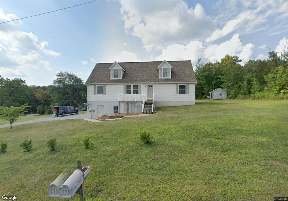
775 Stone Jug Rd Lewisberry, PA 17339
Warrington Township NeighborhoodEstimated Value: $392,000 - $597,000
3
Beds
2
Baths
2,744
Sq Ft
$169/Sq Ft
Est. Value
About This Home
This home is located at 775 Stone Jug Rd, Lewisberry, PA 17339 and is currently estimated at $463,702, approximately $168 per square foot. 775 Stone Jug Rd is a home located in York County with nearby schools including Northern Middle School and Northern High School.
Ownership History
Date
Name
Owned For
Owner Type
Purchase Details
Closed on
Jul 16, 2007
Sold by
Ruth Debbie A and Ruth Thomas E
Bought by
Jones Jack L and Jones Naomi N
Current Estimated Value
Home Financials for this Owner
Home Financials are based on the most recent Mortgage that was taken out on this home.
Original Mortgage
$190,000
Outstanding Balance
$120,482
Interest Rate
6.78%
Mortgage Type
Purchase Money Mortgage
Estimated Equity
$343,220
Purchase Details
Closed on
May 14, 2007
Sold by
Ruth Debbie A and Ruth Thomas E
Bought by
Ruth Debbie A and Ruth Thomas E
Create a Home Valuation Report for This Property
The Home Valuation Report is an in-depth analysis detailing your home's value as well as a comparison with similar homes in the area
Home Values in the Area
Average Home Value in this Area
Purchase History
| Date | Buyer | Sale Price | Title Company |
|---|---|---|---|
| Jones Jack L | $45,000 | None Available | |
| Ruth Debbie A | -- | None Available |
Source: Public Records
Mortgage History
| Date | Status | Borrower | Loan Amount |
|---|---|---|---|
| Open | Jones Jack L | $190,000 |
Source: Public Records
Tax History Compared to Growth
Tax History
| Year | Tax Paid | Tax Assessment Tax Assessment Total Assessment is a certain percentage of the fair market value that is determined by local assessors to be the total taxable value of land and additions on the property. | Land | Improvement |
|---|---|---|---|---|
| 2025 | $5,279 | $193,770 | $41,520 | $152,250 |
| 2024 | $5,221 | $193,770 | $41,520 | $152,250 |
| 2023 | $5,117 | $193,770 | $41,520 | $152,250 |
| 2022 | $4,389 | $169,830 | $41,520 | $128,310 |
| 2021 | $4,103 | $169,830 | $41,520 | $128,310 |
| 2020 | $4,005 | $169,830 | $41,520 | $128,310 |
| 2019 | $3,904 | $169,830 | $41,520 | $128,310 |
| 2018 | $3,820 | $169,830 | $41,520 | $128,310 |
| 2017 | $3,820 | $169,830 | $41,520 | $128,310 |
| 2016 | $0 | $169,830 | $41,520 | $128,310 |
| 2015 | -- | $169,830 | $41,520 | $128,310 |
| 2014 | -- | $169,830 | $41,520 | $128,310 |
Source: Public Records
Map
Nearby Homes
- 1967 Pinetown Rd
- 480 Mount Airy Rd Unit 13
- 329 Mount Airy Rd
- 450 Stone Jug Rd
- 25 Rocky Wood Ln
- 859 Pinetown Rd
- 814 Moores Mountain Rd
- 910 Emanuel Rd
- 833 Stonybrook Ln
- 200 Mountain Rd
- 708 Bencru Ave
- 0 W Camping Area Rd
- 855 Garriston Rd
- 302 W Front St
- 0 Silver Lake Rd Unit PAYK2089288
- Tract #1 Carlisle Rd
- 320 E Front St
- 390 E Front St
- 720 Pleasant Dr
- 6 Glencarron Ct
- 760 Stone Jug Rd
- 740 Stone Jug Rd
- 645 Mount Airy Rd
- 745 Stone Jug Rd
- 630 Mount Airy Rd
- 650 Mount Airy Rd
- 725 Stone Jug Rd
- 700 Stone Jug Rd
- 637 Mount Airy Rd
- 530 Mount Airy Rd
- 1965 Pinetown Rd
- 500 Mount Airy Rd
- 490 Mount Airy Rd
- 1955 Pinetown Rd
- 470 Mount Airy Rd
- 465 Mount Airy Rd
- 715 Mt Airy Rd Unit 5
- 715 Mt Airy Rd Unit 6
- 715 Mt Airy Rd Unit 7
- 455 Mount Airy Rd