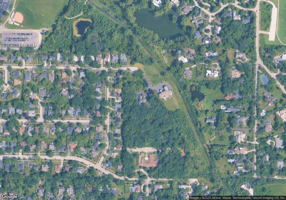
775 Summit Dr Deerfield, IL 60015
Estimated Value: $1,866,049 - $2,423,000
5
Beds
7
Baths
5,932
Sq Ft
$358/Sq Ft
Est. Value
About This Home
This home is located at 775 Summit Dr, Deerfield, IL 60015 and is currently estimated at $2,123,683, approximately $358 per square foot. 775 Summit Dr is a home located in Lake County with nearby schools including Walden Elementary School, Alan B Shepard Middle School, and Deerfield High School.
Ownership History
Date
Name
Owned For
Owner Type
Purchase Details
Closed on
Nov 3, 2008
Sold by
Us Bank National Association
Bought by
Fleishman Adam and Fleishman Wendy
Current Estimated Value
Home Financials for this Owner
Home Financials are based on the most recent Mortgage that was taken out on this home.
Original Mortgage
$1,000,000
Outstanding Balance
$649,574
Interest Rate
5.87%
Mortgage Type
Unknown
Estimated Equity
$1,474,109
Purchase Details
Closed on
Apr 28, 2008
Sold by
Hutsell Jeffrey and Hutsell Sara
Bought by
Us Bank Na and Trust #8338
Purchase Details
Closed on
Jun 1, 2001
Sold by
Hutsell Jeffrey and Hutsell Sara
Bought by
Hutsell Jeffrey and Hutsell Sora
Home Financials for this Owner
Home Financials are based on the most recent Mortgage that was taken out on this home.
Original Mortgage
$718,900
Interest Rate
7.25%
Create a Home Valuation Report for This Property
The Home Valuation Report is an in-depth analysis detailing your home's value as well as a comparison with similar homes in the area
Home Values in the Area
Average Home Value in this Area
Purchase History
| Date | Buyer | Sale Price | Title Company |
|---|---|---|---|
| Fleishman Adam | $1,738,500 | First American Title | |
| Us Bank Na | -- | None Available | |
| Hutsell Jeffrey | -- | Chicago Title Insurance Co |
Source: Public Records
Mortgage History
| Date | Status | Borrower | Loan Amount |
|---|---|---|---|
| Open | Fleishman Adam | $1,000,000 | |
| Previous Owner | Hutsell Jeffrey | $718,900 |
Source: Public Records
Tax History Compared to Growth
Tax History
| Year | Tax Paid | Tax Assessment Tax Assessment Total Assessment is a certain percentage of the fair market value that is determined by local assessors to be the total taxable value of land and additions on the property. | Land | Improvement |
|---|---|---|---|---|
| 2024 | $47,314 | $522,723 | $137,571 | $385,152 |
| 2023 | $49,877 | $501,654 | $132,026 | $369,628 |
| 2022 | $49,877 | $534,032 | $133,360 | $400,672 |
| 2021 | $47,103 | $514,879 | $128,577 | $386,302 |
| 2020 | $45,300 | $514,428 | $128,848 | $385,580 |
| 2019 | $51,221 | $593,165 | $128,629 | $464,536 |
| 2018 | $38,376 | $460,732 | $136,336 | $324,396 |
| 2017 | $37,808 | $459,262 | $135,901 | $323,361 |
| 2016 | $50,683 | $606,706 | $130,762 | $475,944 |
| 2015 | $49,274 | $570,052 | $122,862 | $447,190 |
| 2014 | $41,291 | $472,714 | $123,742 | $348,972 |
| 2012 | $40,249 | $468,544 | $122,650 | $345,894 |
Source: Public Records
Map
Nearby Homes
- 1504 Northwoods Rd
- 1423 Northwoods Rd
- 1770 Overland Trail
- 1342 Barclay Ln Unit 36
- 970 Ivy Ln Unit C
- 1131 Linden Ave
- 1341 Carlisle Place
- 2005 Keats Ln
- 1265 Woodland Dr
- 1666 Cloverdale Ave
- 1263 Carlisle Place
- 1410 Berkley Ct
- 1953 Keats Ct
- 2372 Tennyson Ln
- 1045 Fairoaks Ave
- 1127 Kenton Rd
- 2230 Shady Ln
- 1380 Valley Rd
- 1670 Meadow Ln
- 1685 Sherwood Rd
- 755 Summit Dr
- 1725 Portage Pass
- 1735 Portage Pass
- 1715 Portage Pass
- 1745 Portage Pass
- 1695 Portage Pass
- 1755 Portage Pass
- 1755 Portage Pass
- 810 Summit Dr
- 1675 Portage Pass
- 1730 Portage Pass
- 1740 Portage Pass
- 1720 Portage Pass
- 1750 Portage Pass
- 820 Summit Dr
- 1700 Portage Pass
- 1760 Portage Pass
- 1665 Portage Pass
- 1752 Ryders Ln
- 830 Summit Dr
