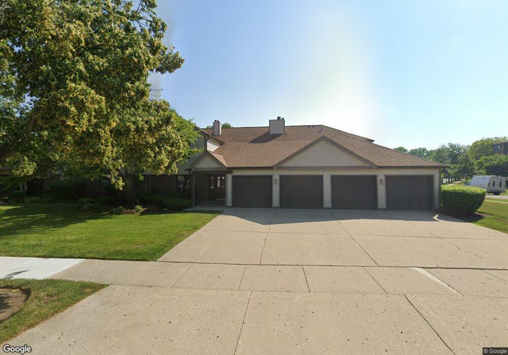
775 White Pine Rd Unit 5D1 Buffalo Grove, IL 60089
South Buffalo Grove NeighborhoodEstimated Value: $242,332 - $275,000
2
Beds
--
Bath
1,150
Sq Ft
$227/Sq Ft
Est. Value
About This Home
This home is located at 775 White Pine Rd Unit 5D1, Buffalo Grove, IL 60089 and is currently estimated at $260,583, approximately $226 per square foot. 775 White Pine Rd Unit 5D1 is a home located in Cook County with nearby schools including Henry W Longfellow Elementary School, Cooper Middle School, and Buffalo Grove High School.
Ownership History
Date
Name
Owned For
Owner Type
Purchase Details
Closed on
Aug 21, 2009
Sold by
Slutzky Norma L
Bought by
Norma L Slutzky Declaration Of Trust
Current Estimated Value
Purchase Details
Closed on
Nov 17, 1995
Sold by
Plezbert Joseph M and Plezbert Pamela J
Bought by
Slutzky Norma L
Home Financials for this Owner
Home Financials are based on the most recent Mortgage that was taken out on this home.
Original Mortgage
$57,500
Interest Rate
7.52%
Purchase Details
Closed on
Sep 28, 1995
Sold by
Werderitch Pamela J
Bought by
Plezbert Joseph and Plezbert Pamela
Home Financials for this Owner
Home Financials are based on the most recent Mortgage that was taken out on this home.
Original Mortgage
$57,500
Interest Rate
7.52%
Create a Home Valuation Report for This Property
The Home Valuation Report is an in-depth analysis detailing your home's value as well as a comparison with similar homes in the area
Home Values in the Area
Average Home Value in this Area
Purchase History
| Date | Buyer | Sale Price | Title Company |
|---|---|---|---|
| Norma L Slutzky Declaration Of Trust | -- | None Available | |
| Slutzky Norma L | -- | -- | |
| Plezbert Joseph | -- | Nations Title Agy Illinois I |
Source: Public Records
Mortgage History
| Date | Status | Borrower | Loan Amount |
|---|---|---|---|
| Closed | Slutzky Norma L | $57,500 | |
| Previous Owner | Plezbert Joseph | $16,900 |
Source: Public Records
Tax History Compared to Growth
Tax History
| Year | Tax Paid | Tax Assessment Tax Assessment Total Assessment is a certain percentage of the fair market value that is determined by local assessors to be the total taxable value of land and additions on the property. | Land | Improvement |
|---|---|---|---|---|
| 2024 | $4,767 | $18,210 | $2,695 | $15,515 |
| 2023 | $4,554 | $18,210 | $2,695 | $15,515 |
| 2022 | $4,554 | $18,210 | $2,695 | $15,515 |
| 2021 | $4,061 | $14,825 | $374 | $14,451 |
| 2020 | $4,030 | $14,825 | $374 | $14,451 |
| 2019 | $4,024 | $16,427 | $374 | $16,053 |
| 2018 | $3,342 | $13,141 | $299 | $12,842 |
| 2017 | $3,301 | $13,141 | $299 | $12,842 |
| 2016 | $3,343 | $13,141 | $299 | $12,842 |
| 2015 | $3,216 | $12,090 | $1,272 | $10,818 |
| 2014 | $3,181 | $12,090 | $1,272 | $10,818 |
| 2013 | $2,922 | $12,090 | $1,272 | $10,818 |
Source: Public Records
Map
Nearby Homes
- 820 Weidner Rd Unit 4013
- 820 Weidner Rd Unit 409
- 665 Thornwood Dr
- 813 Stradford Cir Unit 21B2
- 859 Beechwood Rd
- 535 Estate Dr
- 3300 N Carriageway Dr Unit 317
- 410 Chatham Cir
- 455 Mayfair Ln
- 561 Park View Terrace Unit 153
- 408 Indian Hill Dr
- 1127 Miller Ln Unit 107
- 1115 Miller Ln Unit 104
- 972 Thornton Ln Unit 102
- 476 Raupp Blvd
- 18 E Heritage Ct
- 921 Bernard Dr
- 3157 N Daniels Ct Unit 1502
- 3227 N Heritage Ln
- 310 Rosewood Ave
- 773 White Pine Rd Unit 5C2
- 771 White Pine Rd Unit 5C1
- 777 White Pine Rd Unit 5D2
- 767 White Pine Rd Unit 5B2
- 763 White Pine Rd Unit 5A2
- 761 White Pine Rd Unit 5A1
- 765 White Pine Rd Unit 5B1
- 765 White Pine Rd Unit 765
- 698 Hapsfield Ln Unit 4A2
- 696 Hapsfield Ln Unit 4A1
- 694 Hapsfield Ln Unit 4B2
- 722 Hapsfield Ln Unit 7D1
- 778 White Pine Rd Unit D2
- 778 White Pine Rd Unit 6D2
- 774 White Pine Rd Unit 6C2
- 772 White Pine Rd Unit 6C1
- 692 Hapsfield Ln Unit 4B1
- 726 Hapsfield Ln Unit 7C1
- 768 White Pine Rd Unit 6B2
- 728 Hapsfield Ln Unit 7C2