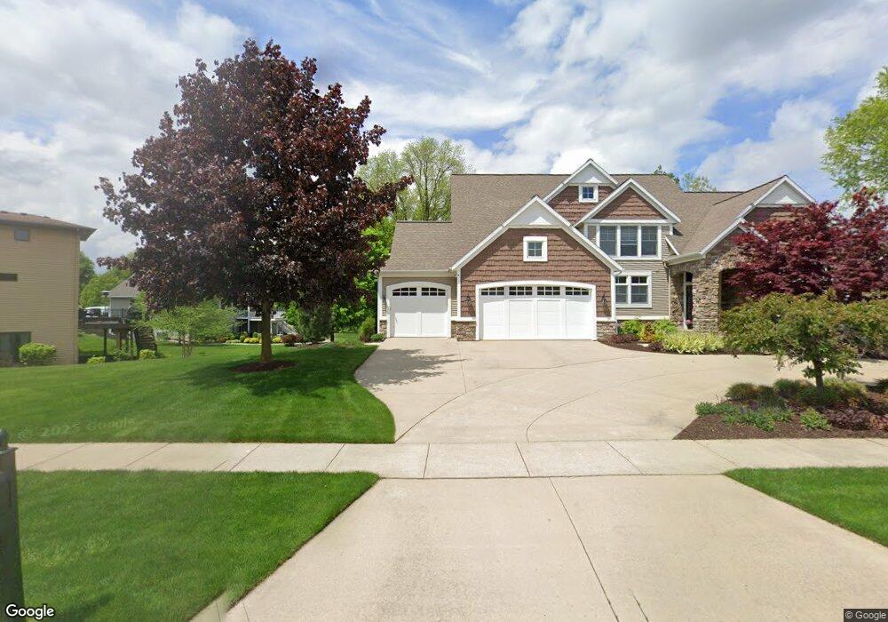
7753 Byron Depot Dr SW Byron Center, MI 49315
Estimated Value: $833,000 - $1,117,000
5
Beds
5
Baths
3,878
Sq Ft
$241/Sq Ft
Est. Value
About This Home
This home is located at 7753 Byron Depot Dr SW, Byron Center, MI 49315 and is currently estimated at $933,317, approximately $240 per square foot. 7753 Byron Depot Dr SW is a home located in Kent County with nearby schools including Brown Elementary School, Robert L. Nickels Intermediate School, and Byron Center West Middle School.
Ownership History
Date
Name
Owned For
Owner Type
Purchase Details
Closed on
Jul 15, 2005
Sold by
Omlor Charles W
Bought by
Omlor Charles W and Omlor Linda E
Current Estimated Value
Home Financials for this Owner
Home Financials are based on the most recent Mortgage that was taken out on this home.
Original Mortgage
$332,000
Outstanding Balance
$173,532
Interest Rate
5.68%
Mortgage Type
New Conventional
Estimated Equity
$759,785
Purchase Details
Closed on
Feb 2, 2004
Sold by
Railside Development Corp
Bought by
Omlor Charles W and Omlor Chuck
Home Financials for this Owner
Home Financials are based on the most recent Mortgage that was taken out on this home.
Original Mortgage
$333,700
Interest Rate
5.5%
Mortgage Type
Purchase Money Mortgage
Create a Home Valuation Report for This Property
The Home Valuation Report is an in-depth analysis detailing your home's value as well as a comparison with similar homes in the area
Home Values in the Area
Average Home Value in this Area
Purchase History
| Date | Buyer | Sale Price | Title Company |
|---|---|---|---|
| Omlor Charles W | -- | Transnation Title | |
| Omlor Charles W | $83,900 | -- |
Source: Public Records
Mortgage History
| Date | Status | Borrower | Loan Amount |
|---|---|---|---|
| Open | Omlor Charles W | $332,000 | |
| Previous Owner | Omlor Charles W | $333,700 |
Source: Public Records
Tax History Compared to Growth
Tax History
| Year | Tax Paid | Tax Assessment Tax Assessment Total Assessment is a certain percentage of the fair market value that is determined by local assessors to be the total taxable value of land and additions on the property. | Land | Improvement |
|---|---|---|---|---|
| 2025 | $6,484 | $441,600 | $0 | $0 |
| 2024 | $6,484 | $419,200 | $0 | $0 |
| 2023 | $6,201 | $369,900 | $0 | $0 |
| 2022 | $8,643 | $358,400 | $0 | $0 |
| 2021 | $8,412 | $340,800 | $0 | $0 |
| 2020 | $5,708 | $318,900 | $0 | $0 |
| 2019 | $8,208 | $310,600 | $0 | $0 |
| 2018 | $8,040 | $299,400 | $42,000 | $257,400 |
| 2017 | $7,829 | $285,300 | $0 | $0 |
| 2016 | $7,542 | $268,300 | $0 | $0 |
| 2015 | $7,412 | $268,300 | $0 | $0 |
| 2013 | -- | $238,200 | $0 | $0 |
Source: Public Records
Map
Nearby Homes
- 3183 Railway Dr SW
- 7998 Byron Depot Dr SW
- 8030 Lionel Dr
- 8115 Byron Depot Dr SW
- Redwood Plan at Railside - Woodland Series
- Sycamore Plan at Railside - Woodland Series
- Bay Harbor Plan at Railside - Landmark Series
- Northport Plan at Railside - Landmark Series
- Pentwater Plan at Railside - Landmark Series
- Oakwood Plan at Railside - Woodland Series
- 3563 Conrail Dr
- 8090 Country Rail Ct SW
- 8047 Erie Dr
- 8138 Boardwalk Dr SW
- 8393 Woodhaven Dr SW Unit 1
- 2740 Woodhaven Ct SW Unit 2
- 8330 Rockledge Way SW Unit 92
- 2581 Ravines Trail Dr SW
- 2569 Ravines Trail Dr SW
- 2567 Ravines Trail Dr SW
- 3111 Byron Depot Ct SW
- 3123 Byron Depot Ct SW
- 7737 Byron Depot Dr SW
- 7752 Byron Depot Dr SW
- 7766 Byron Depot Dr SW
- 3137 Byron Depot Ct SW
- 7715 Byron Depot Dr SW
- 7724 Byron Depot Dr SW
- 7738 Byron Depot Dr SW
- 7780 Byron Depot Dr SW
- 3141 Byron Depot Ct SW
- 3110 Byron Depot Ct SW
- 3120 Byron Depot Ct SW
- 7794 Byron Depot Dr SW
- 7710 Byron Depot Dr SW
- 3130 Byron Depot Ct SW
- 7765 Railyard Dr SW
- 7803 Railyard Dr SW
- 7808 Byron Depot Dr SW
- 7791 Railyard Dr SW