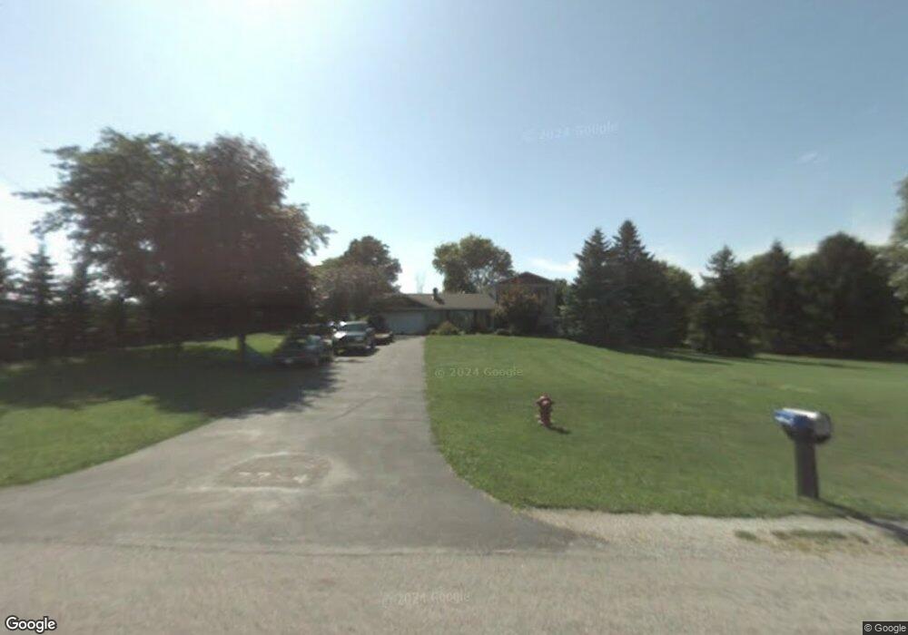
7754 Maple Rd Frankenmuth, MI 48734
Estimated Value: $357,277 - $577,000
3
Beds
3
Baths
2,104
Sq Ft
$206/Sq Ft
Est. Value
About This Home
This home is located at 7754 Maple Rd, Frankenmuth, MI 48734 and is currently estimated at $433,069, approximately $205 per square foot. 7754 Maple Rd is a home located in Saginaw County with nearby schools including List Elementary, E.F. Rittmueller Middle School, and Frankenmuth High School.
Ownership History
Date
Name
Owned For
Owner Type
Purchase Details
Closed on
Oct 30, 2003
Current Estimated Value
Home Financials for this Owner
Home Financials are based on the most recent Mortgage that was taken out on this home.
Original Mortgage
$131,800
Interest Rate
6.08%
Mortgage Type
Purchase Money Mortgage
Purchase Details
Closed on
Apr 23, 1999
Sold by
Lewis Theodore H and Lewis Loretta N
Bought by
Somerville David T and Somerville Renee L
Home Financials for this Owner
Home Financials are based on the most recent Mortgage that was taken out on this home.
Original Mortgage
$193,325
Interest Rate
7.83%
Create a Home Valuation Report for This Property
The Home Valuation Report is an in-depth analysis detailing your home's value as well as a comparison with similar homes in the area
Purchase History
| Date | Buyer | Sale Price | Title Company |
|---|---|---|---|
| -- | $214,800 | -- | |
| Yagiela Steven | $214,800 | Fatic | |
| Somerville David T | $203,500 | Lawyers Title Insurance Corp |
Source: Public Records
Mortgage History
| Date | Status | Borrower | Loan Amount |
|---|---|---|---|
| Previous Owner | Yagiela Steven | $131,800 | |
| Previous Owner | Somerville David T | $193,325 |
Source: Public Records
Tax History
| Year | Tax Paid | Tax Assessment Tax Assessment Total Assessment is a certain percentage of the fair market value that is determined by local assessors to be the total taxable value of land and additions on the property. | Land | Improvement |
|---|---|---|---|---|
| 2025 | $1,274 | $170,000 | $0 | $0 |
| 2024 | $1,236 | $156,700 | $0 | $0 |
| 2023 | $1,177 | $135,100 | $0 | $0 |
| 2022 | $3,783 | $130,300 | $0 | $0 |
| 2021 | $3,462 | $120,300 | $0 | $0 |
| 2020 | $3,378 | $113,500 | $0 | $0 |
| 2019 | $3,221 | $103,100 | $0 | $0 |
| 2018 | $1,026 | $100,500 | $0 | $0 |
| 2017 | $2,907 | $102,500 | $0 | $0 |
| 2016 | $2,889 | $94,400 | $0 | $0 |
| 2014 | -- | $93,100 | $0 | $77,600 |
| 2013 | -- | $92,100 | $0 | $0 |
Source: Public Records
Map
Nearby Homes
- 9351 Lange Rd
- 6450 Curtis Rd
- 0 Judd Rd
- 6977 Rathbun Rd
- 7720 Rookway Rd
- 12 Wilshire Dr
- 6 Wilshire Dr Unit A6
- 2 Wilshire Dr Unit A4
- 000 W Tuscola St
- 10 Harlan Ct
- Parcel E W Rolling Hills Dr
- Parcel B W Rolling Hills Dr
- Parcel D W Rolling Hills Dr
- Parcel F W Rolling Hills Dr
- Parcel C W Rolling Hills Dr
- VL Busch (Parcel B) Rd
- VL Busch (Parcel A) Rd
- 5383 Riverview Dr
- 53 Pine Grove Dr
- 226 List St
- 7700 Maple Rd
- 7671 Maple Rd
- 7860 Maple Rd
- 7619 Maple Rd
- 7620 Maple Rd
- 7588 Maple Rd
- 7571 Maple Rd
- 7975 Maple Rd
- 7491 Maple Rd
- 8110 Townline Rd
- 7835 Townline Rd
- 7890 Townline Rd
- 7665 Townline Rd
- 7665 E Townline
- 7425 Maple Rd
- 8160 Townline Rd
- 7713 Townline Rd
- 8170 Townline Rd
- 7409 Maple Rd
- 8200 Townline Rd
Your Personal Tour Guide
Ask me questions while you tour the home.