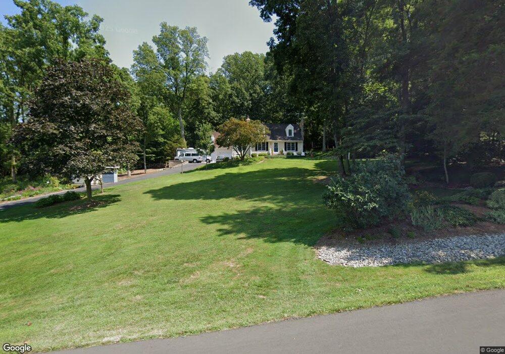
7755 Dollyhyde Rd Mount Airy, MD 21771
Estimated Value: $406,855 - $586,000
Studio
2
Baths
1,416
Sq Ft
$345/Sq Ft
Est. Value
About This Home
This home is located at 7755 Dollyhyde Rd, Mount Airy, MD 21771 and is currently estimated at $488,214, approximately $344 per square foot. 7755 Dollyhyde Rd is a home located in Frederick County with nearby schools including Liberty Elementary School, New Market Middle School, and Linganore High School.
Ownership History
Date
Name
Owned For
Owner Type
Purchase Details
Closed on
Feb 5, 1987
Sold by
M. J. Sponseller, Inc.
Bought by
Handzo Joseph J and Youmans Elizabeth
Current Estimated Value
Home Financials for this Owner
Home Financials are based on the most recent Mortgage that was taken out on this home.
Original Mortgage
$93,400
Interest Rate
9.08%
Purchase Details
Closed on
Oct 3, 1986
Sold by
Harris John C
Bought by
M. J. Sponseller, Inc.
Home Financials for this Owner
Home Financials are based on the most recent Mortgage that was taken out on this home.
Original Mortgage
$71,670
Interest Rate
10.08%
Create a Home Valuation Report for This Property
The Home Valuation Report is an in-depth analysis detailing your home's value as well as a comparison with similar homes in the area
Home Values in the Area
Average Home Value in this Area
Purchase History
| Date | Buyer | Sale Price | Title Company |
|---|---|---|---|
| Handzo Joseph J | $105,500 | -- | |
| M. J. Sponseller, Inc. | $20,000 | -- |
Source: Public Records
Mortgage History
| Date | Status | Borrower | Loan Amount |
|---|---|---|---|
| Closed | Handzo Joseph J | $93,400 | |
| Previous Owner | M. J. Sponseller, Inc. | $71,670 |
Source: Public Records
Tax History
| Year | Tax Paid | Tax Assessment Tax Assessment Total Assessment is a certain percentage of the fair market value that is determined by local assessors to be the total taxable value of land and additions on the property. | Land | Improvement |
|---|---|---|---|---|
| 2025 | $3,979 | $378,300 | $142,500 | $235,800 |
| 2024 | $3,979 | $347,000 | $0 | $0 |
| 2023 | $3,632 | $315,700 | $0 | $0 |
| 2022 | $3,451 | $284,400 | $101,000 | $183,400 |
| 2021 | $3,202 | $273,667 | $0 | $0 |
| 2020 | $3,202 | $262,933 | $0 | $0 |
| 2019 | $3,077 | $252,200 | $91,300 | $160,900 |
| 2018 | $3,104 | $252,200 | $91,300 | $160,900 |
| 2017 | $3,077 | $252,200 | $0 | $0 |
| 2016 | $3,044 | $254,800 | $0 | $0 |
| 2015 | $3,044 | $253,567 | $0 | $0 |
| 2014 | $3,044 | $252,333 | $0 | $0 |
Source: Public Records
Map
Nearby Homes
- 8730 Mapleville Rd
- 7192 Rosalees Walk
- 7192 Rosalees Way
- 7275 Hattery Farm Ct
- 9130 Liberty Village Way
- 6468 General Dr Unit WALBERT
- 6460-B General Dr Unit BARTHOLOW
- 6452 General Dr Unit WALBERT
- 11907 Lime Plant Rd
- 6452-B General Dr Unit BURKE
- 12109 Liberty Rd
- 6905 New London Rd
- 13715 New Windsor Rd
- 11941 South St
- 9522 Bessie Clemson Rd
- 12775 Barnett Dr
- 6501 Green Valley Rd
- 12834 Jesse Smith Rd
- 9177 Oak Tree Ct
- 0 New Windsor Rd Unit MDFR2073236
- 7749 Dollyhyde Rd
- 7738 Emerson Burrier Rd
- 7737 Dollyhyde Rd
- 7732 Emerson Burrier Rd
- 7747 Emerson Burrier Rd
- 7739 Emerson Burrier Rd
- 7748 Emerson Burrier Rd
- 7727 Emerson Burrier Rd
- 7719 Dollyhyde Rd
- 7803 Emerson Burrier Rd
- 7718 Emerson Burrier Rd
- 7725 Emerson Burrier Rd
- 7809 Emerson Burrier Rd
- 7723 Emerson Burrier Rd
- 7815 Emerson Burrier Rd
- 7710 Emerson Burrier Rd
- 7971 Dollyhyde Rd
- 7716 Dollyhyde Rd
- 7821 Emerson Burrier Rd
- 7708 Dollyhyde Rd
Your Personal Tour Guide
Ask me questions while you tour the home.