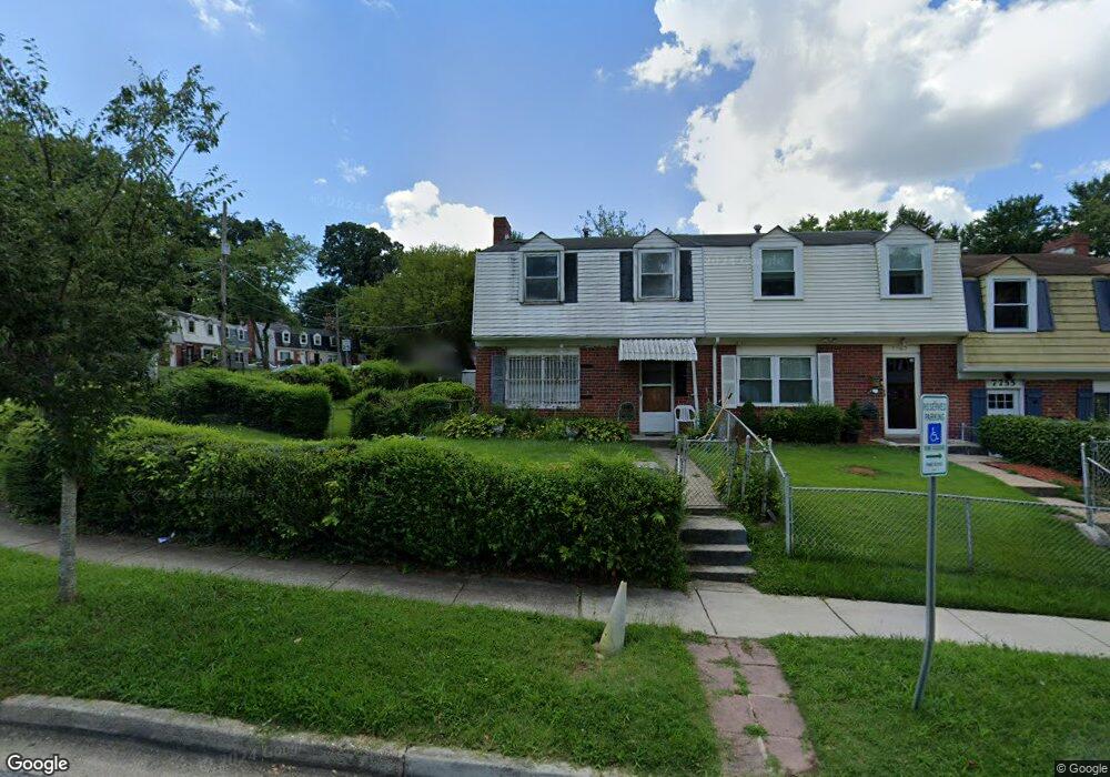
7759 Burnside Rd Hyattsville, MD 20785
Greater Landover NeighborhoodEstimated Value: $228,321 - $314,000
Studio
2
Baths
1,320
Sq Ft
$218/Sq Ft
Est. Value
About This Home
This home is located at 7759 Burnside Rd, Hyattsville, MD 20785 and is currently estimated at $287,330, approximately $217 per square foot. 7759 Burnside Rd is a home located in Prince George's County with nearby schools including William Paca Elementary School, Kenmoor Middle School, and Charles Herbert Flowers High School.
Ownership History
Date
Name
Owned For
Owner Type
Purchase Details
Closed on
Aug 31, 1995
Sold by
Hud Housing Urban Development
Bought by
Dunn Melvin
Current Estimated Value
Home Financials for this Owner
Home Financials are based on the most recent Mortgage that was taken out on this home.
Original Mortgage
$76,500
Interest Rate
7.61%
Purchase Details
Closed on
Jun 2, 1995
Sold by
Friedman Alvin E
Bought by
Hud Housing Urban Development
Purchase Details
Closed on
Nov 9, 1987
Sold by
Savoy Janice
Bought by
Northrop Edward M
Create a Home Valuation Report for This Property
The Home Valuation Report is an in-depth analysis detailing your home's value as well as a comparison with similar homes in the area
Home Values in the Area
Average Home Value in this Area
Purchase History
| Date | Buyer | Sale Price | Title Company |
|---|---|---|---|
| Dunn Melvin | $69,000 | -- | |
| Hud Housing Urban Development | $52,045 | -- | |
| Northrop Edward M | $62,500 | -- |
Source: Public Records
Mortgage History
| Date | Status | Borrower | Loan Amount |
|---|---|---|---|
| Closed | Hud Housing Urban Development | $76,500 |
Source: Public Records
Tax History
| Year | Tax Paid | Tax Assessment Tax Assessment Total Assessment is a certain percentage of the fair market value that is determined by local assessors to be the total taxable value of land and additions on the property. | Land | Improvement |
|---|---|---|---|---|
| 2025 | $2,824 | $245,833 | -- | -- |
| 2024 | $2,824 | $232,967 | -- | -- |
| 2023 | $2,717 | $220,100 | $45,000 | $175,100 |
| 2022 | $2,565 | $208,667 | $0 | $0 |
| 2021 | $2,423 | $197,233 | $0 | $0 |
| 2020 | $2,335 | $185,800 | $45,000 | $140,800 |
| 2019 | $2,237 | $165,067 | $0 | $0 |
| 2018 | $2,134 | $144,333 | $0 | $0 |
| 2017 | $2,049 | $123,600 | $0 | $0 |
| 2016 | -- | $120,533 | $0 | $0 |
| 2015 | $2,064 | $117,467 | $0 | $0 |
| 2014 | $2,064 | $114,400 | $0 | $0 |
Source: Public Records
Map
Nearby Homes
- 7630 Allendale Dr
- 7818 Allendale Dr
- 7708 Bender Rd
- 7617 Allendale Cir
- 7513 Allendale Dr
- 7509 Allendale Dr
- 1827 Dutch Village Dr Unit K-350
- 1765 Dutch Village Dr Unit L-326
- 8001 Barlowe Rd
- 7905 Greenleaf Rd
- 7700 Greenleaf Rd
- 8120 Allendale Dr
- 1783 Village Green Dr Unit Y-89
- 1909 Dutch Village Dr Unit I-234
- 1931 Dutch Village Dr Unit I-245
- 1925 Dutch Village Dr Unit I-242
- 7721 Penbrook Place
- 1827 Village Green Dr Unit X-139
- 1825 Village Green Dr
- 8110 Sheriff Rd
- 7757 Burnside Rd
- 7755 Burnside Rd
- 7753 Burnside Rd
- 7746 Greymont St
- 7767 Burnside Rd
- 7751 Burnside Rd
- 7744 Greymont St
- 7749 Burnside Rd
- 7742 Greymont St
- 7769 Burnside Rd
- 7740 Greymont St
- 7758 Burnside Rd
- 7756 Burnside Rd
- 7760 Burnside Rd
- 7754 Burnside Rd
- 7762 Burnside Rd
- 7747 Burnside Rd
- 7738 Greymont St
- 7765 Greymont St
- 7771 Burnside Rd
Your Personal Tour Guide
Ask me questions while you tour the home.