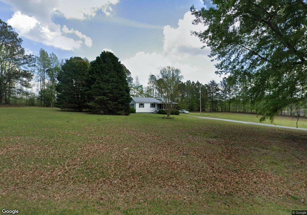
7760 Highway 15 S White Plains, GA 30678
Estimated Value: $120,862 - $241,000
--
Bed
1
Bath
912
Sq Ft
$224/Sq Ft
Est. Value
About This Home
This home is located at 7760 Highway 15 S, White Plains, GA 30678 and is currently estimated at $204,716, approximately $224 per square foot. 7760 Highway 15 S is a home located in Greene County with nearby schools including Greene County High School.
Ownership History
Date
Name
Owned For
Owner Type
Purchase Details
Closed on
Aug 11, 2020
Sold by
Lindsey Deshea F Estate
Bought by
Coleman Family Lllp
Current Estimated Value
Home Financials for this Owner
Home Financials are based on the most recent Mortgage that was taken out on this home.
Original Mortgage
$46,493
Outstanding Balance
$2,344
Interest Rate
2.9%
Mortgage Type
New Conventional
Estimated Equity
$202,372
Purchase Details
Closed on
Dec 19, 2005
Sold by
Lindsey Roy
Bought by
Lindsey Karla
Purchase Details
Closed on
Feb 6, 2002
Sold by
Marchman Billy W and Marchman Lynn J
Bought by
Lindsey Roy Lee and Lindsey Shea F
Purchase Details
Closed on
Feb 5, 1998
Sold by
Coleman William R
Bought by
Marchman Billy W and Marchman Lynn J
Purchase Details
Closed on
Oct 16, 1996
Sold by
Daughtry Ronald F and Daughtry Grace H
Bought by
Coleman William R
Purchase Details
Closed on
Oct 15, 1996
Sold by
Stewart Clinton Mark
Bought by
Daughtry Ronald F and Daughtry Grace H
Purchase Details
Closed on
Jan 1, 1974
Bought by
Stewart Clinton Mark
Create a Home Valuation Report for This Property
The Home Valuation Report is an in-depth analysis detailing your home's value as well as a comparison with similar homes in the area
Home Values in the Area
Average Home Value in this Area
Purchase History
| Date | Buyer | Sale Price | Title Company |
|---|---|---|---|
| Coleman Family Lllp | $54,085 | -- | |
| Lindsey Karla | -- | -- | |
| Lindsey Roy Lee | $53,000 | -- | |
| Marchman Billy W | -- | -- | |
| Coleman William R | $45,000 | -- | |
| Daughtry Ronald F | $45,000 | -- | |
| Stewart Clinton Mark | -- | -- |
Source: Public Records
Mortgage History
| Date | Status | Borrower | Loan Amount |
|---|---|---|---|
| Open | Coleman Family Lllp | $46,493 |
Source: Public Records
Tax History Compared to Growth
Tax History
| Year | Tax Paid | Tax Assessment Tax Assessment Total Assessment is a certain percentage of the fair market value that is determined by local assessors to be the total taxable value of land and additions on the property. | Land | Improvement |
|---|---|---|---|---|
| 2024 | $768 | $34,720 | $4,560 | $30,160 |
| 2023 | $722 | $32,280 | $3,440 | $28,840 |
| 2022 | $538 | $21,320 | $2,640 | $18,680 |
| 2021 | $466 | $19,280 | $2,640 | $16,640 |
| 2020 | $477 | $17,640 | $2,800 | $14,840 |
| 2019 | $491 | $17,640 | $2,800 | $14,840 |
| 2018 | $469 | $17,640 | $2,800 | $14,840 |
| 2017 | $448 | $17,675 | $2,805 | $14,870 |
| 2016 | $461 | $18,229 | $2,805 | $15,424 |
| 2015 | $429 | $18,228 | $2,805 | $15,424 |
| 2014 | $432 | $17,946 | $2,805 | $15,141 |
Source: Public Records
Map
Nearby Homes
- 1766 Crawfordville Rd
- 1766 Crawfordville Rd Unit 1766 Crawfordville R
- 1 Warren Rd
- 0 White Plains Rd Unit 22620714
- 0 Jordans Mill Rd Unit 1025580
- 0 Jordans Mill Rd Unit 7609269
- 0 Jordans Mill Rd Unit 52749
- 0 Jordans Mill Rd Unit 10513078
- 0 Jordans Mill Rd Unit 68500
- 2711 Jordans Mill Rd
- 0 Briar Rose Unit LOT 58 10468122
- LOT 249 Crosscreek Ln
- 1830 Fuller Rd
- 1851 Fuller Rd
- 5321 Highway 15 S
- 1091 Mantahala Lot 2 Ave
- 1091 Mantahala Lot 1 Ave
- 1091 Mantahala Ave Unit LOT 2
- 1091 Mantahala Ave Unit LOT 1
- 0 McGhee Rd Unit 10453026
- 7671 Highway 15 S
- 7641 Highway 15 S
- 1111 Jackson Ave
- 1100 Jackson Ave
- 1080 Jackson Ave
- 1071 Jackson Ave
- 1130 Jernigan Bridge Rd
- 1130 Jernigan Bridge Rd
- 1050 Jackson Ave
- 1040 Jernigan Bridge Rd
- 1111 Jernigan Bridge Rd
- 1081 Main St E
- 1021 Main St E
- 1050 Church St
- 1041 Jernigan Bridge Rd
- 1131 Main St E
- 8010 Highway 15 S
- 21344 Highway 15
- 1040 Church St
- 7481 Georgia 15