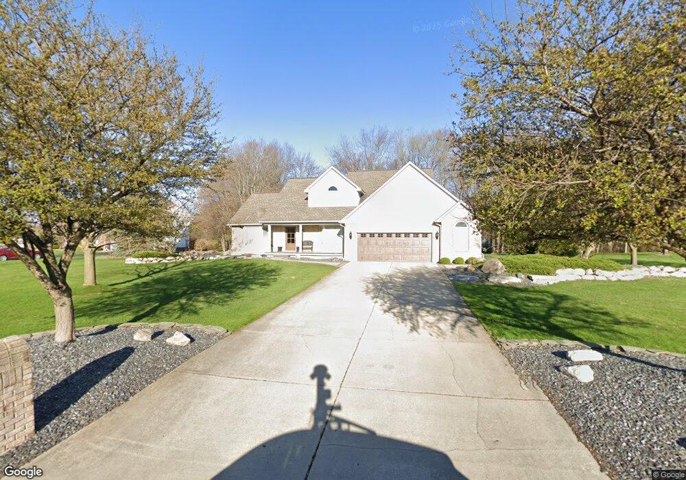
7763 Spring Trace Rd Brighton, MI 48114
Estimated Value: $431,525 - $505,000
4
Beds
3
Baths
2,142
Sq Ft
$223/Sq Ft
Est. Value
About This Home
This home is located at 7763 Spring Trace Rd, Brighton, MI 48114 and is currently estimated at $477,381, approximately $222 per square foot. 7763 Spring Trace Rd is a home located in Livingston County with nearby schools including Three Fires Elementary, Parker Middle School, and Howell High School.
Ownership History
Date
Name
Owned For
Owner Type
Purchase Details
Closed on
Mar 18, 1999
Sold by
Citadel Homes Inc
Bought by
Lincoln Todd L and Lincoln Janene M
Current Estimated Value
Home Financials for this Owner
Home Financials are based on the most recent Mortgage that was taken out on this home.
Original Mortgage
$227,150
Interest Rate
7.1%
Purchase Details
Closed on
Mar 20, 1997
Sold by
B & V Realty Development Inc
Bought by
Citadel Homes Inc
Create a Home Valuation Report for This Property
The Home Valuation Report is an in-depth analysis detailing your home's value as well as a comparison with similar homes in the area
Home Values in the Area
Average Home Value in this Area
Purchase History
| Date | Buyer | Sale Price | Title Company |
|---|---|---|---|
| Lincoln Todd L | $247,082 | -- | |
| Citadel Homes Inc | $43,500 | Lawyers Title Insurance Corp |
Source: Public Records
Mortgage History
| Date | Status | Borrower | Loan Amount |
|---|---|---|---|
| Previous Owner | Lincoln Todd L | $227,150 |
Source: Public Records
Tax History
| Year | Tax Paid | Tax Assessment Tax Assessment Total Assessment is a certain percentage of the fair market value that is determined by local assessors to be the total taxable value of land and additions on the property. | Land | Improvement |
|---|---|---|---|---|
| 2025 | $2,343 | $214,600 | $0 | $0 |
| 2024 | $2,277 | $207,300 | $0 | $0 |
| 2023 | $2,116 | $174,100 | $0 | $0 |
| 2022 | $2,986 | $142,000 | $0 | $0 |
| 2021 | $2,911 | $155,600 | $0 | $0 |
| 2020 | $2,961 | $144,400 | $0 | $0 |
| 2019 | $2,936 | $142,000 | $0 | $0 |
| 2018 | $2,769 | $142,300 | $0 | $0 |
| 2017 | $2,724 | $142,300 | $0 | $0 |
| 2016 | $2,705 | $137,800 | $0 | $0 |
| 2014 | $2,500 | $123,900 | $0 | $0 |
| 2012 | $2,500 | $104,300 | $0 | $0 |
Source: Public Records
Map
Nearby Homes
- 1339 Pond Bluff Way Unit 31
- 8202 Hyne Rd
- 8301 Hyne Rd
- 7975 Bendix Rd
- 1575 Kellogg Rd
- 8270 McClements Rd
- 2575 Woodland Cove Dr
- 2772 Tim Ave
- 8252 Woodland Shore Dr
- 7401 Herbst Rd
- 6421 Breezeway
- 8969 Hyne Rd
- 0 Hunter Rd
- 1290 Hunter Rd
- 1794 S Hughes Rd
- 8461 Woodland Shore Dr
- 2670 Spring Grove Dr
- 1605 S Hughes Rd
- 1716 S Hughes Rd
- 8984 S Christine Dr
- 7741 Spring Trace Rd
- 7795 Spring Trace Rd
- 7810 Windhaven Ln
- 7827 Spring Trace Rd
- 1947 Claiborne Dr
- 7719 Spring Trace Rd
- 7849 Spring Trace Rd
- 1948 Claiborne Dr
- 7798 Spring Trace Rd
- 7838 Windhaven Ln
- 7687 Spring Trace Rd
- 1965 Claiborne Dr
- 7826 Spring Trace Rd
- 1756 Skyview Dr
- 1755 Skyview Dr
- 1750 Greenmeadows Dr
- 1753 Sandy Shore
- 1964 Claiborne Dr
- 7863 Spring Trace Rd
- 7821 Birkenstock Dr
Your Personal Tour Guide
Ask me questions while you tour the home.