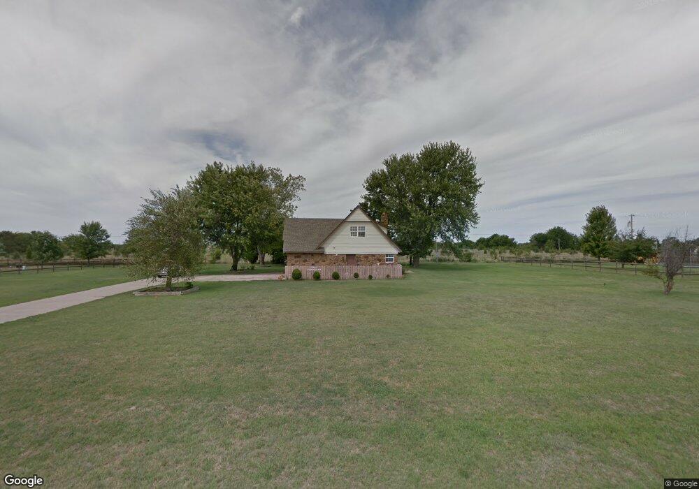
7764 N 181st East Ave Owasso, OK 74055
Estimated Value: $265,000 - $320,000
4
Beds
2
Baths
2,013
Sq Ft
$142/Sq Ft
Est. Value
About This Home
This home is located at 7764 N 181st East Ave, Owasso, OK 74055 and is currently estimated at $286,195, approximately $142 per square foot. 7764 N 181st East Ave is a home located in Rogers County with nearby schools including Stone Canyon Elementary School, Owasso 6th Grade Center, and Owasso 8th Grade Center.
Ownership History
Date
Name
Owned For
Owner Type
Purchase Details
Closed on
Aug 17, 2009
Sold by
Ciga Investments Llc
Bought by
Serna Belen Serna and Saldivar Guadalupe J
Current Estimated Value
Home Financials for this Owner
Home Financials are based on the most recent Mortgage that was taken out on this home.
Original Mortgage
$168,905
Outstanding Balance
$109,620
Interest Rate
5.2%
Mortgage Type
New Conventional
Estimated Equity
$176,575
Purchase Details
Closed on
Mar 5, 2008
Sold by
Rjs3357 Investors Lp
Bought by
Ciga Investments Llc
Purchase Details
Closed on
Nov 9, 2007
Sold by
Soden Robert
Bought by
Rjs 3357 Investors Lp
Purchase Details
Closed on
Feb 13, 2006
Sold by
Katherine Joan Filby Revocable Living Tr
Bought by
Sokolosky Phyllis J and Sokolosky M D
Create a Home Valuation Report for This Property
The Home Valuation Report is an in-depth analysis detailing your home's value as well as a comparison with similar homes in the area
Home Values in the Area
Average Home Value in this Area
Purchase History
| Date | Buyer | Sale Price | Title Company |
|---|---|---|---|
| Serna Belen Serna | $166,000 | Frisco Title Corporation | |
| Ciga Investments Llc | -- | Frisco Title Corporation | |
| Rjs 3357 Investors Lp | -- | Faisco Title Corporation | |
| Sokolosky Phyllis J | -- | None Available |
Source: Public Records
Mortgage History
| Date | Status | Borrower | Loan Amount |
|---|---|---|---|
| Open | Serna Belen Serna | $168,905 |
Source: Public Records
Tax History Compared to Growth
Tax History
| Year | Tax Paid | Tax Assessment Tax Assessment Total Assessment is a certain percentage of the fair market value that is determined by local assessors to be the total taxable value of land and additions on the property. | Land | Improvement |
|---|---|---|---|---|
| 2025 | $2,014 | $19,698 | $6,138 | $13,560 |
| 2024 | $2,014 | $19,124 | $5,959 | $13,165 |
| 2023 | $2,014 | $18,568 | $5,730 | $12,838 |
| 2022 | $1,925 | $18,027 | $4,950 | $13,077 |
| 2021 | $1,878 | $18,319 | $4,605 | $13,714 |
| 2020 | $1,818 | $17,268 | $3,740 | $13,528 |
| 2019 | $1,774 | $16,855 | $3,740 | $13,115 |
| 2018 | $1,765 | $17,306 | $3,740 | $13,566 |
| 2017 | $1,766 | $17,173 | $3,740 | $13,433 |
| 2016 | $1,725 | $16,772 | $3,740 | $13,032 |
| 2015 | $1,682 | $16,290 | $3,740 | $12,550 |
| 2014 | $1,673 | $16,075 | $3,740 | $12,335 |
Source: Public Records
Map
Nearby Homes
- 17798 E Anthem Ridge Rd
- 17401 E 78th St N
- 8219 N 175th East Ave
- 18894 E 80th St N
- 18934 Chickadee Ct
- 19433 E 73rd Place N
- 6940 N Garden Stone Ln
- 18533 E Crooked Oak Dr
- 19425 E 69th St N
- 6568 N Blue Sage Dr
- 17822 E Patriot Dr
- 17862 E Patriot Dr
- 18420 E Persimmon Ln
- 17762 E Patriot Dr
- 19460 E Boulder Dr
- 17823 E White Tail Cove
- Laredo Plan at Stone Creek
- Dean Plan at Stone Creek
- Cali Plan at Stone Creek
- Elgin Plan at Stone Creek
- 0 E 112th St Unit 2325621
- 0 E 112th St Unit 1931204
- 0 E 112th St Unit 2114679
- 7808 N 181st East Ave
- 7722 N 181st East Ave
- 18181 E 76th St N
- 7850 N 181st East Ave
- 7676 N 181st East Ave
- 18074 E 79th St N
- 18132 E 79th St N
- 7634 N 181st East Ave
- 7634 N 181st East Ave
- 18026 E 79th St N
- 18217 E 76th St N
- 17982 E 79th St N
- 17948 E 79th St N
- 18178 E 79th St N
- 18224 E 79th St N
- 17926 E 79th St N
- 18031 E 79th St N