Estimated Value: $3,291,000
6
Beds
9
Baths
7,196
Sq Ft
$457/Sq Ft
Est. Value
About This Home
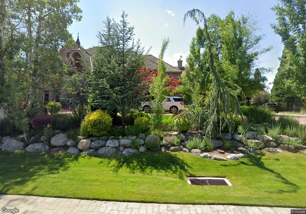
This home is located at 7768 S Pheasant Wood Dr, Sandy, UT 84093 and is currently priced at $3,291,000, approximately $457 per square foot. 7768 S Pheasant Wood Dr is a home located in Salt Lake County with nearby schools including Oakdale School, Albion Middle School, and Brighton High School.
Ownership History
Date
Name
Owned For
Owner Type
Purchase Details
Closed on
Oct 18, 2011
Sold by
Smith Sean Dee and Smith Janae D
Bought by
Nattress David W
Current Estimated Value
Home Financials for this Owner
Home Financials are based on the most recent Mortgage that was taken out on this home.
Original Mortgage
$2,000,000
Outstanding Balance
$1,360,784
Interest Rate
4.05%
Mortgage Type
New Conventional
Purchase Details
Closed on
Apr 3, 2002
Sold by
Day Andrew J
Bought by
Smith Sean and Smith Janae
Create a Home Valuation Report for This Property
The Home Valuation Report is an in-depth analysis detailing your home's value as well as a comparison with similar homes in the area
Home Values in the Area
Average Home Value in this Area
Purchase History
| Date | Buyer | Sale Price | Title Company |
|---|---|---|---|
| Nattress David W | -- | Cottonwood Title | |
| Smith Sean | -- | First Amer Title Ins Agency |
Source: Public Records
Mortgage History
| Date | Status | Borrower | Loan Amount |
|---|---|---|---|
| Open | Nattress David W | $2,000,000 |
Source: Public Records
Tax History
| Year | Tax Paid | Tax Assessment Tax Assessment Total Assessment is a certain percentage of the fair market value that is determined by local assessors to be the total taxable value of land and additions on the property. | Land | Improvement |
|---|---|---|---|---|
| 2025 | $7,469 | $868,600 | $868,600 | -- |
| 2024 | $7,469 | $785,300 | $785,300 | -- |
| 2023 | $7,295 | $748,000 | $748,000 | $0 |
| 2022 | $7,365 | $733,300 | $733,300 | $0 |
| 2021 | $7,831 | $666,600 | $666,600 | $0 |
| 2020 | $9,615 | $894,900 | $621,900 | $273,000 |
| 2019 | $8,700 | $744,300 | $602,300 | $142,000 |
| 2016 | $7,361 | $569,200 | $544,900 | $24,300 |
Source: Public Records
Map
Nearby Homes
- 1341 E Creek Rd
- 1335 E Milne Ln
- 1695 E Ensign Place
- 1997 E Parkridge Dr
- 1354 W 7240 S
- 1627 E Mulberry Way
- 1325 E Milne Ln
- 7755 S 1130 E
- 1228 E Waterside Cove Unit 12
- 1222 E Waterside Cove Unit 31
- 1222 E Waterside Cove Unit 10
- 8109 S Cottonwood Hills Cir
- 1212 E Waterside Cove Unit 12
- 1212 E Waterside Cove Unit 10
- 1205 E Waterside Cove Unit 13
- 2110 Lonsdale Dr
- 1780 Julho St
- 1091 E 7575 S
- 7193 S Station Creek Way Unit 9C
- 1196 E Waterside Cove Unit 22
- 7768 Pheasant Wood Dr
- 7743 Keswick Rd
- 7759 Keswick Rd
- 7725 Keswick Rd
- 7775 Keswick Rd
- 7709 S Keswick Rd
- 7724 Pheasant Wood Dr
- 7709 Keswick Rd
- 7792 Pheasant Wood Dr
- 7792 S Pheasant Wood Dr
- 7740 S Keswick Rd
- 7793 Keswick Rd
- 7740 Keswick Rd
- 7754 Keswick Rd
- 7722 S Keswick Rd
- 7693 S Keswick Rd
- 7722 Keswick Rd
- 7693 Keswick Rd
- 1636 Langdale Cir
- 1636 E Langdale Cir Unit 30
Your Personal Tour Guide
Ask me questions while you tour the home.