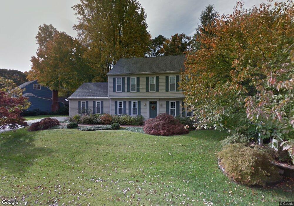
777 Brushwood Ct Millersville, MD 21108
Estimated Value: $629,000 - $877,000
--
Bed
3
Baths
2,388
Sq Ft
$299/Sq Ft
Est. Value
About This Home
This home is located at 777 Brushwood Ct, Millersville, MD 21108 and is currently estimated at $713,214, approximately $298 per square foot. 777 Brushwood Ct is a home located in Anne Arundel County with nearby schools including Benfield Elementary School, Severna Park Middle School, and Severna Park High School.
Ownership History
Date
Name
Owned For
Owner Type
Purchase Details
Closed on
Jul 27, 2023
Sold by
Durst Robert S
Bought by
Durst Family Trust and Durst
Current Estimated Value
Purchase Details
Closed on
Nov 27, 1990
Sold by
Brown Gregory A
Bought by
Durst 2Nd Robert S and Durst Patricia J
Home Financials for this Owner
Home Financials are based on the most recent Mortgage that was taken out on this home.
Original Mortgage
$175,000
Interest Rate
9.93%
Create a Home Valuation Report for This Property
The Home Valuation Report is an in-depth analysis detailing your home's value as well as a comparison with similar homes in the area
Home Values in the Area
Average Home Value in this Area
Purchase History
| Date | Buyer | Sale Price | Title Company |
|---|---|---|---|
| Durst Family Trust | -- | None Listed On Document | |
| Durst 2Nd Robert S | $249,900 | -- |
Source: Public Records
Mortgage History
| Date | Status | Borrower | Loan Amount |
|---|---|---|---|
| Previous Owner | Durst 2Nd Robert S | $175,000 |
Source: Public Records
Tax History Compared to Growth
Tax History
| Year | Tax Paid | Tax Assessment Tax Assessment Total Assessment is a certain percentage of the fair market value that is determined by local assessors to be the total taxable value of land and additions on the property. | Land | Improvement |
|---|---|---|---|---|
| 2025 | $4,738 | $547,533 | -- | -- |
| 2024 | $4,738 | $512,100 | $258,700 | $253,400 |
| 2023 | $4,619 | $505,067 | $0 | $0 |
| 2022 | $4,329 | $498,033 | $0 | $0 |
| 2021 | $8,511 | $491,000 | $248,700 | $242,300 |
| 2020 | $4,152 | $491,000 | $248,700 | $242,300 |
| 2019 | $4,092 | $491,000 | $248,700 | $242,300 |
| 2018 | $5,526 | $545,000 | $258,700 | $286,300 |
| 2017 | $3,912 | $524,767 | $0 | $0 |
| 2016 | -- | $504,533 | $0 | $0 |
| 2015 | -- | $484,300 | $0 | $0 |
| 2014 | -- | $458,800 | $0 | $0 |
Source: Public Records
Map
Nearby Homes
- 762 Cougar Dr
- 405 Ben Oaks Dr W
- 8201 Longford Rd
- 302 Blue Cedar Ct
- 610 Echo Cove Dr
- 1158 Blue Bird Ln
- 771 Generals Hwy
- 759 Stacy Oak Way
- 626 Evergreen Rd
- 518 Lakeland Rd S
- 401 Green Grove Ct
- 396 Aurora Dr
- 1220 Indian Landing Rd
- 513 Old Pasture Ln
- 439A Lakeland Rd N
- 601 Brightwood Rd
- 1610 Hog Farm Rd
- 8011 Horicon Point Dr
- 304 W Pasadena Rd
- 764 Springbloom Dr
- 775 Brushwood Ct
- 779 Brushwood Ct
- 773 Brushwood Ct
- 781 Brushwood Ct
- 774 Brushwood Ct
- 0 Brasswood Ln Unit 1004240468
- 771 Brushwood Ct
- 783 Brushwood Ct
- 772 Brushwood Ct
- 785 Brushwood Ct
- 916 W Benfield Dr
- 769 Brushwood Ct
- 920 W Benfield Rd
- 446 Old Orchard Cir
- 770 Brushwood Ct
- 768 Brushwood Ct
- 912 W Benfield Dr
- 787 Brushwood Ct
- 407 Dale Rd
- 448 Old Orchard Cir